

Photo adjustments
Proportionally resized and converted to WebP without cropping, retouching or changing the photographed subject.
Explore the region
About Boundary Island
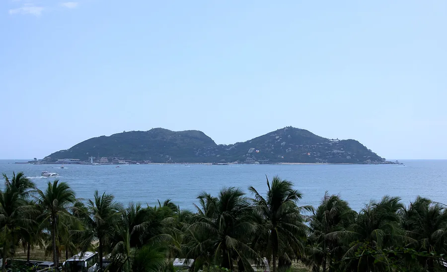
A ferry crossing leads to a compact island of rocky coast, sea viewpoints and developed marine recreation. The land-based paths offer a worthwhile visit without adding diving or other paid activities. Boat operations and sea conditions determine access, so allow a flexible return plan. Diving products have their own health, age and weather requirements and should not be treated as part of a simple sightseeing ticket.
The island formed where Niuling (牛岭) extends southward into the South China Sea and subsides beneath it. It covers an area of 3.8 hectares, reaches a highest elevation of 99.5 meters, and lies about 1.6 nautical miles from the nearest coast. It is considered an important north-south climatic divide for Hainan Island: areas to its south have a pronounced monsoonal climate with distinct dry and wet seasons, while areas to the north have a more oceanic climate with abundant rainfall.
It was the earliest uninhabited island in Hainan to be developed as a tourist area. In 2008 it became a national 4A-level tourist scenic area (国家4A级旅游景区), and in 2013 it was upgraded to a national 5A-level tourist attraction (国家5A级旅游景区), making it China's first, and currently only, national 5A-level island-type tourist attraction.
What to look for
- Rocky island paths and elevated coastal viewpoints.
- The contrast between the offshore island and Hainan’s mainland coast.
Location & getting there
Getting to Boundary Island
Travel to the Boundary Island, Fenjiezhou, passenger pier on the Lingshui side of the east coast. Confirm the day’s ferry operation before leaving your hotel.
Combine your visit
Suggested order for a focused visit to this part of Hainan.
-
Boundary Island passenger pier分界洲岛客运码头
Check boarding and the last return sailing.
-
Island scenic paths岛上海岸观景步道
Use the open land-based visitor circuit.
Confirm the opening of individual stops and the return connection. This is an editorial sequence, not a combined ticket.
Find Boundary Island
分界洲岛 · 陵水
The pin marks the area, not the entrance.
More places nearby
Approximate straight-line distances between map pins, not travel distances.
Riyue Bay 日月湾
6 km awayRiyue Bay is the centre of Wanning’s surf scene, where beach cafés, surf schools and spectators share a compact coastal strip. The atmosphere is more active and informal than a secluded resort beach. A first visit can be as…
View guide →Shimei Bay 石梅湾
13 km awayShimei Bay combines a broad sandy coast with a surviving belt of green-bark forest, giving it a softer, more wooded setting than many developed resort beaches. It suits a beach walk, a café stop and time looking out over the…
View guide →Xinglong Tropical Botanical Garden 兴隆热带植物园
17 km awayXinglong Tropical Botanical Garden connects tropical scenery with the crops behind everyday flavours: coffee, cacao, pepper and vanilla. Its scientific background makes labelled plants and agricultural interpretation especially…
View guide →Sources & visit information
The sources below support the place-specific description and arrival information. Suggested combinations are editorial planning ideas; confirm current opening, entry arrangements and transport services for your date.
- Hainan Free Trade Port: Boundary Island visitor introduction ↗
- Boundary Island (Hainan) ↗
- Chinese Wikipedia: 分界洲 (revision 91797054, 2026-03-07) ↗
- English Wikipedia: Boundary Island (Hainan) (revision 1173133491, 2023-08-31) ↗
Visitor information adapted and edited from Wikipedia contributors, “Boundary Island (Hainan)” · CC BY-SA 4.0. Source revision 1173133491.
Background paragraphs translated and condensed from Wikipedia contributors, "分界洲", Chinese Wikipedia · CC BY-SA 4.0. Source revision 91797054.
Background paragraphs condensed from Wikipedia contributors, "Boundary Island (Hainan)", English Wikipedia · CC BY-SA 4.0. Source revision 1173133491.