

Photo adjustments
Full frame retained; proportionally resized and converted to WebP. No retouching or changes to the photographed subject. Card displays may crop the view.
Explore the region
About Furong River
Furong River (芙蓉江) is the largest tributary of the Wu River (乌江), flowing north out of Guizhou and joining it at Jiangkou (江口) in Wulong District, Chongqing. Its last 35 km in Wulong form a national scenic area of karst gorges.
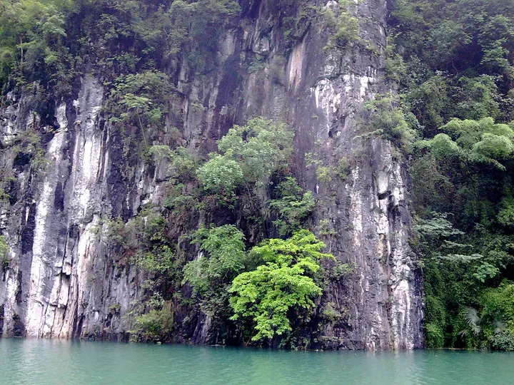
The river was known in the past as the Rushui (濡水) and is also called the Pangu River (盘古河); the Wulong government says the name Furong comes from the many furong (芙蓉) trees along the banks at Jiangkou. It rises in Suiyang County (绥阳县), Guizhou, and is about 230 km long, 87 percent of it in Guizhou. The basin is karst country with few inhabitants, and the valley is a V-shaped gorge with original vegetation thick on both banks.
The scenic area runs from Zhuzixi (珠子溪) in Haokou Township (浩口乡) down to the river mouth at Jiangkou and covers 152.8 km². The State Council approved it on 17 May 2002 in the fourth batch of national key scenic areas. In 2007 the river was inscribed on the World Heritage List within the Wulong Karst part of the South China Karst site, as the buffer zone to the core zone at Furong Cave (芙蓉洞). After the Jiangkou hydropower reservoir filled in 2003, the water rose by more than 100 m, turning this stretch into a lake between high gorge walls, dotted with islands and peninsulas.
The district divides the riverside into several sections. The Furong Cave section centres on the cave; the Pangu River section has Miao (苗族) village life, old trees, bamboo, a monkey park and banana groves; Xuanba (悬坝) has Butterfly Valley and waterfalls; and Zhuzixi has the Red Army Crossing (红军渡) and Agate Flying Spring (玛瑙飞泉). An old line quoted by the district, "一川游尽画图中" (a whole river travelled inside a painting), records how earlier visitors judged the river.
What to look for
- Furong Cave (芙蓉洞), beside the river at Jiangkou and the core zone of the World Heritage listing
- The reservoir lake above the Jiangkou dam, with islands and peninsulas left by the 2003 impoundment
- Butterfly Valley (蝴蝶谷), Longkong Waterfall (龙孔飞瀑) and the large and small stone spires (大小石笋) in the Xuanba section
- Red Army Crossing (红军渡) and Agate Flying Spring (玛瑙飞泉) in the Zhuzixi section
- Miao village life, old trees, bamboo groves and the monkey park along the Pangu River section
Location & getting there
Getting to Furong River
- Search for 芙蓉江 with 重庆市 and 武隆区.

Find Furong River
芙蓉江 · 武隆区
No reliable map pin yet: search by the Chinese name.
Sources & visit information
Written from the linked sources and checked sentence by sentence against quoted extracts by a separate reviewer on 2026-09-23. Opening hours, admission and access arrangements are not covered; confirm current visitor information with the site.
Some facts checked against Wikipedia contributors, "芙蓉江" · CC BY-SA 4.0.