

Photo adjustments
Full-frame source proportionally resized and converted to WebP for display. No subject alteration. Source-supplied marks and edits remain; cards may crop the view.
Explore the region
About Hehuanshan Designated Mountain Trails
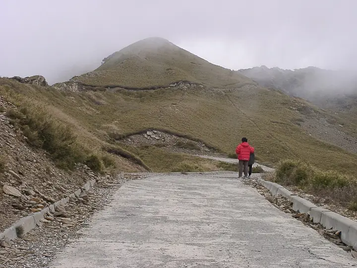
Hehuanshan is a high mountain landscape where designated trails rise through open alpine vegetation and broad stands of Yushan cane. The forestry recreation area, established in 1963, provides access to a setting markedly different from Taiwan's lower forested hills: exposure, low temperatures and rapidly changing visibility are part of the landscape itself.
Hehuan Main Peak, Hehuan East Peak and Shimenshan are separate summits associated with the recreation area. Their routes have different starting points and demands, so the destination should not be presented as one interchangeable loop. Open slopes and ridgelines give opportunities to observe alpine plants and mountain landforms, while species adapted to elevation contribute to the area's ecological interest.
Snow and rhododendron bloom are well-known seasonal images, but neither can be promised for a particular trip. Road access also does not turn a summit walk into an ordinary roadside stop. Choose a currently open, designated route that matches your experience, and leave space in the plan to turn back. The quality of the visit can lie in observing the alpine setting without reaching every named peak.
What to look for
- Alpine slopes and Yushan cane vegetation.
- Distinct trails towards Hehuan Main Peak, East Peak and Shimenshan.
- High-elevation plants and birds in an exposed mountain environment.
Location & getting there
Getting to Hehuanshan Designated Mountain Trails
Use the forestry authority's current trail map to choose an exact starting point. Check road and weather notices, carry warm and waterproof layers, and treat each summit route as a separate mountain plan.
- Search for 合欢山正规开放步道 with 仁爱乡.

Find Hehuanshan Designated Mountain Trails
合欢山正规开放步道 · 仁爱乡
No reliable map pin yet: search by the Chinese name.
Sources & visit information
The identity, setting and selected historical or architectural features were checked against the linked official sources on 10 September 2026. This is a sourced introduction and observation guide. Opening hours, prices, transport timetables and access conditions require a fresh check before travel.
Selected visitor facts translated and adapted from Tourism Administration and contributing local tourism authorities, 2026 Tourism Information Database v2.1 — 合歡山國家森林遊樂區 (Attraction_345040000G_000010) · Open Government Data License 1.0.