


Get to know Zhongwei

Photo adjustments
Full frame retained; proportionally resized and converted to WebP. No retouching or changes to the photographed subject. Card displays may crop the view.
- Administrative area
- Prefecture-level city · 地级市
- Part of
- Ningxia
- Chinese name
- 中卫市
- Local areas
- 3 local areas
Area & population
- Area in the source
- 16,986.10 km²
- Population · 2019
- 1,174,600
- Administrative seat
- Shapotou
Source: cited geographic source, as of the dates shown.
Tourism
Zhongwei's main attraction is Gao Miao, a temple that has hosted Confucian, Buddhist, and Taoist ceremonies. A bomb shelter was also built beneath the temple during the Cultural Revolution. It has since been converted into a rendition of a Buddhist hell. The prefecture is also the location of the beginning of the northern bend in the Yellow River that produces the Ordos Loop. A drum tower is located in the city center.
Transportation
Zhongwei Shapotou Airport Baotou–Lanzhou railway Baoji–Zhongwei railway, to points south (connections to Xi'an, Chengdu) Taiyuan-Zhongwei-Yinchuan railway, to the east (connection to Beijing) Gantang–Wuwei railway, to western Gansu and westward Zhongwei–Lanzhou high-speed railway G70 Fuzhou–Yinchuan Expressway G2012 Dingbian–Wuwei Expressway China National Highway 109
Explore Zhongwei
Core places to explore, with English and Chinese names.
Shapotou 沙坡头
Zhongwei Gaomiao 中卫高庙
Zhongwei 中卫
Sikouzi Scenic Area 寺口子风景区
Zhongwei Drum Tower 中卫鼓楼
Zhongwei Xiangshan Park 中卫香山公园
Shikong Great Buddha Temple 石空大佛寺
Jinsha Island · Tengger Desert Wetland 腾格里沙漠湿地·金沙岛旅游区
Shikong Temple Grottoes 石空寺石窟
Shapotou Desert Stargazing Camp 沙漠星空营地正规运营项目
Nanhua Mountain in Haiyuan 南华山
Shapotou District 沙坡头区
Zhongning County 中宁县
Haiyuan County 海原县
Places to explore around Zhongwei
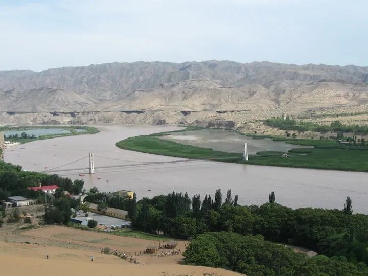 The Yellow River bend and cable bridge at Shapotou, with Tengger Desert dunes in the foreground · 沙坡头黄河湾与索桥,前景为腾格里沙漠沙丘 Source-recorded photograph date: 2016-12-06 00:29:00.
Shapotou沙坡头
Shapotou brings the Tengger Desert to the edge of a bend in the Yellow River. The river-facing slope and the larger desert activity area offer different experiences: landscape viewing, sand sliding and optional organised rides…
Read the place guide →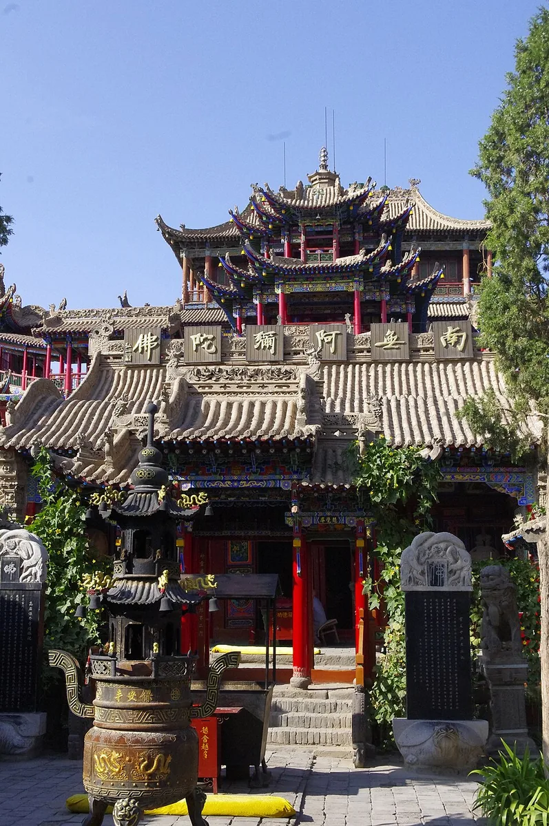 Layered roofs, ornate columns and a courtyard at Zhongwei Gaomiao, September 2015.
Zhongwei Gaomiao中卫高庙
Zhongwei Gaomiao is a densely layered temple whose halls rise through successive platforms. Buddhist, Daoist and Confucian elements share the complex. The Mahavira Hall, South Heavenly Gate and upper pavilions are linked by…
Read the place guide →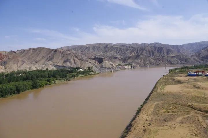 The Yellow River flowing past Shapotou town in Zhongwei, Ningxia · 宁夏中卫沙坡头镇黄河风光 Source-recorded photograph date: 2015-09-23.
Zhongwei中卫
Zhongwei is a practical base for the Yellow River and the southeastern edge of the Tengger Desert. Its central Drum Tower and Gaomiao temple give the town a historical focus before the larger landscape outings. Shapotou and…
Read the place guide →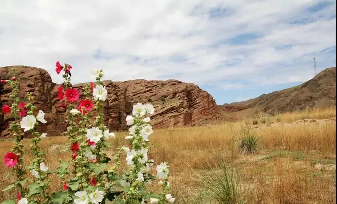 Sikouzi Scenic Area · 寺口子风景区
Sikouzi Scenic Area寺口子风景区
Sikouzi has two contrasting landscape areas near Xuanhe: narrow gorges and unusual rock forms in the east, and red Danxia terrain in the west. The Yixiantian passage is one of the named gorge features, while stories of Su Wu…
Read the place guide → Zhongwei Drum Tower · 中卫鼓楼 Photograph date recorded by the source: 2026-08-09 18:18:10.
Zhongwei Drum Tower中卫鼓楼
Zhongwei’s Drum Tower anchors the intersecting streets of the old town. The upper timber building rises in several tiers above a substantial base, creating a recognisable skyline from each approach. The monument’s history…
Read the place guide → AI illustration · AI 示意图(仅供参考,非该地点实拍)
Zhongwei Xiangshan Park中卫香山公园
Xiangshan Park provides a lakeside green space in southern Zhongwei, away from the busier old-town monuments. Paths around Xiangshan Lake and planted banks make it suitable for an unhurried walk or a break between journeys…
Read the place guide → Shikong Great Buddha Temple · 石空大佛寺
Shikong Great Buddha Temple石空大佛寺
Shikong Great Buddha Temple is a cave-temple group at the southern foot of Shuanglong Mountain near Zhongning. Its upper, middle and lower sections contain Buddhist sculpture and painted surfaces from different periods. Much of…
Read the place guide → A dune slope above the Yellow River at Shapotou, on the southern edge of the Tengger Desert.
Jinsha Island · Tengger Desert Wetland腾格里沙漠湿地·金沙岛旅游区
Lakes, reeds and flower gardens on the Tengger Desert's edge near Zhongwei, with seven linked lakes, a 30 m sand hill and Great Wall remains.
Read the place guide → Shikong Temple Grottoes · 石空寺石窟
Shikong Temple Grottoes石空寺石窟
Shikong Temple Grottoes (石空寺石窟), also called Shuanglong Mountain Grottoes (双龙山石窟), are Buddhist caves cut into a hillside at Yuding Township (余丁乡), Zhongning County (中宁县), Zhongwei (中卫市), Ningxia, in Tang times.
Read the place guide →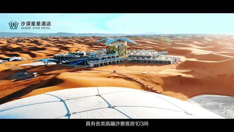 Shapotou Desert Stargazing Camp · 沙漠星空营地正规运营项目
Shapotou Desert Stargazing Camp沙漠星空营地正规运营项目
The desert star-gazing camp at Shapotou (沙坡头) in Zhongwei (中卫市), Ningxia, is the night-sky side of the Shapotou scenic area in Shapotou District (沙坡头区): the Desert Star Hotel (沙漠星星酒店), opened in the Tengger Desert in 2020, and the star-gazing valley (观星谷) where guides point out constellations.
Read the place guide → Nanhua Mountain in Haiyuan · 南华山
Nanhua Mountain in Haiyuan南华山
Nanhua Mountain rises south of Haiyuan’s county town, forming part of the mountain landscape of southern Ningxia.
Read the place guide →Local life & food
Zhongwei local specialties
中卫市特色美食 · 9 specialties to discover
 Zhongwei haozi noodles 中卫蒿子面AI illustration · AI 示意图
The strands are fine yet resilient, with the plant ingredient contributing a distinctive texture and subtle aroma rather than a large leafy garnish.
Source ↗Read the dish guide →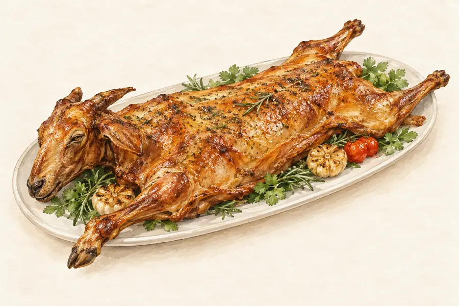 Shapotou Roast Whole Lamb 沙坡头烤全羊AI illustration · AI 示意图(仅供参考,非实拍)
Shapotou Roast Whole Lamb (沙坡头烤全羊) is listed among the local specialties of Zhongwei, Ningxia. The name includes 羊 (sheep). 烤 describes roasting or grilling.
Read the dish guide →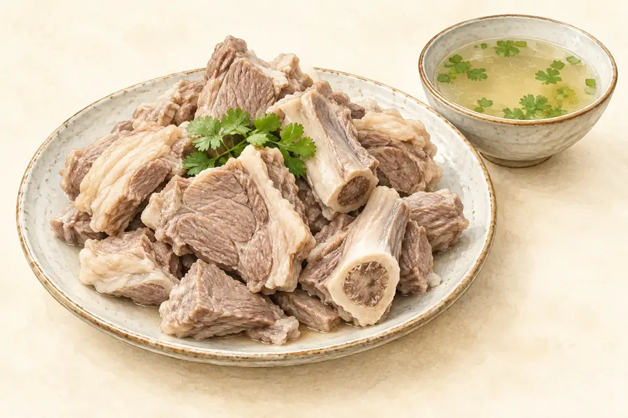 Zhongwei Mutton 中卫羊肉AI illustration · AI 示意图(仅供参考,非实拍)
Zhongwei Mutton (中卫羊肉) is listed among the local specialties of Zhongwei, Ningxia. The name includes 羊肉 (lamb or mutton).
Read the dish guide →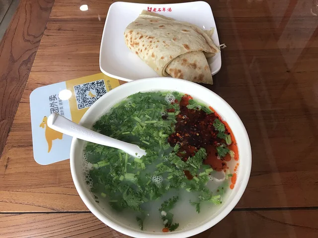 Lamb offal soup 羊杂碎Dish illustration · regional recipe not verified
Textures range from tender and fine to springy and chewy, with a strong lamb aroma and savory broth. Chili and herbs can sharpen the finish.
Source ↗Read the dish guide →
Photo adjustments
Resized proportionally to a maximum 640 px long edge, EXIF orientation applied where present, and encoded as WebP. No crop or subject alteration.
Zhongning Goji Mutton Stew 中宁枸杞炖羊肉AI illustration · AI 示意图(仅供参考,非实拍)
Zhongning Goji Mutton Stew (中宁枸杞炖羊肉) is listed among the local specialties of Zhongwei, Ningxia. The name includes 羊肉 (lamb or mutton). 炖 describes slow simmering.
Read the dish guide → Ningxia lamb saozi noodles 羊肉臊子面AI illustration · AI 示意图
The noodles are substantial and the topping distributes meat flavor through many small bites. Chili can add heat, but the lamb-and-vegetable base remains central.
Source ↗Read the dish guide → Ningxia mixed savoury soup bowl 宁夏烩小吃AI dish illustration / AI 菜品示意图
The appeal lies in changing textures: soft tofu, springy noodles, vegetables and savoury meat. Chilli or vinegar may be offered separately, which allows a gentler first taste of the broth.
Source ↗Read the dish guide →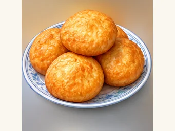 Youxiang fried bread 油香AI illustration · AI 示意图
The outer surface is lightly crisp and oily-fragrant, while the interior stays soft and airy, making it suitable for tearing and sharing.
Source ↗Read the dish guide →More dishes from across Ningxia are in the Ningxia food guide.
Counties & districts in Zhongwei
3 areas belong directly to Zhongwei.
3 areas
Shapotou District沙坡头区
Shapotou District (simplified Chinese: 沙坡头区; traditional Chinese: 沙坡頭區; pinyin: Shāpōtóu Qū, Xiao'erjing: شَاپُوَتِوْ ٿِيُوِ) is a district of Zhongwei, Ningxia, China, noted for the Tengger Desert, and…
Explore the area →CountyZhongning County中宁县
Zhongning County is a county under the administration of Zhongwei city in west-central Ningxia Hui Autonomous Region of China, bordering Inner Mongolia to the northwest.
Explore the area →CountyHaiyuan County海原县
Haiyuan County (simplified Chinese: 海原县; traditional Chinese: 海原縣; pinyin: Hǎiyuán Xiàn; Wade–Giles: Hai-yüan Hsien, Xiao'erjing: خَيْيُوًا ثِيًا) is a county under the administration of the prefecture-level…
Explore the area →No areas match this name.
Plan your visit
Getting there
Search for 中卫市 in a map app to find stations and your accommodation.
Where to stay →Build your route
Shapotou and Zhongwei Gaomiao are about 15 km apart in a straight line. The linked place guides have entrance and visit details.
Continue with Ningxia →More in Ningxia
Sources & geographic information
Administrative names and parent areas: Official geographic directory · Reference date 2026-09-06.
Background text adapted from Zhongwei — Wikipedia contributors, under CC BY-SA 4.0. Text has been shortened and reorganized; source revision 1371209685.
Photo: Shapotou · sylvannus · CC BY-SA 3.0. Full frame retained; proportionally resized and converted to WebP. No retouching or changes to the photographed subject. Card displays may crop the view.
.jpg)
Photo: Zhongwei Gaomiao · w0zny · CC BY-SA 3.0. Proportionally resized and converted to WebP without cropping, retouching or changing the photographed subject.

Photo: Zhongwei · w0zny · CC BY-SA 3.0. Full frame retained; proportionally resized and converted to WebP. No retouching or changes to the photographed subject. Card displays may crop the view.

Photo: Sikouzi Scenic Area · Source photographer · License not provided. EXIF orientation normalized; resized without changing aspect ratio; converted to WebP. No subject edits.
Photo: Zhongwei Drum Tower · Windmemories · CC BY-SA 4.0. Full frame retained; proportionally resized and converted to WebP. No retouching or changes to the photographed subject. Card displays may crop the view.

Photo: Shikong Great Buddha Temple · Source photographer · License not provided. EXIF orientation normalized; resized without changing aspect ratio; converted to WebP. No subject edits.
Photo: Jinsha Island · Tengger Desert Wetland · sylvannus · CC BY-SA 3.0. Wikimedia thumbnail; fitted to the ranking-card frame.
.jpg)
Photo: Shikong Temple Grottoes · Source photographer · License not provided. EXIF orientation normalized; resized without changing aspect ratio; converted to WebP. No subject edits.
Photo: Shapotou Desert Stargazing Camp · Source photographer · License not provided. EXIF orientation normalized; resized without changing aspect ratio; converted to WebP. No subject edits.
Photo: Nanhua Mountain in Haiyuan · Peellden · Public domain. EXIF orientation normalized; resized without changing aspect ratio; converted to WebP. No subject edits.

Map data © OpenStreetMap contributors. Pins mark approximate centres, not entrances or boundaries.