

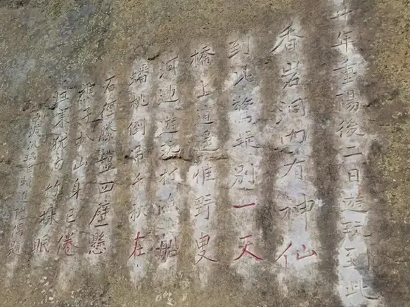
Photo adjustments
EXIF orientation normalized; resized without changing aspect ratio; converted to WebP. No subject edits.
Explore the region
About Xiangqiao Natural Bridge
The geopark covers 139 square kilometres with a core area of 39 square kilometres, and the regional Department of Natural Resources counts more than 50 principal geological and geomorphological relics inside it, among them the Xiangqiaoyan natural bridge, the Xiangqiaoyan gorge, Jiulong Cave, the Xiangshui stone forest and the Xiangshui waterfall. The area was designated a provincial-level scenic and historic area in 1988 and was awarded national geopark status in September 2005. It was opened at a ceremony on 18 October held together with Luzhai County's second tourism and culture festival, which the department reported in October 2008. Karst geologists, the department writes, have called the area a miniature of China's karst landforms and a natural geological museum of karst landforms.
The department notes that within an area of under 40 square kilometres the park brings together typical landform scenery from different stages of subtropical karst development, and treats this as significant for the study of how karst evolves. Among the individual forms it picks out are the Xiangqiao natural bridge, the tower-karst peak forest at Zhongdu, the Liumo iron stone forest, a group of skylights opening over the underground river, the Xiangqiao karst gorge, the low-head waterfall at Xiangshui and brain-pattern deposits inside Jiulong Cave. Liuzhou's municipal listing describes the park as consisting mainly of karst scenery, with caves, an underground river, natural bridges and tiankeng sinkholes among its characteristic features.
What to look for
- The Xiangqiaoyan natural bridge (香桥岩天生桥), named among the park's principal geological relics.
- The Xiangqiaoyan karst gorge (香桥岩峡谷), listed alongside the bridge in the same group of relics.
- Jiulong Cave (九龙洞), which the Department of Natural Resources singles out for its brain-pattern cave deposits.
- The Xiangshui stone forest (响水石林) and the low-head waterfall at Xiangshui (响水低水头瀑布).
- The tower-karst peak forest at Zhongdu (中渡塔状峰林) and the group of skylights over the underground river (地下河天窗群).
Location & getting there
Getting to Xiangqiao Natural Bridge
Use an authorised visitor route. Cave sections, geological sites and access roads can close independently, so confirm the area that your ticket covers.
- Search for 香桥岩 with 柳州市 and 鹿寨县.

Find Xiangqiao Natural Bridge
香桥岩 · 鹿寨县
No reliable map pin yet: search by the Chinese name.
Sources & visit information
The linked sources support the identity and background described in this introduction. Opening hours, admission, activity availability and exact arrival arrangements have not been comprehensively checked. Confirm current visitor information with the venue; the original catalogue locality and editorial review flag are retained.