

Photo adjustments
Full frame retained; proportionally resized and converted to WebP. No retouching or changes to the photographed subject. Card displays may crop the view.
Explore the region
About Red Stone Forest
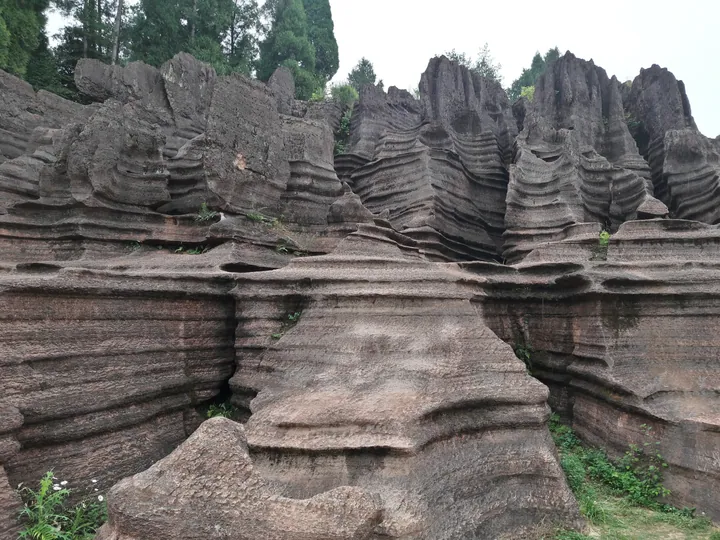
The pillars are weathered out of Ordovician shallow-marine carbonate platform sediment laid down around 485 million years ago, when shallow sea covered much of the region. The core area runs to more than 84 square kilometres, spreading over Hongshilin town and the Furong Town area on both banks of the You river, and provincial accounts describe it as the largest and most widely distributed red stone forest so far found in the world.
One consequence is that the ground changes appearance with the weather. In dry conditions the rock reads as purplish red, after a shower it darkens to brownish red, and as it dries it returns to purple, because the carbonate reacts slightly with water and dulls the surface. The wider geopark that Hongshilin belongs to covers 2,710 square kilometres across seven counties and cities, and holds two internationally significant golden spikes, stratigraphic reference sections, one of them on the west bank of the You river at Luoyixi town in this same county.
What to look for
- The stone pillars themselves, weathered from Ordovician shallow-marine carbonate platform beds around 485 million years old
- The change of colour across the rock between dry and wet weather, from purplish to brownish red
- The spread of the stone forest across both banks of the You river, between Hongshilin town and the Furong Town area
- The setting inside the Xiangxi Global Geopark, whose Guzhang golden spike section lies at Luoyixi in the same county
Location & getting there
Getting to Red Stone Forest
Use an authorised visitor route. Cave sections, geological sites and access roads can close independently, so confirm the area that your ticket covers.
- Search for 红石林 with 湘西土家族苗族自治州 and 古丈县.
Find Red Stone Forest
红石林 · 古丈县
No reliable map pin yet: search by the Chinese name.
Sources & visit information
The linked sources support the identity and background described in this introduction. Opening hours, admission, activity availability and exact arrival arrangements have not been comprehensively checked. Confirm current visitor information with the venue; the original catalogue locality and editorial review flag are retained.