

Photo adjustments
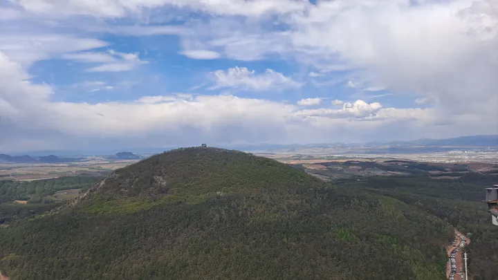
Full frame retained; proportionally resized and converted to WebP. No retouching or changes to the photographed subject. Card displays may crop the view.
Explore the region
About Mao'er Mountain
Its forest combines planted conifers, including Mongolian pine, with secondary deciduous woodland. This mix makes the mountain part of Yanji's suburban forest ecosystem as well as a place associated with climbing and recreation.
Wooden climbing paths and smaller trails beneath the trees provide different ways to experience the wooded slopes. The forest's structure, from evergreen crowns to broadleaf growth, is as much a feature of the mountain as its distinctive summit outline.
What to look for
- The hat-shaped summit profile
- Mixed conifer and deciduous woodland
- Wooden climbing paths and forest trails
Location & getting there
Getting to Mao'er Mountain
Check weather, trail access and the last return service. A mountain or forest area is not one entrance, and a map’s central pin may be far from the trailhead.
- Search for 帽儿山 with 延边朝鲜族自治州 and 延吉市.
Find Mao'er Mountain
帽儿山 · 延吉市
No reliable map pin yet: search by the Chinese name.
Sources & visit information
The linked sources support the identity and background described in this introduction. Opening hours, admission, activity availability and exact arrival arrangements have not been comprehensively checked. Confirm current visitor information with the venue; the original catalogue locality and editorial review flag are retained.