


Explore the region
About Honghai Bay Zhelang Peninsula
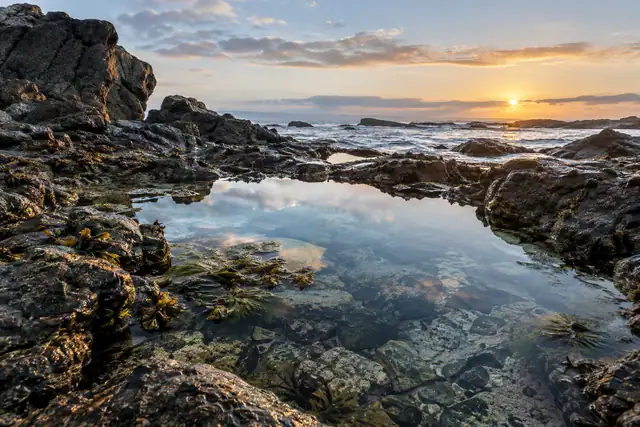
The Red Bay development zone's own tourism page describes the peninsula, locally called 粤东麒麟角, as acting like a barrier against the wind and waves on its east and west sides, and says the scene on its two flanks is completely different whatever the wind direction, one running with heavy surf while the other stays calm. It puts the coastline of the wider tourist area at about 72 kilometres of varied reef rock, and records the peninsula's coastal rock scenery as the outdoor filming location for more than 20 films and television productions, among them 岸边激浪 and 和平年代. The area is a Guangdong marine sports training base and is listed as a national AAAA tourist area.
The Shanwei municipal government's own tourism page lists Zhelang, also called the Nan'ao peninsula, as designated one of the country's major natural sea-bathing beaches. It names Lighthouse Island (灯塔岛, also called 遮浪岩岛) just offshore, carrying a navigation lighthouse about 100 metres tall, first built in the Guangxu reign and rebuilt in the 1980s. It also records the Zhelang coastal defence fort, a Qing-dynasty installation established in 1671 with barracks added in 1717, of which only ruined ramparts survive, and the Guanyin of the South Sea scenic area (南海观世音景区), a shrine at Dashi'ao on the peninsula's east side.
What to look for
- The Zhelang (Nan'ao) peninsula itself, whose two flanks the development zone's page describes as showing contrasting wave conditions whatever the wind direction.
- Lighthouse Island (灯塔岛/遮浪岩岛), with its roughly 100-metre navigation lighthouse first built in the Guangxu reign and rebuilt in the 1980s.
- The Zhelang coastal defence fort (遮浪炮台), a Qing installation of 1671 with barracks added in 1717, now surviving only as ruined ramparts.
- The Guanyin of the South Sea scenic area (南海观世音景区) at Dashi'ao on the peninsula's east side.
- The peninsula's reef-rock coastline, used as an outdoor filming location for more than 20 films and television productions.
Location & getting there
Getting to Honghai Bay Zhelang Peninsula
Confirm ferry arrangements where needed, weather and any local restrictions on water access. A beach listing does not establish that swimming is permitted.
- Search for 红海湾遮浪 with 汕尾市 and 城区.
Find Honghai Bay Zhelang Peninsula
红海湾遮浪 · 城区
No reliable map pin yet: search by the Chinese name.
Sources & visit information
The linked sources support the identity and background described in this introduction. Opening hours, admission, activity availability and exact arrival arrangements have not been comprehensively checked. Confirm current visitor information with the venue; the original catalogue locality and editorial review flag are retained.