

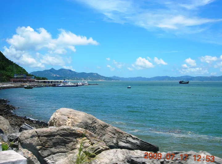
Photo adjustments
Full frame retained; proportionally resized and converted to WebP. No retouching or changes to the photographed subject. Card displays may crop the view.
Explore the region
About Xiachuan Island
Xiachuan Island (下川岛) lies in the western part of the Chuanshan Archipelago (川山群岛) in the South China Sea and belongs to Chuandao Town (川岛镇) in Taishan (台山), Jiangmen (江门). Shangchuan Island (上川岛) faces it across the water to the east.
The island covers 98.68 km², measuring about 23 km from north to south and a little over 12 km from east to west. Most of it is low granite hills, topping out at 529 m, and vegetation covers close to 68% of the land. Dozens of bays cut into the shore, among them Guabangwan (挂榜湾), Niutangwan (牛塘湾), Dawan (大湾) and Xiwuwan (细雾湾). Of the archipelago's islands, most of them continental islands, only Xiachuan, Shangchuan and Mangzhou (漭洲) are inhabited.
Local tradition holds that at the end of the Southern Song, after the Battle of Yamen (崖山海战), the grand tutor Zhang Shijie (张世杰) fell back to these waters with the remnants of his force and proclaimed the Song emperor's last edict on a small nearby island, later called Wangfuzhou (王府洲). Remains identified as a drill ground, a platform for reviewing generals, a flag platform and command steps are still pointed out there. Song refugees later moved onto the main island to found villages and ancestral halls; Zhao (赵) is the commonest surname, and the villagers keep their own speech and customs.
Wangfuzhou is now the island's main resort: crescent-shaped and enclosed on three sides by peaks, with a bathing beach 1,600 m long. Guanyin Mountain (观音山), 434 m high in the south-centre of the island, looks out over the whole island and carries the Denggao Stone (登高石), an oddly shaped boulder inscribed by Guan Shanyue (关山月), a master of Chinese-style painting. East Bay (东湾), in the southwest, is the island's spot for watching the sunset. The archipelago has been developed for holidays since the 1980s and was rated a national AAAA scenic area in 2009. Ferries from Shanzui Harbour (山咀港) in Taishan land at Duwan (独湾) port.
What to look for
- Wangfuzhou (王府洲), a crescent-shaped resort area with peaks on three sides and a 1,600 m bathing beach
- Guanyin Mountain (观音山), a 434 m summit with a view over the whole island
- Denggao Stone (登高石), a boulder on Guanyin Mountain inscribed by Guan Shanyue
- East Bay (东湾) in the southwest, the island's sunset spot
- Traces linked with Zhang Shijie at Wangfuzhou, such as the general-reviewing platform (点将台)
- Guabangwan (挂榜湾) and Niutangwan (牛塘湾), two of the island's many bays
Location & getting there
Getting to Xiachuan Island
- Search for 下川岛 with 江门市 and 台山市.

Find Xiachuan Island
下川岛 · 台山市
No reliable map pin yet: search by the Chinese name.
Sources & visit information
Written from the linked sources and checked sentence by sentence against quoted extracts by a separate reviewer on 2026-09-23. Opening hours, admission and access arrangements are not covered; confirm current visitor information with the site.
Some facts checked against Wikipedia contributors, "下川岛" · CC BY-SA 4.0.
Some facts checked against Wikipedia contributors, "Xiachuan Island" · CC BY-SA 4.0.
Some facts checked against Wikipedia contributors, "川山群岛" · CC BY-SA 4.0.