

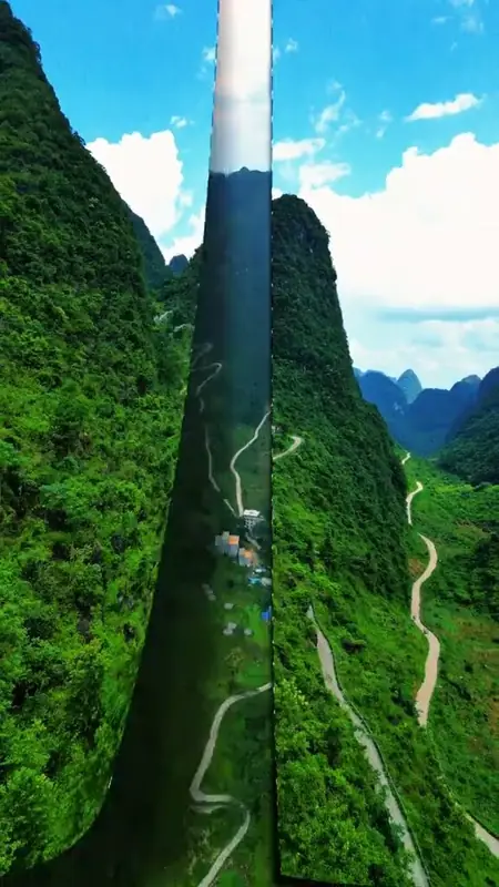
Photo adjustments
EXIF orientation normalized; resized without changing aspect ratio; converted to WebP. No subject edits.
About Qibainong Geopark
The geopark lies on the lower part of the south-eastern slope of the Yunnan-Guizhou Plateau and covers 323.4 square kilometres, divided into the Qianshan Wannong viewing area, the Banlan Gorge area, the Shiguo Tiandu area and the Shili Yougu area. Its primary geoheritage is high peak clusters with deep depressions; karst valleys, gorges, caves, underground rivers, geological sections and water features are among those listed as secondary. The county government describes it as the only geopark in China whose dominant landscape is that combination, and repeats a wider claim that the area is the best developed and most typical high peak-cluster deep-depression region in the world, ranking it with the Yunnan Stone Forest and the peak forest of Guilin and Yangshuo as one of three typical karst types; both of those are the county's own characterisations. The park was made an autonomous-region-level scenic area in 1996 and granted national geopark status by the Ministry of Land and Resources in 2009.
The geopark passed its acceptance review by the ministry and the regional land and resources department in 2012. By then the Qianshan Wannong and Bali Jiuwan viewing platforms, the Tianxia Diyi Nong stairway and Shili Yougu were finished, together with interpretive signs setting out how the landforms were made. The Qibainong National Geological Museum was completed in September 2012 at a cost of more than ten million yuan; it covers 3,000 square metres and displays the park's geology, the regional geological evolution, geoheritage specimens and plant specimens. The Qianshan Wannong area, 65 kilometres north-east of the Dahua county town, lies on the route in, and the county's description of it names peak-cluster depressions, cliff-sided high peak clusters, dolines and flat-floored polje valleys.
Reports differ on how many peaks and depressions the area holds, and the two are cited here rather than reconciled. A People's Daily Online report on the geopark's opening in November 2012 counted more than 9,000 peaks at 800 metres elevation and above and 2,566 depressions of varying shape, within a geopark boundary that then spanned Qibainong and Bansheng townships. A Xinhua News Agency feature on poverty alleviation, published in 2020 and describing Qibainong township alone rather than the geopark as bounded, instead counted more than 1,300 depressions scattered among more than 5,000 stone mountains, without giving an elevation range for the mountains.
What to look for
- The Qianshan Wannong viewing platform, from which the surrounding hills and depressions can be taken in together
- The Qibainong National Geological Museum, a 3,000-square-metre building completed in September 2012 displaying the park's geology and plant specimens
- The Bali Jiuwan viewing platform and the Tianxia Diyi Nong stairway, both completed by 2012
- The Shili Yougu and Banlan Gorge areas, two of the geopark's four named divisions
- The dolines and flat-floored polje valleys named in the county's description of the Qianshan Wannong landforms
Location & getting there
Getting to Qibainong Geopark
Use an authorised visitor route. Cave sections, geological sites and access roads can close independently, so confirm the area that your ticket covers.
- Search for 七百弄 with 河池市 and 大化瑶族自治县.
Find Qibainong Geopark
七百弄 · 大化瑶族自治县
No reliable map pin yet: search by the Chinese name.
Sources & visit information
The linked sources support the identity and background described in this introduction. Opening hours, admission, activity availability and exact arrival arrangements have not been comprehensively checked. Confirm current visitor information with the venue; the original catalogue locality and editorial review flag are retained.