

Photo adjustments
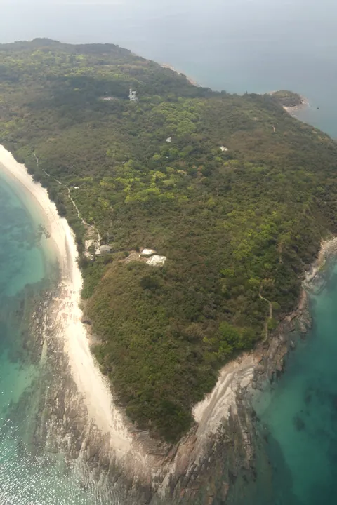
Full frame retained; proportionally resized and converted to WebP. No retouching or changes to the photographed subject. Card displays may crop the view.
Explore the region
About Tung Ping Chau
Tung Ping Chau is a low island in Mirs Bay, in the northeastern waters of Hong Kong. Its finely layered sedimentary rocks distinguish it from the volcanic landscapes often associated with the Hong Kong UNESCO Global Geopark. The name also needs care: Tung Ping Chau is a different island from Peng Chau near Lantau.
The geopark describes its flat terrain and thinly laminated siltstone as defining features. Layers, fractures and the work of the sea create patterns that can be read at different scales, from the outline of the shore to the close texture of a rock face. The interest lies in that geological structure, so rocks should remain in place for other visitors and future study.
Follow the official sightseeing route and spend time comparing successive exposures rather than rushing around the island solely to finish a circuit. Coastal footing and access can change with weather and sea conditions. Plan the return boat before departure from the mainland and keep enough time to reach its landing point without a hurried final section.
What to look for
- Examine the thin horizontal layers of sedimentary siltstone.
- Compare the low island profile with details revealed along the coast.
Location & getting there
Getting to Tung Ping Chau
Use 東平洲 in 大鵬灣. Confirm the current ferry service, return sailing and geopark route notices; avoid collecting rocks or leaving designated visitor paths.
- Use 东平洲 with Hong Kong when searching for the visitor entrance.
Find Tung Ping Chau
东平洲 · 大埔区
No reliable map pin yet: search by the Chinese name.
Sources & visit information
Place identity, setting and described features checked against the linked institutional sources on 9 September 2026. Suggested observation and visiting sequences are editorial guidance. Current opening arrangements and access to individual interiors must be checked with the venue; this review adds no inferred map coordinates.