

Photo adjustments
Full frame retained; proportionally resized and converted to WebP. No retouching or changes to the photographed subject. Card displays may crop the view.
Explore the region
About Hong Kong UNESCO Global Geopark
Hong Kong's UNESCO Global Geopark brings together volcanic rock columns, sedimentary formations and coastal communities across separate land-and-sea areas.
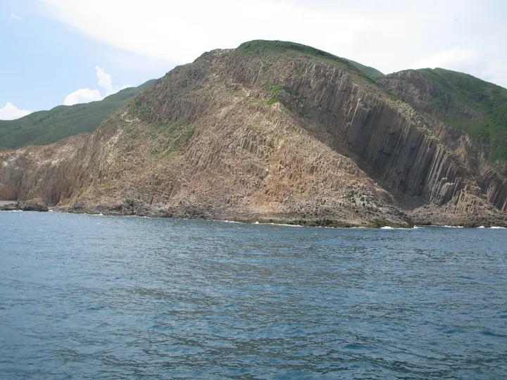
The Sai Kung region is known for hexagonal volcanic columns, while other geosites reveal a long sequence of sedimentary rocks. Mangroves, woodland and villages add ecological and cultural context. The geopark is an umbrella for many sites, so a High Island visit and an offshore boat excursion require different plans.
The geopark is best approached through a specific geosite and a theme, such as volcanic columns or sedimentary history. Some sites can be viewed from land, while others depend on marine transport. The geological identity does not mean all shorelines are freely accessible or suitable for landing. Use the park's current visitor information to select a legal, practical route.
What to look for
- Sai Kung's volcanic rock columns.
- Sedimentary formations at other geosites.
- Coastal ecology and village heritage.
Location & getting there
Getting to Hong Kong UNESCO Global Geopark
Select an official geosite and check its recommended access method. Use an appropriate local operator for boat-based sites and follow current sea and weather advice; not every coast is reachable on foot.
Find Hong Kong UNESCO Global Geopark
香港聯合國教科文組織世界地質公園 · 香港多個地質景點
No reliable map pin yet: search by the Chinese name.
Sources & visit information
The linked reference supports the place identity and background. Route suggestions are editorial planning guidance; use the venue’s current notices for open areas, tickets and transport.