

Photo adjustments
Full frame retained; EXIF orientation normalized, proportionally resized to at most 800 pixels and converted to WebP. No generated pixels or subject changes. Cards may crop the display.
Explore the region
About MacLehose Trail in Sai Kung
The Sai Kung sections of the MacLehose Trail connect reservoir infrastructure, beaches, villages and steep coastal hills. They form the eastern beginning of a much longer cross-territory trail. Describing this area simply as one walk hides important differences between individual sections and the approaches needed to reach them.
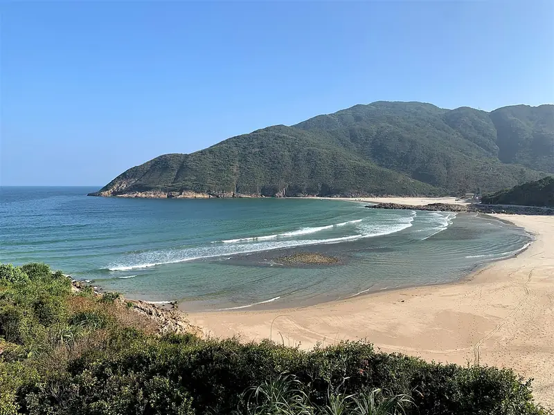
Section 1 runs from Pak Tam Chung toward Long Ke, passing the High Island Reservoir landscape. Section 2 continues from Long Ke to Pak Tam Au, crossing hill terrain before reaching coastal scenery around Sai Wan and Ham Tin and then the quieter inlet at Chek Keng. The official trail guide rates the second section as very difficult, so a photograph of a beach is a poor guide to the effort involved.
Choose a named section or a clearly mapped shorter outing before travelling. Think about ascent, shade and the distance to the next exit as well as kilometres. The reward is the changing sequence of water, settlement and hillside, which can be appreciated without joining several demanding sections into an overlong day.
What to look for
- Compare reservoir scenery in Section 1 with the coast of Section 2.
- Identify the start, finish and intermediate exits before setting out.
Location & getting there
Getting to MacLehose Trail in Sai Kung
Search for 麥理浩徑第一段 or 第二段 and use the official map for that section. Confirm current access and onward transport; separate hill extensions need their own preparation.
- Use 麦理浩径西贡段 with Hong Kong when searching for the visitor entrance.
Find MacLehose Trail in Sai Kung
麦理浩径西贡段 · 西贡区
No reliable map pin yet: search by the Chinese name.
Sources & visit information
Place identity, setting and described features checked against the linked institutional sources on 9 September 2026. Suggested observation and visiting sequences are editorial guidance. Current opening arrangements and access to individual interiors must be checked with the venue; this review adds no inferred map coordinates.