

Photo adjustments
Proportionally resized and converted to WebP without cropping, retouching or changing the photographed subject.
Explore the region
About Baofeng Lake
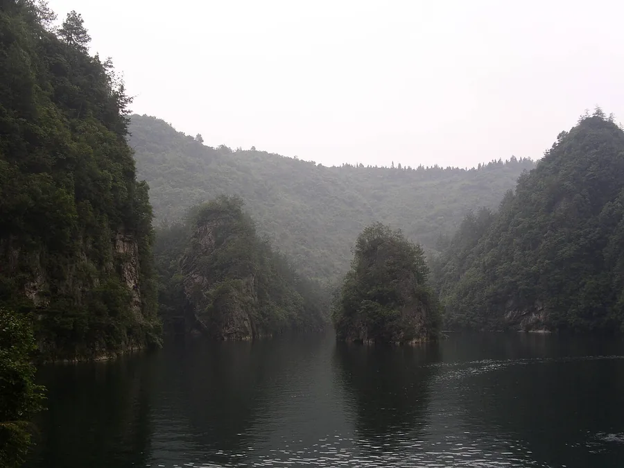
Its boat route places visitors close to the reflections of wooded stone peaks, offering a gentler perspective than the high plateau viewpoints. The waterfall near the entrance adds a different visual feature to the visit. Although the setting looks remote in photographs, the lake is a reservoir created in the twentieth century. Check the route’s walking and shuttle requirements, and treat any singing or other performance as dependent on the operator’s programme.
Baofeng Lake was created in the 1970s, when local villagers in Suoxiyu Village, Wulingyuan District, Zhangjiajie, built dams across a gorge to generate electricity; the project inadvertently formed the lake. It was named Baofeng Lake because it lies backed by Baofeng Mountain. The resulting reservoir has an average depth of 72 metres and a length of 2.5 kilometres.
What to look for
- Wooded peaks and reflections from the lake’s boat route.
- The waterfall and lower visitor-area setting.
Location & getting there
Getting to Baofeng Lake
Go to the Baofeng Lake visitor centre south of Wulingyuan town. The ticket entrance and boat pier are separate points, so check whether the booked product includes the internal transfer and lake cruise.
Combine your visit
A suggested order for exploring this place and its immediate setting.
-
Visitor centre and lower waterfall游客中心与宝峰飞瀑
Begin with the lower scenic area and transfer instructions.
-
Lake pier宝峰湖游船码头
Board only the service included in your reservation.
-
Lake circuit宝峰湖游船线
Enjoy the changing views before returning through the designated exit route.
Check access to the individual stops. A suggested sequence does not imply a combined ticket or guaranteed transfer.

Find Baofeng Lake
宝峰湖 · 张家界市
The pin marks the area, not the entrance.
More places nearby
Approximate straight-line distances between map pins, not travel distances.
Wulingyuan 武陵源
5 km awayWulingyuan is the wider protected landscape that brings together Zhangjiajie’s sandstone pillars, ravines, forests and several distinct scenic sectors. It works best as a route-planning region rather than a single stop at one…
View guide →Huanglong Cave Scenic Area, Zhangjiajie 张家界黄龙洞景区
7 km awayHuanglong Cave presents a limestone underground landscape near Wulingyuan, contrasting with the sandstone pillars above ground. The visitor route combines passages, chambers and the Xiangshui River section, with the slender…
View guide →Tianzi Mountain · representative mountain point 天子山·山地区域示意点
10 km awayTianzi Mountain offers broad views over the northern part of Wulingyuan’s sandstone-pillar landscape. Yubi Feng, often translated as Imperial Brush Peaks, and the Fairy Scattering Flowers viewpoint turn individual formations…
View guide →Sources & visit information
The sources below support the place-specific description and arrival information. Suggested combinations are editorial planning ideas; confirm current opening, entry arrangements and transport services for your date.
- Baofeng Lake ↗
- Provincial tourism authority — lake, waterfall and pier context ↗
- English Wikipedia: Baofeng Lake (revision 1365871222, 2026-07-24) ↗
Visitor information adapted and edited from Wikipedia contributors: Baofeng Lake · CC BY-SA 4.0. Source revision 1365871222.
Background paragraphs condensed from Wikipedia contributors, "Baofeng Lake", English Wikipedia · CC BY-SA 4.0. Source revision 1365871222.