

Photo adjustments
EXIF orientation normalized; resized without changing aspect ratio; converted to WebP. No subject edits.
Explore the region
About Dehang Miao Village and Canyon
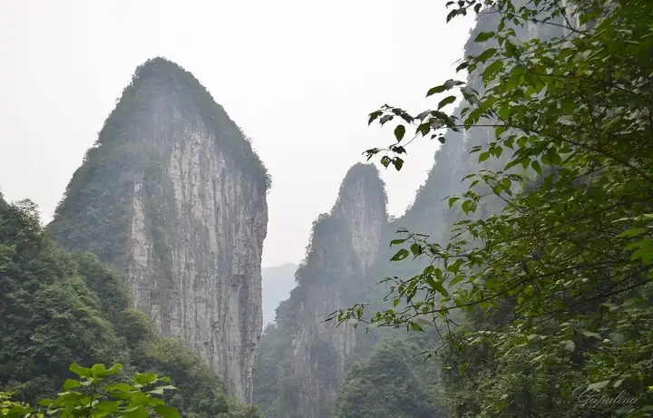
The Dehang Grand Canyon runs about 15 kilometres, between 300 and 430 metres deep and 900 to 1,300 metres from rim to rim, with a floor only some 60 metres wide. It is cut in limestone laid down in the Cambrian more than 500 million years ago, at the point where the third step of China's topography rises towards the second, so cliffs, peak forest and waterfalls stand close together. The provincial authorities count seven major gorges and seven major waterfalls in the wider area, the largest being Liusha waterfall with a drop of 216 metres.
The village lies about four kilometres upstream from Aizhai town, reached along a stream past water wheels, water mills and old fords, with the Jiulong stream running through the settlement itself. An old bridge, the Jielongqiao, ties together the two natural hamlets that make up Dehang, and the village keeps its dark-tiled timber houses, black and white fire gables and carved windows. Its people are Miao. Hunan approved the area as a provincial scenic area in 1991 before its national designation.
The canyon rim carries features of its own. Tianwentai is a rock platform open on three sides and attached to the cliff on the fourth, about six metres across with roughly 150 metres of air beneath it, long used by the Miao as a place of prayer and sacrifice. Near it stands Jidou, a Miao village of thirty to forty households with flagstone paths and terraced fields dropping away in front of it.
What to look for
- Liusha waterfall, a drop of 216 metres
- The Jielong bridge, the old crossing that links the two hamlets forming Dehang village
- Tianwentai, a rock platform about six metres across standing clear above roughly 150 metres of drop, long a Miao ritual site
- Jidou Miao village on the rim above the canyon, with its flagstone paths and terraced fields
- Pangu peak above the village, over 400 metres high, whose summit carries more than five hectares of old-growth forest inside a ring of cliffs
Location & getting there
Getting to Dehang Miao Village and Canyon
Identify the main visitor approach and any separately managed houses, museums or performances. Ask before entering residential spaces or photographing residents.
- Search for 德夯苗寨与峡谷 with 湘西土家族苗族自治州 and 吉首市.

Find Dehang Miao Village and Canyon
德夯苗寨与峡谷 · 吉首市
No reliable map pin yet: search by the Chinese name.
Sources & visit information
The linked sources support the identity and background described in this introduction. Opening hours, admission, activity availability and exact arrival arrangements have not been comprehensively checked. Confirm current visitor information with the venue; the original catalogue locality and editorial review flag are retained.