

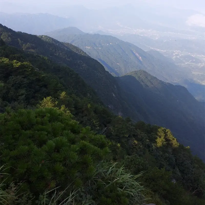
Photo adjustments
EXIF orientation normalized; resized without changing aspect ratio; converted to WebP. No subject edits.
Explore the region
About Mufu Mountain
Mufu Mountain (幕阜山) is a range where Hunan, Hubei and Jiangxi meet, with its main peak in Nanjiang Town (南江镇), Pingjiang County (平江县), Yueyang (岳阳). The range forms the northern arm of the Luoxiao Mountains (罗霄山脉).
The Hunan provincial government describes the range as running about 200 km southwest to northeast, from Pingjiang to Jiujiang County (九江县) in Jiangxi, and puts its highest point at 1,606 m; Chinese Wikipedia gives the main peak as 1,597.2 m and names Jiugong Mountain (九宫山, 1,543 m) among the other high summits. The mountain covers 6,468 hectares with forest cover close to 94%. The provincial government counts more than 1,100 hectares of Taiwan red pine (Pinus taiwanensis), the largest stand of the tree south of the Yangtze, and lists the clouded leopard, a first-class national protected animal, along with 22 second-class species such as the pangolin, macaques and otters.
The mountain was anciently called Tianyue (天岳山). It takes its present name from the Three Kingdoms, when the Eastern Wu general Taishi Ci (太史慈) resisted the army of Liu Biao (刘表) and pitched his tents (幕) on the summit. Daoists count its cave, the Xuanzhen Taiyuan Grotto-Heaven (玄真太元洞天), as the 25th of their 36 grotto-heavens. Ge Hong (葛洪) of the Eastern Jin wrote an account of the mountain, and the late-Qing writer Li Yuandu (李元度) wrote a record of travelling here. The provincial government describes Mufu as a strategically important battlefield in ancient times and notes well-preserved stone inscriptions along its mountain roads.
The State Forestry Administration approved Mufu Mountain as a national forest park in 2005. The park has forty-eight named sights, among them the red cliffs of Danyan Xizhao (丹岩夕照) and the Tianyue ancient battlefield (天岳古战场), and the provincial government also points to its waterfalls, old temples, flowering plants and wide mountain meadows. A jungle adventure park on top of the mountain has a 1,435 m zip line, rope courses in the treetops and swinging bridges.
What to look for
- Danyan Xizhao, "red cliffs at sunset", one of the forty-eight named sights
- Longtan Feipu (龙潭飞瀑), the waterfall of the dragon pool
- The Tianyue ancient battlefield and old stone inscriptions along the mountain roads
- Feisha Ancient Well (沸沙古井), the "well of boiling sand"
- Stands of Taiwan red pine covering more than 1,100 hectares
- The summit jungle adventure park with a 1,435 m zip line and treetop rope courses
Location & getting there
Getting to Mufu Mountain
- Search for 幕阜山 with 岳阳市 and 平江县.
Find Mufu Mountain
幕阜山 · 平江县
No reliable map pin yet: search by the Chinese name.
Sources & visit information
Written from the linked sources and checked sentence by sentence against quoted extracts by a separate reviewer on 2026-09-23. Opening hours, admission and access arrangements are not covered; confirm current visitor information with the site.
Some facts checked against Wikipedia contributors, "幕阜山" · CC BY-SA 4.0.