

Photo adjustments
Proportionally resized and converted to WebP without cropping, retouching or changing the photographed subject.
Explore the region
About Dali Lake
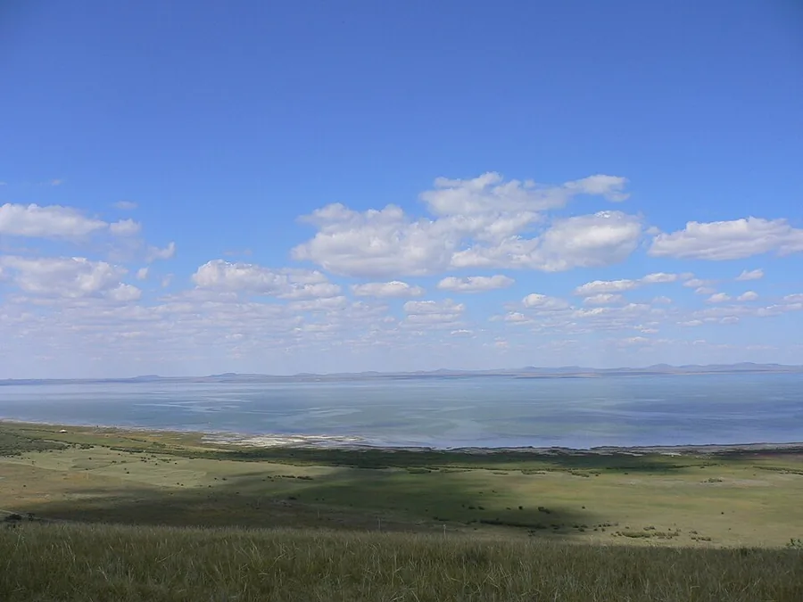
It is a closed saline lake with a wide horizon and important bird habitat around its margins. The southern visitor area adds the perspective of Mantuo Mountain, which rises beside the shore. Combining an authorised lakeside stop with the mountain viewpoint reveals the meeting of water, grassland and sand without trying to circle the lake or enter its protected bird habitat.
Dali Lake is also known historically as Yu'erluo or Da'erhaizi (鱼儿泺, 答儿海子), and was formed as a lava-dammed lake (熔岩堰塞湖). It is bordered by the Xilingol grassland (锡林郭勒草原) to the west, in addition to the Gongger grassland (贡格尔草原) and Hunshandake sands (浑善达克沙地) nearby. The lake supports a range of animal life. Fish include the Amur ide (Leuciscus waleckii, 雅罗鱼), crucian carp and common carp. Birds are present mainly in summer and include wild ducks, wild geese, gulls, swans, white-naped cranes and red-crowned cranes. The lake's area has been affected by global climate change and by human activity, showing an overall shrinking trend. Between 1991 and 2013, its water surface decreased from 223.50 square kilometres to 195.84 square kilometres.
What to look for
- The broad lake and grassland margin from the southern visitor area.
- The elevated view from the Mantuo Mountain route, when open.
Location & getting there
Getting to Dali Lake
Travel from Jingpeng to the Dali Lake south-shore scenic area by Dali Lake Fishery and Mantuo Mountain.
- The north and south visitor sectors have different approaches; the route here uses the south shore and avoids protected wetland interiors.
Combine your visit
Suggested order within this visit:
-
South-shore lakeside viewpoint
Begin with the scale of the water and shore.
-
Mantuo Mountain visitor route
Continue to a higher perspective on the lake and surrounding terrain.
This sequence is an editorial suggestion based on the features described in the sources. Access to individual buildings or areas should be checked locally; no travel time or shared admission is implied.

Find Dali Lake
达里诺尔 · 赤峰
The pin marks the area, not the entrance.
More places nearby
Approximate straight-line distances between map pins, not travel distances.
Sources & visit information
The sources below support the place-specific description and arrival information. Suggested combinations are editorial planning ideas; confirm current opening, entry arrangements and transport services for your date.
- Wikipedia: 达里湖 ↗
- Chifeng Culture and Tourism: Dali Lake and Mantuo Mountain ↗
- Ctrip: Dali Lake south-shore visitor-area address ↗
Visitor information adapted and edited from Wikipedia contributors · CC BY-SA 4.0. Source revision 92591943.
Background paragraphs translated and condensed from Wikipedia contributors, "达里湖", Chinese Wikipedia · CC BY-SA 4.0. Source revision 92591943.