

Photo adjustments
Full frame retained; proportionally resized and converted to WebP. No retouching or changes to the photographed subject. Card displays may crop the view.
About Xianjingtai
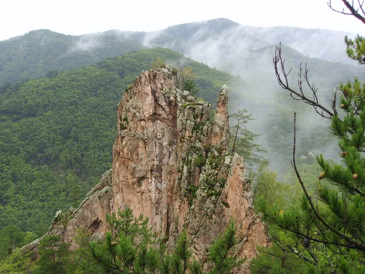
Xianjingtai is a mountain landscape in the Helong area of Yanbian, associated with distinctive granite peaks and exposed rock forms. Weathering along joints has helped produce the separate pillars, ridges and silhouettes seen above the surrounding vegetation. The shapes of the rocks are the main focus of a visit.
The provincial landscape account describes cliff pines, seasonal flowers and changing cloud conditions around the peaks. These elements alter how the granite is framed rather than replacing it as the defining feature. From different angles, a single formation can appear slender, broad or partly merged with the ridge behind it.
Use established viewpoints to compare a rock formation first against the sky and then against neighbouring peaks. Look for the joints and ledges that explain its shape before considering the imaginative names given to individual rocks. Clouds or flowers may add to the scene when conditions allow, but neither should be treated as a fixed feature available throughout the year.
What to look for
- Compare the silhouettes of the granite formations.
- Look for joints, ledges and pines on the rock faces.
- Observe how a change of viewpoint alters the same peak.
Location & getting there
Getting to Xianjingtai
Search for 和龙仙景台. Follow the maintained mountain route and check visibility and surface conditions before choosing higher viewpoints.
- Use 仙景台 with Jilin when searching for the visitor entrance.
Find Xianjingtai
仙景台 · 和龙市
No reliable map pin yet: search by the Chinese name.
Sources & visit information
Place identity, setting and described features checked against the linked institutional sources on 9 September 2026. Suggested observation and visiting sequences are editorial guidance. Current opening arrangements and access to individual interiors must be checked with the venue; this review adds no inferred map coordinates.