

Photo adjustments
Proportionally resized and converted to WebP without cropping, retouching or changing the photographed subject.
City & district guides
About Mount Taibai
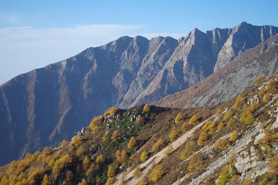
The mountain’s character changes markedly with elevation: wooded lower slopes give way to colder high-country habitats and landforms left by ancient glaciers. A visitor outing starts in the forest park above Tangyu, rather than automatically reaching the summit. Choose the open scenic route for the day; the wider mountain and protected high-altitude terrain extend well beyond an ordinary park circuit.
What to look for
- The changing forest communities on the mountain’s lower and middle slopes.
- The high mountain’s glacially shaped ridges and basins, explained by the park’s landscape interpretation where accessible.
Location & getting there
Getting to Mount Taibai
Use the Mount Taibai visitor centre at Tangyu Town in Mei County as the mountain’s established scenic-area approach.
- Confirm the operating park transport and permitted upper limit before ascending; Baxiantai and the Aotai ridge should not be assumed to be part of an open visitor route.
Combine your visit
Suggested order within this visit:
-
Tangyu visitor centre
Choose an open route and understand the mountain’s elevation zones.
-
Lower forest section
Look closely at the warmer forest environment.
-
Accessible mountain viewpoint
Compare the vegetation and ridge landscape at the highest point permitted on your chosen route.
This sequence is an editorial suggestion based on the features described in the sources. Access to individual buildings or areas should be checked locally; no travel time or shared admission is implied.
Find Mount Taibai
太白山 · 宝鸡
The pin marks the area, not the entrance.
More places nearby
Approximate straight-line distances between map pins, not travel distances.
Changqing Nature Reserve长青国家级自然保护区
37 km awayChangqing protects Qinling forest habitats around Huayang, associated with giant pandas, golden snub-nosed monkeys, takin and crested ibis. These are conservation habitats, and a visit should not be planned as an unrestricted…
View guide →Yangling Agricultural Museum杨凌农林博览园
46 km awayThe agricultural museum complex at Northwest A&F University in Yangling combines natural-history collections with the history of farming. Its specialist museums cover insects, animals, soil, plants and agriculture, with further…
View guide →Louguantai楼观台
53 km awayLouguantai is a Daoist mountain-foot site in Zhouzhi, traditionally associated with Laozi’s transmission of the Daodejing. Its principal visit rises toward Shuojing Terrace, where later temple buildings occupy a wooded elevation…
View guide →Sources & visit information
The sources below support the place-specific description and arrival information. Suggested combinations are editorial planning ideas; confirm current opening, entry arrangements and transport services for your date.
Visitor information adapted and edited from Wikipedia contributors · CC BY-SA 4.0. Source revision 93872312.
Visitor information adapted and edited from Wikivoyage contributors · CC BY-SA 4.0. Source revision 5205128.