

Photo adjustments
EXIF orientation normalized; resized without changing aspect ratio; converted to WebP. No subject edits.
Explore the region
About Yimeng Yunpu Dongtian Scenic Area
Feixian County's tourism pages put the area in the north of the county, backed by Mengshan and fronted by the Jun River, and give its extent as more than 5,000 mu made up chiefly of Lianhua Shan and Tianmeng Lake. The county rates it a national AAAA tourist area and calls it one core scenic area of the Yimengshan National Geopark, so the geopark designation belongs to the wider park rather than to this site alone. The county's register of A-level scenic areas records the official name Feixian Yimeng Yunpu Dongtian Tourist Area, an address four kilometres north of Dongmeng Town, and a 4A assessment in 2009 following an earlier one in 2005. Development began in 1999, and the county now describes the opened ground as five park sectors, an entrance area together with sectors named for Zhidongshi, Tianmeng Lake, the boulder field and Lianhua Shan, holding more than eighty named viewpoints. An older county page divides the same ground into four differently named sectors, one of them called Yunpu Dongtian in its own right, so the internal divisions have shifted rather than settled.
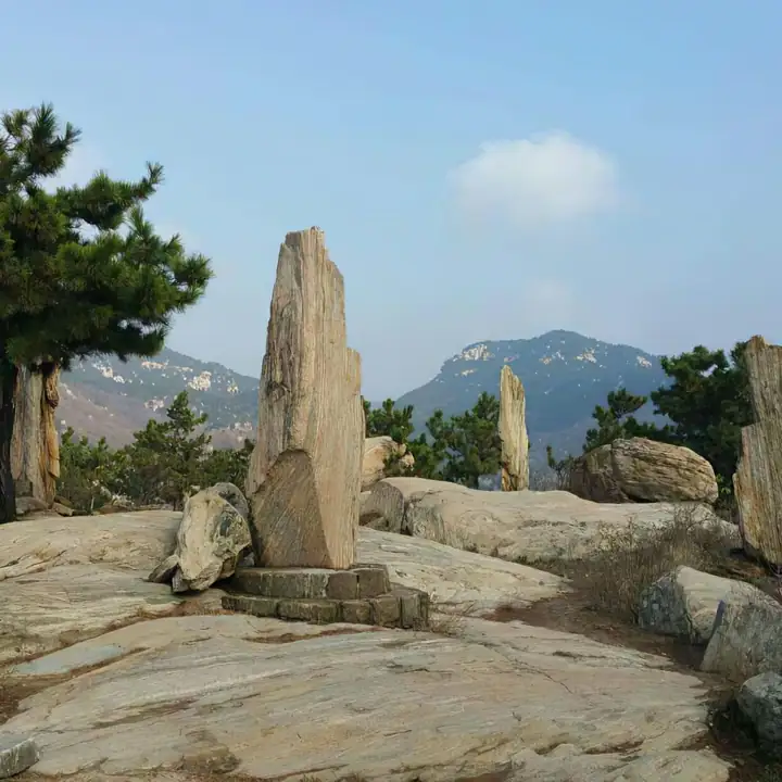
Lianhua Shan, named for a profile the county likens to a lotus bud about to open, reaches 480 metres, and its flanks are cliff and boulder country rather than smooth slope, with named features that include Panlong Gorge, Nantianmen, Xianren Qiao and Yixiantian. Linked hollows run through the stacked rock, six of which the county names: Yunshui, Lingxu, Qianyuan, Kunling, Taiyi and Wuji. Weathered granite shapes across the hill are identified with animals and figures, the vulture and the tortoise stone among the best known. Tianmeng Lake lies below the hill and covers more than 800 mu, with a timber boardwalk built along its shore.
What to look for
- Zhidongshi, a hundred-tonne granite boulder about seven metres long and five wide that rests on two rocks and can be made to rock with the pressure of one finger
- Lianhua Shan, the 480-metre hill named for a profile likened to a lotus bud about to open
- The linked hollows through the stacked rock, which the county names Yunshui, Lingxu, Qianyuan, Kunling, Taiyi and Wuji
- Tianmeng Lake, more than 800 mu of water below the hill, with a timber boardwalk along its shore
- Weathered granite shapes identified with animals and figures, the vulture and the tortoise stone among the best known
Location & getting there
Getting to Yimeng Yunpu Dongtian Scenic Area
Use an authorised visitor route. Cave sections, geological sites and access roads can close independently, so confirm the area that your ticket covers.
- Search for 沂蒙云瀑洞天 with 临沂市 and 费县.
Find Yimeng Yunpu Dongtian Scenic Area
沂蒙云瀑洞天 · 费县
No reliable map pin yet: search by the Chinese name.
Sources & visit information
The linked sources support the identity and background described in this introduction. Opening hours, admission, activity availability and exact arrival arrangements have not been comprehensively checked. Confirm current visitor information with the venue; the original catalogue locality and editorial review flag are retained.