

Photo adjustments
Full-frame source proportionally resized and converted to WebP for display. No subject alteration. Source-supplied marks and edits remain; cards may crop the view.
Explore the region
About Yehliu
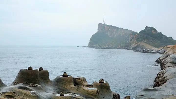
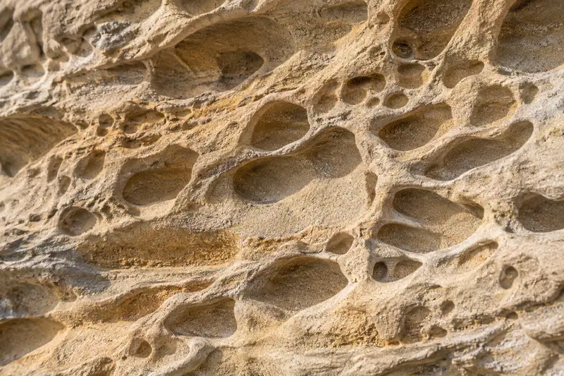
Mushroom rocks, honeycombed surfaces and shallow potholes make the changing shoreline easy to read on foot. The Queen’s Head is its best-known formation, but the wider rock landscape is the main reason to leave time for the visit.
Follow the marked visitor paths and compare the varied shapes instead of concentrating only on one photograph. The rocks are fragile and the coast is exposed, so keep outside the protected zones and follow current sea-condition instructions. This guide uses the geopark entrance as the arrival destination; the cape’s map pin is not an entrance.
What to look for
- The Queen’s Head is one example of the cape’s weathered mushroom rocks.
- Tofu-like stone surfaces, potholes and coastal erosion features show different processes.
- The open cape gives a broad view of the northern coastline.
Location & getting there
Getting to Yehliu
The visitor entrance is at 167-1 Gangdong Road, Yeliu Village, Wanli District. Use Yehliu Geopark as the arrival destination rather than the lighthouse or the tip of the cape.
Combine your visit
Build the visit around these complementary stops.
-
Geopark entrance地質公園入口
Check the current route and conditions before entering.
-
Mushroom-rock landscape蕈狀岩區
Compare the rock forms and the Queen’s Head from marked viewpoints.
-
Coastal viewing paths海岸觀景步道
Continue along the permitted route for the wider cape scenery.
Use the current visitor programme and local conditions to choose which stops to include.
Find Yehliu
野柳 · 新北市
The pin marks the area, not the entrance.
More places nearby
Approximate straight-line distances between map pins, not travel distances.
Heping Island 和平島
9 km awayHeping Island Geopark sits on Keelung’s northeastern coast, where waves and weather have shaped pale rock into mushroom-like forms and blocky platforms. Fossils and coastal plants add details to a walk that first appears to be…
View guide →Yangmingshan 阳明山
16 km awayYangmingshan is a broad volcanic landscape on Taipei’s northern edge, with steaming ground, grasslands and wooded paths spread between distinct visitor areas. Xiaoyoukeng makes the geology particularly visible through fumaroles…
View guide →Jiufen 九份
19 km awayJiufen grew with gold mining before its hillside streets found a new life through tourism and cinema. The old settlement sits between mountain and sea, with steep changes of level, close-packed buildings and tea houses that…
View guide →Sources & visit information
The sources below support the place-specific description and arrival information. Suggested combinations are editorial planning ideas; confirm current opening, entry arrangements and transport services for your date.
Selected visitor facts translated and adapted from Tourism Administration and contributing local tourism authorities, 2026 Tourism Information Database v2.1 — 野柳地質公園 (Attraction_382000000A_109735) · Open Government Data License 1.0.