

Entry & permits for Tibet (Xizang)
Foreign tourists need Tibet entry approval, commonly called a Tibet Travel Permit, and an organised visit arranged through a specialist travel agency in China. Confirm your approved route before booking transport. Requirements differ for Taiwan residents and for travellers using mainland or Hong Kong/Macao Chinese resident documents; check the document guide before you book.
Check the travel-document requirements →Policy scope verified: 2026-09-06. UK FCDO: China regional travel advice ↗ State Council Taiwan Affairs Office: Tibet entry approval ↗ Xizang Department of Culture and Tourism: Medog border permit notice ↗
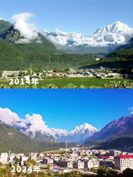
Photo adjustments
EXIF orientation normalized; resized without changing aspect ratio; converted to WebP. No subject edits.
About Gyirong Valley Official Route
The Gyirong valley lies deep within the central Himalayas and has long been a route for exchange between China, Nepal and the wider South Asian subcontinent. Below Bangxing village in Gyirong town, a gorge holds an extensive primeval forest designated a Tibet Autonomous Region nature reserve, covering more than 30,000 hectares, flanked by steep peaks and snow-capped year-round above dense forest, with waterfalls and streams through its middle slopes. The forest contains rare tree species found nowhere else in China, including Tibetan long-leaf pine, long-leaf spruce and Himalayan yew, and is home to grey langurs, musk deer, black bears and macaques, alongside leopards, blue sheep, leopard cats and Tibetan snowcock. The valley's southernmost point, Resuo, sits at only about 1,800 m elevation, where the Gyirong river joins the Donglin river before entering Nepal.
What to look for
- the primeval forest below Bangxing village, with long-leaf pine, long-leaf spruce and Himalayan yew
- wildlife including grey langurs, musk deer and leopard cats
- the valley's descent to Resuo, at about 1,800 m, where the Gyirong river crosses into Nepal
Location & getting there
Getting to Gyirong Valley Official Route
Confirm the visitor entrance and which boat or walking routes operate on your date. Rainfall, water levels and weather can change access.
- Search for 吉隆沟正规开放线路 with 日喀则市 and 吉隆县.

Find Gyirong Valley Official Route
吉隆沟正规开放线路 · 吉隆县
No reliable map pin yet: search by the Chinese name.
Sources & visit information
The linked sources support the identity and background described in this introduction. Opening hours, admission, activity availability and exact arrival arrangements have not been comprehensively checked. Confirm current visitor information with the venue; the original catalogue locality and editorial review flag are retained.