

Entry & permits for Tibet (Xizang)
Foreign tourists need Tibet entry approval, commonly called a Tibet Travel Permit, and an organised visit arranged through a specialist travel agency in China. Confirm your approved route before booking transport. Requirements differ for Taiwan residents and for travellers using mainland or Hong Kong/Macao Chinese resident documents; check the document guide before you book.
Check the travel-document requirements →Policy scope verified: 2026-09-06. UK FCDO: China regional travel advice ↗ State Council Taiwan Affairs Office: Tibet entry approval ↗ Xizang Department of Culture and Tourism: Medog border permit notice ↗
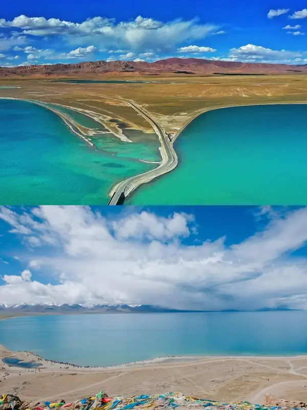
Photo adjustments
EXIF orientation normalized; resized without changing aspect ratio; converted to WebP. No subject edits.
Explore the region
About Selin Co Official Roadside Viewpoint
The municipal entry puts the lake surface at 4,530 metres and the lake at 77.7 kilometres along its east-west long axis, with a maximum width of 45.5 kilometres and a mean width of about 20.95 kilometres; its area is given as 2391 square kilometres in a parenthesis that opens 2014年6月 and is never closed, so the figure is quoted here as the page prints it. The basin, in which many rivers and lakes run together as an inland lake group, covers 45,530 square kilometres, which the municipal government calls first among Tibet's inland water systems. The page names the Zhajia Zangbo, the Zhagen Zangbo and the Boqu Zangbo as the main inflows and says they all enter from the south-east, while also saying that the Zhajia Zangbo enters at the lake's northern shore; the two statements are not reconciled on the page and are not reconciled here. The Zhajia Zangbo is 409 kilometres long and is described as the longest inland river in Tibet, rising in the Tanggula mountains, with a basin of 16,675 square kilometres fed mainly by ice and snowmelt.
The lake lies inside the Tibet Selin Co Black-necked Crane National Nature Reserve. The Ministry of Ecology and Environment's register of Tibetan nature reserves, current to the end of 2012, lists it as entry 藏37, covering Xainza, Nyima, Baingoin, Amdo and Nagqu counties, with an area of 2,032,380 hectares, black-necked crane breeding grounds and the plateau wetland ecosystem as its objects of protection, wildlife as its type, national as its level, 19930101 as its date of establishment and forestry as its supervising department. The municipal page gives the same total area and breaks it into a core zone of 812,570 hectares, a buffer zone of 1,124,610 hectares and an experimental zone of 95,200 hectares, and places the reserve between 87°46' and 91°48' east and 30°10' and 32°10' north. The two sources differ on the reserve's history: the register gives one establishment date, while the municipal page says the lake was made a regional-level reserve in 1985, that the black-necked crane reserve was set up in 1993, and that it was promoted to national level in 2003.
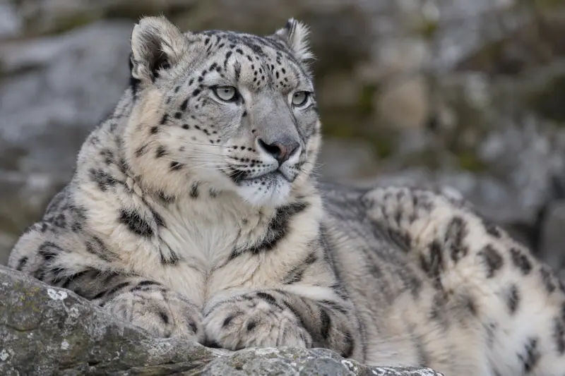
The municipal government describes Selin Co as the area with the most rare and endangered species in the plateau alpine steppe ecosystem and as the world's largest black-necked crane nature reserve. Alongside the black-necked crane it names the snow leopard, Tibetan antelope, argali, Tibetan wild ass and Tibetan snowcock among the first-class nationally protected animals there, and records Gymnocypris selincuoensis, the Selin Co naked carp, as the only fish species in the lake.
The catalogue entry is an editorial label for an official roadside viewpoint. No cited source designates one, names one, or says which parts of the lake shore may be visited, and none is claimed here; what the sources establish is the lake, its basin and the national reserve that contains it.
What to look for
- The lake itself, its surface at 4,530 metres and its long axis running 77.7 kilometres east to west
- The black-necked crane, for whose breeding grounds the surrounding national nature reserve was established
- Other first-class protected animals the municipal government names at the lake include snow leopard, Tibetan antelope, argali, Tibetan wild ass and Tibetan snowcock
- The Selin Co naked carp, Gymnocypris selincuoensis, recorded as the only fish species in the lake
- The mouth of the Zhajia Zangbo, the 409-kilometre river described as the longest inland river in Tibet
Location & getting there
Getting to Selin Co Official Roadside Viewpoint
Confirm the visitor entrance and which boat or walking routes operate on your date. Rainfall, water levels and weather can change access.
- Search for 色林错正规公路观景点 with 那曲市 and 班戈县、申扎县.
Find Selin Co Official Roadside Viewpoint
色林错正规公路观景点 · 班戈县、申扎县
No reliable map pin yet: search by the Chinese name.
Sources & visit information
The linked sources support the identity and background described in this introduction. Opening hours, admission, activity availability and exact arrival arrangements have not been comprehensively checked. Confirm current visitor information with the venue; the original catalogue locality and editorial review flag are retained.