

Photo adjustments
Proportionally resized and converted to WebP without cropping, retouching or changing the photographed subject.
Explore the region
About Nanxi River (Zhejiang)
Furong preserves Ming-and-Qing-period residences within a layout associated with the seven stars and eight dipper ponds, while Yantou’s Lishui Street follows a curving waterside covered corridor. These give a concrete village-focused visit within a much larger scenic region. Choose the riverbank and village area first; distant waterfalls and rock formations belong to separate excursions rather than a continuous walk along the whole river.
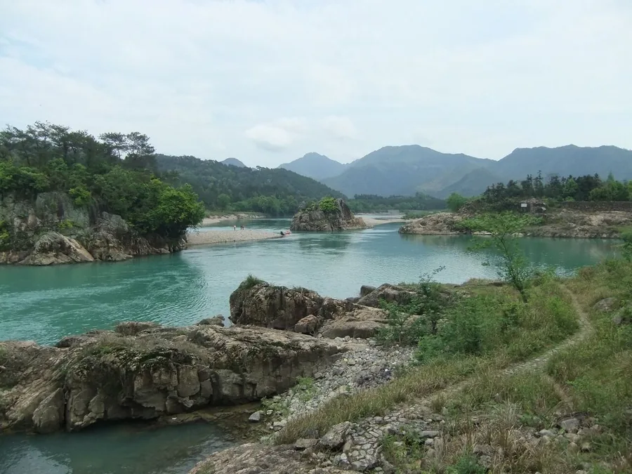
The river flows south between the Yandang Mountains (雁荡山) and Kuocang Mountains (括苍山), joining the Ou River (瓯江). Its broad, shallow channel runs over a bed containing many pebbles. Tuff, rhyolite and granite form much of the surrounding mountain terrain. The waterway has also carried timber: wood floated from the forested upper reaches was collected farther downstream.
Daruo Mountain (大若岩山) was a retreat of the Liang-dynasty Taoist scholar Tao Hongjing (陶弘景). At its foot, Taogong Cave (陶公洞) is a natural cavern measuring 56 metres high, 76 metres wide and 79 metres deep. The wider river landscape received national scenic designation in 1988 and was added to China's UNESCO World Heritage Tentative List on 29 November 2001 in the mixed cultural and natural category.
What to look for
- Furong’s historic residential layout connects lanes and ponds with a symbolic village plan.
- Lishui Street in Yantou follows a covered corridor beside the water.
The surrounding area
Southern Zhejiang's distinct urban and commercial life, well beyond a short Hangzhou detour.
Location & getting there
Getting to Nanxi River (Zhejiang)
For this middle-valley route, approach Furong Village beside Provincial Road 41 near Yantou in Yongjia. Arrange the onward connection between the village and Yantou’s Lishui Street.
Combine your visit
A suggested sequence linking the specific features of this visit.
-
Furong village lanes
Begin with the historic residential arrangement.
-
Furong ponds and open spaces
Read how water features form part of the village plan.
-
Lishui Street, Yantou
Compare village interiors with a covered commercial corridor beside water.
This order is editorial. Confirm access and any transfers between stops; it does not establish a walking route, same-day connection or common admission ticket.
Find Nanxi River (Zhejiang)
楠溪江 · 温州市
The pin marks the area, not the entrance.
More places nearby
Approximate straight-line distances between map pins, not travel distances.
Wuma Street 五马街
3 km awayWuma Street is the commercial spine of Wenzhou’s old centre, connecting Jiefang South Road with Chanjie. The bronze Five Horses sculpture gives the street’s name a visible marker, while older shop fronts and adjoining lanes…
View guide →Jiangxin Island 江心屿
4 km awayJiangxin Island divides the Ou River in Wenzhou and is marked by its East and West Pagodas. Their long association with navigation gives the river views a historical purpose beyond scenery. Jiangxin Temple occupies the central…
View guide →Wenzhou Museum 温州博物馆
6 km awayWenzhou Museum introduces the Ou region through archaeology, art and natural history. The entrance’s stone-carved banyan tree and the central hall’s mythological bronze reliefs establish a strong visual opening. Collection…
View guide →Sources & visit information
The sources below support the place-specific description and arrival information. Suggested combinations are editorial planning ideas; confirm current opening, entry arrangements and transport services for your date.
- en.wikipedia.org ↗
- wm.yj.gov.cn ↗
- wl.wenzhou.gov.cn ↗
- Chinese Wikipedia: 楠溪江 (revision 94275659, 2026-09-10) ↗
- English Wikipedia: Nanxi River (Zhejiang) (revision 1367612744, 2026-08-04) ↗
Background paragraphs translated and condensed from Wikipedia contributors, "楠溪江", Chinese Wikipedia · CC BY-SA 4.0. Source revision 94275659.
Background paragraphs condensed from Wikipedia contributors, "Nanxi River (Zhejiang)", English Wikipedia · CC BY-SA 4.0. Source revision 1367612744.