

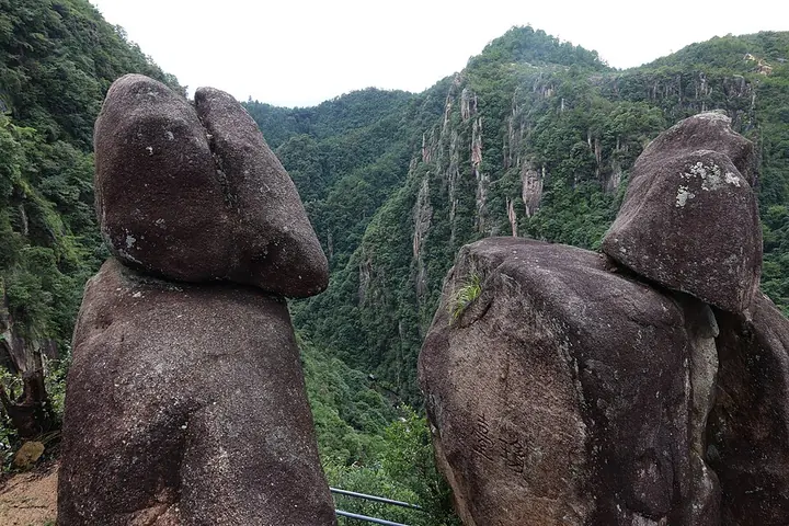
Photo adjustments
Full frame retained; proportionally resized and converted to WebP. No retouching or changes to the photographed subject. Card displays may crop the view.
Explore the region
About Tiantai Mountain
Guoqing Temple provides the historical focus for the Tiantai Buddhist tradition, while Shiliang’s natural stone bridge spans a waterfall. Huading offers a higher forest landscape. Begin with one temple-and-waterfall pairing and treat the summit area as an additional excursion. The name describes a wider mountain destination, so a railway arrival or single attraction ticket does not imply access to every section.
The range runs from northeast to southwest and forms a watershed between the Yong River (甬江), Cao'e River (曹娥江) and Ling River (灵江). Its granite summit, Huading (华顶山), reaches 1,138 metres. Outlying ridges extend into the sea to form the Zhoushan Islands (舟山群岛), continuing the mountain system beyond the mainland.
Tiantai Buddhism developed in sixth-century China with a particular emphasis on the Lotus Sutra. A Japanese monk's visit in 805 preceded the founding of a related school in Japan, while a Korean branch was established during the twelfth century. The mountain also received national park designation on August 1, 1988.
What to look for
- Guoqing Temple anchors the mountain’s Tiantai Buddhist heritage.
- Shiliang Waterfall drops beneath a natural stone bridge.
Location & getting there
Getting to Tiantai Mountain
Tiantaishan Railway Station provides the regional arrival point. Continue to the selected Guoqing or Shiliang visitor area by the current local transport, checking transfers between the separate sections.
Combine your visit
A suggested sequence linking the specific features of this visit.
-
Guoqing Temple国清寺
Begin with the mountain’s Buddhist historical setting.
-
Shiliang Waterfall
Compare the temple landscape with the natural stone bridge and waterfall after a separate transfer.
-
Huading forest area
Add the higher mountain landscape only if the route and available transport allow.
This order is editorial. Confirm access and any transfers between stops; it does not establish a walking route, same-day connection or common admission ticket.

Find Tiantai Mountain
天台山 · 台州市
The pin marks the area, not the entrance.
More places nearby
Approximate straight-line distances between map pins, not travel distances.
Guoqing Temple 国清寺
Less than 1 km awayGuoqing Temple stands at the foot of Tiantai Mountain and is closely associated with the Tiantai Buddhist tradition and its Japanese Tendai connections. Its present halls reflect repeated rebuilding and restoration, while the…
View guide →Taizhou Prefecture City Wall 台州府城墙
38 km awayThe Taizhou Prefecture City Wall surrounds the historic core of Linhai, rather than modern central Taizhou at Jiaojiang. Its hillside and riverside sections served different purposes: the northern line follows the ridge, while…
View guide →Xuedou Mountain 雪窦山
53 km awayAn 800-metre Fenghua peak with Xuedou Temple, a 33-metre bronze Maitreya, the Qianzhangyan waterfall and Chiang Kai-shek's villa.
View guide →Sources & visit information
The sources below support the place-specific description and arrival information. Suggested combinations are editorial planning ideas; confirm current opening, entry arrangements and transport services for your date.
- zh.wikipedia.org ↗
- www.ttsly.com.cn ↗
- Tiantai Mountain ↗
- Chinese Wikipedia: 天台山 (revision 94031911, 2026-08-24) ↗
- English Wikipedia: Tiantai Mountain (revision 1369727686, 2026-08-16) ↗
Visitor information adapted and edited from Wikipedia contributors, “Tiantai Mountain” · CC BY-SA 4.0. Source revision 1369727686.
Background paragraphs translated and condensed from Wikipedia contributors, "天台山", Chinese Wikipedia · CC BY-SA 4.0. Source revision 94031911.
Background paragraphs condensed from Wikipedia contributors, "Tiantai Mountain", English Wikipedia · CC BY-SA 4.0. Source revision 1369727686.