

Photo adjustments
Full frame retained; EXIF orientation normalized, proportionally resized to at most 800 pixels and converted to WebP. No generated pixels or subject changes. Cards may crop the display.
Explore the region
About FuLaiShan scenic spot
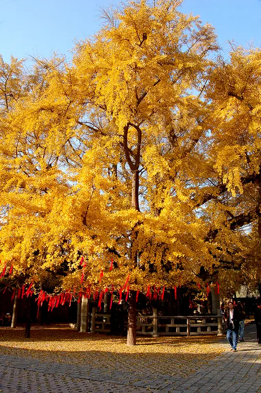
The visit is as much about religious buildings and old trees as mountain scenery. Dinglin Temple and the celebrated ancient ginkgo are the best-known pairing, while Chaoyang Taoist Temple adds another religious setting. The modest height makes this a different landscape from Shandong’s larger mountain ascents, though paths still vary.
Fulaishan is also known as Fuqiu (浮丘). It lies west of the seat of Ju County, 8 kilometers away, at the junction of Ju, Yinan and Yishui counties, where the 336 provincial road passes through, at an elevation of 298.9 meters at the far edge of the plain west of Ju. Its three peaks are named Folai Peak (佛来峰) in the north, Fulai Peak (浮来峰) in the west and Feilai Peak (飞来峰) in the south; the three stand closely joined together, opening only slightly toward the east.
What to look for
- Dinglin Temple and the ancient ginkgo that has become a symbol of Fulaishan.
- Chaoyang Taoist Temple within the three-hill setting.
Location & getting there
Getting to FuLaiShan scenic spot
Approach the scenic area from Fulai West Road, west of Ju County town. The listed visitor address is 1001 Fulai West Road in Fulaishan; use the scenic entrance rather than the railway station with the same regional name.
Combine your visit
A suggested sequence linking the specific features of this visit.
-
Dinglin Temple and ginkgo
Begin with the temple and the old tree at the heart of the visit.
-
Chaoyang Taoist Temple
Compare the second religious site and its surrounding hill landscape.
This order is editorial. Confirm access and any transfers between stops; it does not establish a walking route, same-day connection or common admission ticket.

Find FuLaiShan scenic spot
浮来山 · 日照市
The pin marks the area, not the entrance.
More places nearby
Approximate straight-line distances between map pins, not travel distances.
Underground Grand Canyon in Shandong 山东地下大峡谷
23 km awayShandong Underground Grand Canyon runs beneath Longgang Mountain southwest of Yishui. The cave alternates between constricted passages and broader chambers, with stalactites above an underground river. This contrast between rock…
View guide →Wanpingkou 万平口
78 km awayWanpingkou is a long public beach landscape on Rizhao’s Yellow Sea coast, arranged around squares, planted areas and different stretches of sand. The main Ecological Square anchors the southern visitor area, while Zhulang Bridge…
View guide →Mengshan (Shandong) 蒙山
80 km awayMengshan is a mountain range with several separate visitor sectors. Guimeng, on the Pingyi side, leads toward its highest summit and combines rugged rock with a landscape of pines and deep valleys. Yingwo Peak rises sharply from…
View guide →Sources & visit information
The sources below support the place-specific description and arrival information. Suggested combinations are editorial planning ideas; confirm current opening, entry arrangements and transport services for your date.
Visitor information adapted and edited from Wikipedia contributors, “浮来山” · CC BY-SA 4.0. Source revision 92198870.
Visitor information adapted and edited from Wikivoyage contributors, listing “FuLaiShan scenic spot” · CC BY-SA 4.0.
Background paragraphs translated and condensed from Wikipedia contributors, "浮来山", Chinese Wikipedia · CC BY-SA 4.0. Source revision 92198870.