

Photo adjustments
Full-frame source proportionally resized and converted to WebP for display. No subject alteration. Source-supplied marks and edits remain; cards may crop the view.
Explore the region
About Caoling Scenic Area
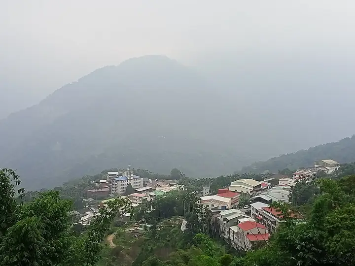
Caoling is a mountain settlement and geological landscape in eastern Gukeng Township, Yunlin County. The surrounding hills, streams and exposed rock give it a very different character from Yunlin's agricultural plain. This is the Caoling scenic area in central Taiwan; the similarly named Caoling Historic Trail on the northeast coast belongs to another place.
The landscape records repeated movement as well as erosion. Alternating sandstone and shale, steep slopes and the Qingshui River have contributed to major landslides, including the collapse associated with the 1999 earthquake. Rock faces and stream channels are therefore evidence of a changing mountain environment, rather than a permanently fixed collection of scenic shapes.
Local visitor information identifies the geological experience area, Youqing Valley and named rock formations as parts of the wider destination. Begin with the visitor centre to understand their positions and the currently designated routes. Reading the slopes from an approved viewpoint can be more informative than trying to reach every named rock; old photographs and old trail descriptions may show terrain that has subsequently changed.
What to look for
- Exposed sandstone and shale and the area's landslide history.
- Stream-cut rock scenery within the designated geological visitor area.
- Interpretation of Caoling's changing landscape at the village visitor centre.
Location & getting there
Getting to Caoling Scenic Area
Search for 草嶺遊客中心 in Gukeng, Yunlin. Confirm the current mountain-road and trail arrangements locally, and remain outside closed slopes and river channels.
- Search for 草岭 with 古坑乡.
Find Caoling Scenic Area
草岭 · 古坑乡
No reliable map pin yet: search by the Chinese name.
Sources & visit information
Identity, setting and selected historical, cultural or natural features were checked against the linked official sources on 10 September 2026. This is a sourced introduction and observation guide. Current exhibitions, access, prices and transport services need a fresh check before travel.
- Tourism Administration open data — 草嶺地質體驗區, 草嶺遊客中心 ↗
- Tourism Administration: Caoling Scenic Area ↗
- Forestry landscape register: Caoling landslide ↗
- Regional tourism directory — further reading ↗
Selected visitor facts translated and adapted from Tourism Administration and contributing local tourism authorities, 2026 Tourism Information Database v2.1 — 草嶺地質體驗區 (Attraction_376490000A_000331) · Open Government Data License 1.0.
Selected visitor facts translated and adapted from Tourism Administration and contributing local tourism authorities, 2026 Tourism Information Database v2.1 — 草嶺遊客中心 (Attraction_376490000A_000332) · Open Government Data License 1.0.