


Photo adjustments
Full frame retained; proportionally resized and converted to WebP. No retouching or changes to the photographed subject. Card displays may crop the view.
Explore the region
About Mojiang
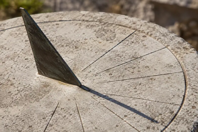
Its Tropic of Cancer Symbol Park uses a main marker, sundial and other installations to explain the relationship between the sun, latitude and seasons. The broader town also presents Hani culture and a festival associated with twins, but a normal visit need not depend on a festival date. Focus on the park’s geographic interpretation first, and treat stories about twin births as cultural narratives rather than a scientific effect of local water.
What to look for
- The main-marker sundial makes solar observation tangible through stone and shadow.
- The temperate-and-tropical-zone installation explains the significance of the latitude boundary.
Background & history
Mojiang Hani Autonomous County (simplified Chinese: 墨江哈尼族自治县; traditional Chinese: 墨江哈尼族自治縣; pinyin: Mòjiāng Hānízú Zìzhìxiàn; Hani: Meiqjal Haqniqssaq Ziiqziifxeif) is an autonomous county under the jurisdiction of Pu'er City, in the south of Yunnan Province, China. It borders Zhenyuan County and Xinping County to the north, Yuanjiang County, Honghe County and Lüchun County to the east, Jiangcheng County to the south and Ning'er County to the west.
Excerpt from Wikipedia: Mojiang Hani Autonomous County · Wikipedia contributors · CC BY-SA 4.0. Selected introductory sentences; formatting simplified. Background information, not current visitor-service advice.
Location & getting there
Getting to Mojiang
For this town visit, use the Tropic of Cancer Symbol Park in Lianzhu Town, Mojiang. The park is listed at 64 Xinjian Road; arrange your local transfer to its visitor gate rather than a general county-centre pin.
Combine your visit
Suggested order for the visit:
-
Main marker and sundial
Start with the relationship between sunlight and time.
-
Temperate-and-tropical-zone installation
Continue with the geographic interpretation.
This is an editorial sequence of named spaces or places. It does not imply a verified walking connection or promise opening, ticket availability or a journey time.
Find Mojiang
墨江 · 普洱
The pin marks the area, not the entrance.
Sources & visit information
The sources below support the place-specific description and arrival information. Suggested combinations are editorial planning ideas; confirm current opening, entry arrangements and transport services for your date.
- Mojiang Hani Autonomous County ↗
- Xinhua: 2026 field visit to Mojiang Symbol Park ↗
- Amap: Mojiang Symbol Park internal landmark ↗
- People’s Daily: Mojiang cultural tourism ↗
Visitor information adapted and edited from Wikipedia contributors, “Mojiang Hani Autonomous County” · CC BY-SA 4.0. Source revision 1336981622.