

Photo adjustments
Full-frame source proportionally resized and converted to WebP for display. No subject alteration. Source-supplied marks and edits remain; cards may crop the view.
Explore the region
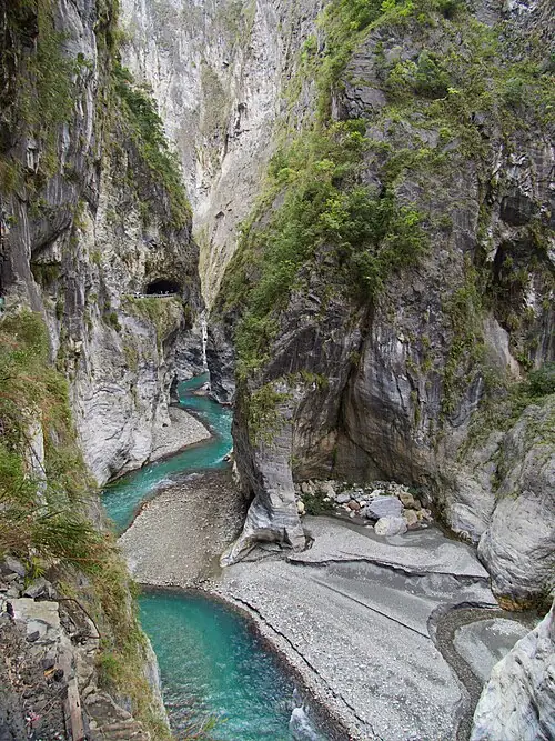
About Taroko National Park
Earthquake damage has changed how visitors can experience the gorge. The current park guidance lists several classic routes, including Shakadang, Swallow Grotto, the Tunnel of Nine Turns, Baiyang and Zhuilu, as closed; older full-gorge itineraries should not be reused.
An accessible starting point is the Taroko Visitor Center and the surrounding Taroko Terrace, where exhibitions and river views introduce the landscape. Tianxiang has some open visitor areas, while parts of the Lushui routes operate as out-and-back walks. These require a separate access decision based on the park’s latest road and trail notices.
What to look for
- The marble landscape and Liwu River explain the park’s geological character.
- Taroko Visitor Center provides context while major gorge trails recover.
- Taroko Terrace offers river and landscape views near the visitor centre.
Location & getting there
Getting to Taroko National Park
The visitor centre is at 291 Fushi Village, Xiulin Township, Hualien County. Check the current connection to the entrance area. The park currently reports the Taroko–Tianxiang bus service suspended, so an onward Tianxiang visit requires separately arranged road transport and confirmation of road controls.
Combine your visit
Build the visit around these complementary stops.
-
Taroko Visitor Center太魯閣遊客中心
Check the latest open areas and interpretive displays.
-
Taroko Terrace太魯閣臺地
Choose an open path near the centre for river and landscape views.
-
Tianxiang visitor area天祥遊憩區
Consider this separately only after confirming road access and transport.
Use the current visitor programme and local conditions to choose which stops to include.
Find Taroko National Park
太鲁阁国家公园 · 花蓮縣
The pin marks the area, not the entrance.
More places nearby
Approximate straight-line distances between map pins, not travel distances.
Cingjing Farm 清境農場
21 km awayCingjing Farm occupies a highland setting in Ren’ai Township, with grass slopes, sheep and views across the surrounding mountains. Green Green Grasslands is the main pastoral visitor area. The Guanshan pasture sector and the…
View guide →Qixingtan Beach 七星潭
33 km awayQixingtan is a crescent-shaped Pacific bay edged with pebbles, despite the lake-like meaning of its name. The rounded stones, surf and mountain backdrop are the main attraction. Changes in cloud and light can alter the coast…
View guide →Sun Moon Lake 日月潭
54 km awaySun Moon Lake has several distinct shores, so choose the part of the lake that matches your day. The Shuishe–Xiangshan route keeps close to the water and links two visitor hubs. Ita Thao adds a settlement and food district with…
View guide →Sources & visit information
The sources below support the place-specific description and arrival information. Suggested combinations are editorial planning ideas; confirm current opening, entry arrangements and transport services for your date.
- Tourism Administration: 太魯閣國家公園 — attraction record Attraction_376550000A_003128 ↗
- Taroko National Park: current post-earthquake access and transport FAQ ↗
- Taroko National Park: current access advisories for day trips ↗
- Taroko National Park: Taroko Terrace ↗
Selected visitor facts translated and adapted from Tourism Administration and contributing local tourism authorities, 2026 Tourism Information Database v2.1 — 太魯閣國家公園 (Attraction_376550000A_003128) · Open Government Data License 1.0.