

Explore the region
About Nanshan Pasture
The grassland is not natural in its present form. Reclamation began in March 1956, when 950 young people from Changsha and Shaoyang went up as a land-clearing team, and the effort went through repeated advances and retreats over the following decades. Between 1956 and 1980, six batches totalling 3,117 young reclaimers came to Nanshan and only 290 stayed; those who remained strung power lines, built roads and housing, sowed grass, established herds and set up factories. About 230,000 mu of rough hill grassland were turned into pasture sown with imported forage varieties and stocked with dairy cattle, which the municipal government describes as the largest modern mountain pasture in southern China. Nanshan is now a national park pilot area.
Ziyang Peak is the landmark viewpoint, looking out over open grass where the dairy herds graze, and yurts stand in the folds of the hills. The Maopinghu scenic area combines an alpine lake with rock formations and shaped trees. The pasture also carries two layers of military history: the Laoshanjie Red Army road, associated with Lu Dingyi's essay of that name, and a high-mountain sentry post built after 1949 with tunnels and bunkers. Other named features include Qingshan'ao, the mists of Jiaozidong, the Lujiahao waterfall and the sunrise viewpoint at Daiyakou.
What to look for
- Ziyang Peak, the pasture's landmark viewpoint over the grazing land
- The Maopinghu area, where an alpine lake sits among rock formations and wind-shaped trees
- The Laoshanjie Red Army road, the route described in Lu Dingyi's essay 'Laoshanjie'
- The high-mountain sentry post built after 1949, with its tunnels and bunkers
- The Lujiahao waterfall and the sunrise viewpoint at Daiyakou
Location & getting there
Getting to Nanshan Pasture
Confirm the road and activity operator, weather and return transport. Stay on permitted routes and do not treat open land as unrestricted access.
- Search for 南山牧场 with 邵阳市 and 城步苗族自治县.

Find Nanshan Pasture
南山牧场 · 城步苗族自治县
No reliable map pin yet: search by the Chinese name.
Sources & visit information
The linked sources support the identity and background described in this introduction. Opening hours, admission, activity availability and exact arrival arrangements have not been comprehensively checked. Confirm current visitor information with the venue; the original catalogue locality and editorial review flag are retained.
Image credits & notes (1)
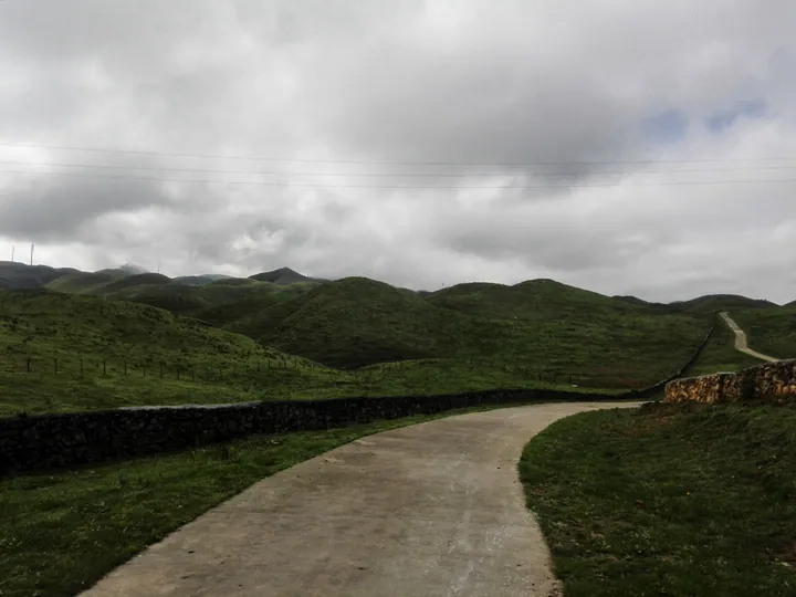
- A road winding through the green rolling grassland of Nan Shan Pasture, Chengbu Miao Autonomous County · 城步苗族自治县南山牧场,蜿蜒山路与草甸风光 Source-recorded photograph date: Taken on 27 September 2015.Photo: Qiu Mao · CC BY 3.0Resized for the web; the photo itself has not been edited. Thumbnails may show a cropped view.
