

Entry & permits for Tibet (Xizang)
Foreign tourists need Tibet entry approval, commonly called a Tibet Travel Permit, and an organised visit arranged through a specialist travel agency in China. Confirm your approved route before booking transport. Requirements differ for Taiwan residents and for travellers using mainland or Hong Kong/Macao Chinese resident documents; check the document guide before you book.
Check the travel-document requirements →Policy scope verified: 2026-09-06. UK FCDO: China regional travel advice ↗ State Council Taiwan Affairs Office: Tibet entry approval ↗ Xizang Department of Culture and Tourism: Medog border permit notice ↗
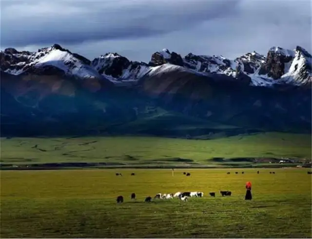
Photo adjustments
EXIF orientation normalized; resized without changing aspect ratio; converted to WebP. No subject edits.
Explore the region
About Nagqu Grassland
The Tibet Department of Natural Resources page devoted to the grassland places it within Nagqu County, between 91°12' and 93°02' east and 30°31' and 31°55' north, adjoining Damxung to the south, Nyainrong and Amdo to the north, Biru and Lhari to the east and Baingoin to the west; the county measures at most 233 kilometres east to west and 185 kilometres north to south and covers 16,000 square kilometres. The catalogue places this record in Seni District; the page, dated 2010, uses the earlier name Nagqu County throughout and also writes of the Nagqu prefecture rather than the present Nagqu City, and no equivalence between the old and new units is asserted here.
The climate is described as plateau subfrigid semi-arid monsoon, marked by low temperatures, thin air, a clean dry atmosphere, strong solar radiation and a wide daily range. The mean annual temperature is given as -1.5°C with a mean daily range of 16.1°C; January averages -13.2°C against an annual extreme minimum of -41.2°C, and July averages 9.0°C against an extreme maximum of 23.60°C. There are 164.5 days above freezing and 2,846.9 hours of sunshine in the year, an average of 103 frost days, snow cover and frozen ground from mid-October to mid-May, and a plateau vegetation growing period confined to July, August and September. Within the wider embrace of the Tanggula, Nyainqentanglha and Gangdise ranges the department names the Dargo snow mountain to the west and the Buji snow mountain to the east, likening the pair to two fierce lions guarding the place; the Qiangtang as a whole covers more than 400,000 square kilometres at an average elevation above 4,500 metres, its central and western ground broad and flat with hills, basins, scattered lakes and rivers running through.
The seasonal event the catalogue points at is the horse-racing festival. The department's page describes a race festival held every August, the sixth month of the Tibetan calendar, as the great gathering of the northern Tibetan grassland, drawing sightseers, herders from every direction and traders; it also names Xiaodeng Monastery as a famous monastery of northern Tibet that visitors may see. Xinhua reported the 2025 Nagqu Qiaqing horse-racing festival opening on 5 September at the Gesar Racecourse in Nagqu City and running for three days, with sports competitions, artistic performances and culture-and-tourism promotion; riders showed traditional horsemanship and traditional mounted archery, and the programme included a 12,000-metre ambling race and a 10,000-metre speed race ridden by young riders. The August date is the department's 2010 statement and the September date is Xinhua's record of one year's festival; neither is presented here as the rule.
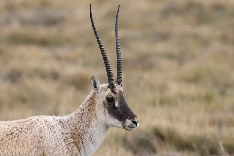
The department's page also records that the broad Qiangtang grassland and the uninhabited area of northern Tibet hold wild yak, Tibetan antelope, wild ass and many other first-class nationally protected animals. Xinhua names the racecourse only as being in Nagqu City and gives no district, so none is attached to it here.
What to look for
- The open pasture of the Qiangtang, which the department's page describes as broad and flat in its central and western parts, with hills, basins and scattered lakes
- The Qiaqing horse-racing festival at the Gesar Racecourse, with traditional horsemanship, mounted archery, a 12,000-metre ambling race and a 10,000-metre speed race
- Xiaodeng Monastery, which the department's page names as a famous monastery of northern Tibet
- The Dargo snow mountain to the west and the Buji snow mountain to the east, which the page likens to two guarding lions
- Wild yak, Tibetan antelope and wild ass, which the page records among the first-class protected animals of the Qiangtang and the uninhabited area
Location & getting there
Getting to Nagqu Grassland
Confirm the road and activity operator, weather and return transport. Stay on permitted routes and do not treat open land as unrestricted access.
- Search for 那曲草原 with 那曲市 and 色尼区.
Find Nagqu Grassland
那曲草原 · 色尼区
No reliable map pin yet: search by the Chinese name.
Sources & visit information
The linked sources support the identity and background described in this introduction. Opening hours, admission, activity availability and exact arrival arrangements have not been comprehensively checked. Confirm current visitor information with the venue; the original catalogue locality and editorial review flag are retained.