


Get to know Jin'an District
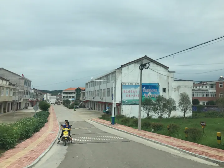
Photo adjustments
Full frame retained; proportionally resized and converted to WebP. No retouching or changes to the photographed subject. Card displays may crop the view.
- Administrative area
- District · 市辖区
- Part of
- Lu'an
- Chinese name
- 金安区
- Local areas
- District guide
Area & population
- Area in the source
- 1,657.00 km²
- Population · 2017
- 845,000
Source: cited geographic source, as of the dates shown.
History
The district government traces local history to Gaoyao (皋陶), revered as the founding figure of Chinese law, who was enfeoffed here and whose tomb lies in the district. Emperor Wu of Han created the kingdom of Liu'an (六安国), and the Dongxi old city (东西古城) and the Han royal tombs at Shuangdun (双墩汉王墓) survive from that period.
The Shuangdun tombs came to light in late 2006 and early 2007 on the construction site of the Hefei–Wuhan high-speed railway; they were identified as the burial of Liu Qing (刘庆), the first King of Liu'an, and the railway was shifted more than 100 metres to the south. In 1947 the Liu–Deng army's march into the Dabie Mountains opened the strategic offensive of the civil war; the Zhangjiadian Battle Memorial Hall (张家店战役纪念馆) in Zhangdian town (张店镇) is a provincial protected heritage site.
What to see
The Ninety-li Landscape Gallery (九十里山水画廊) follows the Liu–Dong provincial road for more than 90 li from the Youran Nanshan resort (悠然南山) in Zhongdian town to Maotanchang, across five townships on the ridge of the Yangtze–Huai watershed. At its centre, the Dabie Mountain Grottoes (大别山石窟) are best known for Changyan (敞岩), a cave about 200 metres wide and 150 metres deep, and include Jiulongtang (九龙堂), a temple dating from the late Yuan. The Wanxi Grand Canyon (皖西大裂谷) takes its name from a mountain split into a huge V-shaped cleft. Further south, Dahua Mountain (大华山) in Donghekou town combines scenery with a Buddhist site and is called the "Jiuhua north of the Yangtze" (江北九华).
Maotanchang is a national historic and cultural town that began under the state horse administration of the first Ming emperor, Zhu Yuanzhang (朱元璋). Its Ming–Qing old street runs for 1,320 metres, and its old Hui-style dwellings number more than 750 rooms, and the private shrine of the Qing official Tu Zongying (涂宗瀛) is kept there. The last 4A scenic area the district lists on the corridor is Dongshisun (东石笋), named for a stone pinnacle about 38 metres high.
Food and local products
The Wanxi white goose (皖西白鹅) is a breed under national livestock genetic-resource protection. The district government lists Lu'an Guapian tea (六安瓜片), Jin'an crisp peaches, Huashan Yinhao tea (华山银毫), Wengdun paper-cuts (翁墩剪纸), Maotanchang red umbrellas and Yipinzhai writing brushes (一品斋毛笔) among its local goods. Local snacks include hot-and-peppery soup (胡辣汤) and a soup of shrimp and mung-bean balls, and mutton hotpot is another local dish.
Highlights
- Maotanchang old street 毛坦厂老街: A 1,320-metre Ming–Qing street with more than 750 rooms of old Hui-style dwellings in a national historic and cultural town.
- Dabie Mountain Grottoes 大别山石窟: Changyan cave, about 200 metres wide, and the late-Yuan Jiulongtang temple.
- Wanxi Grand Canyon 皖西大裂谷: Named for a mountain split into a huge V-shaped cleft.
- Dongshisun 东石笋: A stone pinnacle about 38 metres high, the last 4A scenic area listed on the Ninety-li corridor.
- Wanxi white goose 皖西白鹅: A local breed under national livestock genetic-resource protection.
Sources for this guide
金安简介_六安市金安区人民政府 · Jin'an District People's Government, Lu'an
自然地理_六安市金安区人民政府 · Jin'an District People's Government, Lu'an
历史人文_六安市金安区人民政府 · Jin'an District People's Government, Lu'an
金安区 - 维基百科,自由的百科全书 · Wikipedia (Chinese) · CC BY-SA 4.0
Original English written from the listed sources and checked sentence by sentence against quoted extracts by a separate reviewer. Updated 2026-09-23.
Explore Jin'an District
Core places to explore, with English and Chinese names.
Jin'an District 金安区
Plan your visit
Getting there
Jin'an District covers the centre of Lu'an. Search for 金安区 in a map app to find stations and your accommodation.
Where to stay →More in Lu'an
Sources & geographic information
Administrative names and parent areas: Official geographic directory · Reference date 2026-09-06.
Some facts checked against 金安区 — Wikipedia contributors, CC BY-SA 4.0.
Map data © OpenStreetMap contributors. Pins mark approximate centres, not entrances or boundaries.