


Get to know Dianjiang County

Photo adjustments
Full-frame source proportionally resized and converted to WebP for display. No subject alteration. Source-supplied marks and edits remain; cards may crop the view.
- Administrative area
- County · 县
- Part of
- Chongqing
- Chinese name
- 垫江县
- Local areas
- County guide
Area & population
- Area in the source
- 1,518.00 km²
- Population · 2020
- 650,694
Source: cited geographic source, as of the dates shown.
Setting and landscape
The county covers 1,518 square kilometres at the eastern end of the Huaying Mountains (华蓥山脉). Ranges rise on its east and west sides with rolling hills between, and the ground falls gently from north to south, between 1,183 metres at its highest and 320 metres at its lowest. All its rivers lie in the Yangtze-system basin of the Longxi River (龙溪河), which the county government gives as 98.7 kilometres long.
Dianjiang borders Fengdu (丰都县) and Zhong County (忠县) to the east, Fuling (涪陵区) and Changshou (长寿区) to the south, Liangping (梁平区) to the north, and Sichuan to the west. Summers are hot and often dry; autumns bring long spells of rain.
History
The county was created in 556, under Emperor Gong of the Western Wei (西魏), from land taken out of Linjiang County (临江县). The county government says the name was first written Diejiang (褺江) and that the Book of Han (汉书) miswrote it as Dianjiang, the form still in use. It was renamed Wei'an (魏安县) in 567 and took back the Dianjiang name in 598.
In 619 Qingshui County (清水县), later renamed Guixi (桂溪县), was created from Linjiang land; it merged into Dianjiang in 1072. Merged into Fengdu in 1284, Dianjiang was restored in 1363 by Ming Yuzhen (明玉珍), the rebel leader who founded the Daxia (大夏) state in Chongqing. In 2008 it was named one of China's first 40 "Millennium Ancient Counties" (千年古县), the only one in Chongqing.
What to see
The county government calls Dianjiang the birthplace of the Shanshui peony (山水牡丹), grown here for more than two thousand years. According to a 2012 CCTV report, the peonies are planted mainly on Mingyue Mountain around Taiping town (太平镇), across about 20,000 mu (roughly 1,300 hectares), with the best displays at Bailing Mountain (百灵山), Kaizhifeng (恺之峰) and Yuzhi Island on Taiping Lake (太平湖玉指岛). More than 70 varieties grow there, among them Taiping Red (太平红), and full bloom usually falls in mid to late March. The county has three national 4A scenic areas.
Food and local products
Dianjiang holds the title of China's home of stone-ground tofu pudding (石磨豆花). The county government lists Zhao beef (赵牛肉), Chuanjiu steamed duck (川久蒸鸭), Dianjiang Chinese shallots (垫江藠头), Yong'an zajiu (永安咂酒) liquor, Dongyin tea (东印茶叶) and the orchid dendrobium (铁皮石斛) among its specialities, and ranks its medicinal peony-root bark (丹皮) the best in China. Municipal intangible-heritage items include the Xinmin spring-ox dance (新民春牛舞), Gaofeng paddy-weeding songs (高峰薅秧歌) and Dashi bamboo weaving (大石竹编).
Highlights
- Kaizhifeng Tourist Area 恺之峰旅游区: One of the three showcase peony areas on Mingyue Mountain named by CCTV.
- Taiping Lake Yuzhi Island 太平湖玉指岛: One of three showcase peony areas around Taiping town named by CCTV.
- Stone-ground tofu pudding 石磨豆花: Dianjiang is titled China's home of stone-ground tofu pudding.
- Xinmin spring-ox dance 新民春牛舞: A municipal intangible-heritage item from the county.
Sources for this guide
垫江简介_垫江县人民政府 · Dianjiang County People's Government
历史沿革_垫江县人民政府 · Dianjiang County People's Government
旅游资源_垫江县人民政府 · Dianjiang County People's Government
自然地理_垫江县人民政府 · Dianjiang County People's Government
垫江牡丹文化节开幕 免收门票 · CCTV (cntv.cn), reprinting Chongqing Evening News
Original English written from the listed sources and checked sentence by sentence against quoted extracts by a separate reviewer. Updated 2026-09-25.
Explore Dianjiang County
Core places to explore, with English and Chinese names.
Places to explore around Dianjiang County
 Kaizhifeng Tourist Area ·
 Local life & food
Dianjiang County local specialties
垫江县特色美食 · 6 specialties to discover
 Dianjiang stone-ground tofu pudding 垫江石磨豆花AI illustration · AI 示意图
The tofu is mild, moist and softly textured, while chili, herbs and other condiments supply a much stronger flavor.
Source ↗Read the dish guide →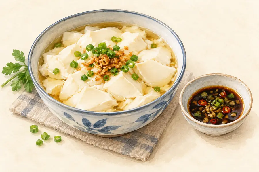 Stone-Ground Soft Tofu 石磨豆花AI illustration · AI 示意图(仅供参考,非实拍)
Stone-Ground Soft Tofu (石磨豆花) is the hand-made tender bean curd of Dianjiang County (垫江县), Chongqing, eaten hot with a spicy dipping sauce.
Read the dish guide → Dianjiang Sauce-Pickled Melon 垫江酱瓜AI illustration · AI 示意图(仅供参考,非实拍)
Dianjiang Sauce-Pickled Melon (垫江酱瓜) is a pickle made in Dianjiang County (垫江县), Chongqing, from huagua (花瓜), a local melon with a patterned green skin that is salted and cured in sauce in vats. It is also known simply as huagua.
Read the dish guide → Dianjiang Beef 垫江牛肉AI illustration · AI 示意图(仅供参考,非实拍)
Dianjiang Beef (垫江牛肉) is braised beef (卤牛肉) from Dianjiang County (垫江县), Chongqing, slow-cooked in a spiced braising liquid.
Read the dish guide → Dianjiang Peony Cake 垫江牡丹饼AI illustration · AI 示意图(仅供参考,非实拍)
Dianjiang Peony Cake (垫江牡丹饼) is a baked pastry with a filling of peony petals, bean paste and white sugar, made in Dianjiang County (垫江县), Chongqing, from the petals of the county's peonies.
Read the dish guide → Dianjiang Rice Noodles 垫江米粉Reference photo of a similar dish · 同类菜品参考照片
Dianjiang Rice Noodles (垫江米粉) is listed among the local specialties of Dianjiang County, Chongqing. The term 米粉 points to rice noodles or rice meal.
Read the dish guide →
Photo adjustments
Full frame retained; EXIF orientation normalized, proportionally resized to at most 800 pixels and converted to WebP. No generated pixels or subject changes. Cards may crop the display.
More dishes from across Chongqing are in the Chongqing food guide.
Plan your visit
Getting there
Dianjiang County is about 115 km in a straight line from central Chongqing. Search for 垫江县 in a map app to find stations and your accommodation.
Where to stay →Build your route
Start with Kaizhifeng Tourist Area. The linked place guides have entrance and visit details.
Continue with Chongqing →More in Chongqing
Sources & geographic information
Administrative names and parent areas: Official geographic directory · Reference date 2026-09-06.
Photo: Kaizhifeng Tourist Area · Source photographer · License not provided. EXIF orientation normalized; resized without changing aspect ratio; converted to WebP. No subject edits.
Map data © OpenStreetMap contributors. Pins mark approximate centres, not entrances or boundaries.