


Get to know Fuling District

Photo adjustments
Full frame retained; proportionally resized and converted to WebP. No retouching or changes to the photographed subject. Card displays may crop the view.
- Administrative area
- District · 市辖区
- Part of
- Chongqing
- Chinese name
- 涪陵区
- Local areas
- District guide
Area & population
- Area in the source
- 2,941.46 km²
- Population · 2020
- 1,115,016
Source: cited geographic source, as of the dates shown.
Setting and landscape
The district borders Fengdu (丰都县) to the east, Wulong (武隆区) and Nanchuan (南川区) to the south, Banan (巴南区) to the west, and Changshou (长寿区) and Dianjiang (垫江县) to the north. Most land lies between 200 and 800 metres. The northwest is low hill and valley country with broad river valleys; the higher southeast is karst, cut by narrow valleys. The Wuling Mountains (武陵山脉) extend into the district. Summers are long and hot with frequent midsummer drought; autumns are short and often drizzly.
History
Fuling was anciently called Zhi (枳). From the Western Zhou to the mid Warring States period the Ba state (巴国) held it, and many of its early kings were buried here; around 308 BC Qin made it Zhi County. The Xiaotianxi Ba tombs (小田溪巴人墓群), on the west bank of the Wu River about 15 kilometres southeast of the city, have yielded more than 700 royal Ba objects in seven digs since 1972, among them gold-inlaid chime bells and willow-leaf swords. The name Fuling was first applied to this area in 346, when a Fuling commandery was set up across the Wu River from the relocated Zhi county town. The present district dates from December 1997.
What to see
Baiheliang (白鹤梁) is a natural rock ridge in the Yangtze, about 1,600 metres long, carved with around 175 inscriptions and 18 stone fish; the earliest, a pair of carp, predate 764. The fish eyes served as a zero mark for low water, and the carvings record more than 60 dry years across 1,200 years. The ridge went on China's tentative World Heritage list in 2006. Facing flooding by the Three Gorges Dam, the carvings were preserved in place inside the Baiheliang Underwater Museum (白鹤梁水下博物馆), which visitors enter by a 91-metre lift to underwater galleries.
The Wuling Mountain Great Rift Valley (武陵山大裂谷), a national 5A scenic area about 45 kilometres southeast of the city, has relief of up to 1,380 metres from valley floor to summit and a gorge walled by cliffs up to 300 metres high. The district also lists the 816 Project (816工程) and Dianyi Cave (点易洞) among its sights.
Food and local products
Fuling is the birthplace of zhacai (榨菜), preserved mustard stem. The district government dates the product to 1898, when the merchant Qiu Shou'an (邱寿安) wind-dried local mustard stems, salted them, pressed out the brine, mixed in spices and sealed them in jars. He opened a workshop in 1899 and named the product after the pressing, zha.
Highlights
- Baiheliang Underwater Museum 白鹤梁水下博物馆: Keeps the Baiheliang low-water carvings in place beneath the Yangtze.
- Wuling Mountain Great Rift Valley 武陵山大裂谷: National 5A area with up to 1,380 metres of relief and cliffs up to 300 metres high.
- Xiaotianxi Ba tombs 小田溪巴人墓群: Tomb group on the Wu River that has yielded over 700 royal Ba objects.
- Fuling zhacai 涪陵榨菜: Pressed, salted mustard stem first made by the Fuling merchant Qiu Shou'an in 1898.
Sources for this guide
区情概况_重庆市涪陵区人民政府 · Fuling District People's Government, Chongqing
建置沿革_重庆市涪陵区人民政府 · Fuling District People's Government, Chongqing
自然环境_重庆市涪陵区人民政府 · Fuling District People's Government, Chongqing
枳巴文化_重庆市涪陵区人民政府 · Fuling District People's Government, Chongqing
榨菜文化_重庆市涪陵区人民政府 · Fuling District People's Government, Chongqing
白鹤梁水文文化_重庆市涪陵区人民政府 · Fuling District People's Government, Chongqing
涪陵武陵山大裂谷_重庆市人民政府网 · Chongqing Municipal People's Government
Original English written from the listed sources and checked sentence by sentence against quoted extracts by a separate reviewer. Updated 2026-09-25.
Explore Fuling District
Core places to explore, with English and Chinese names.
Places to explore around Fuling District
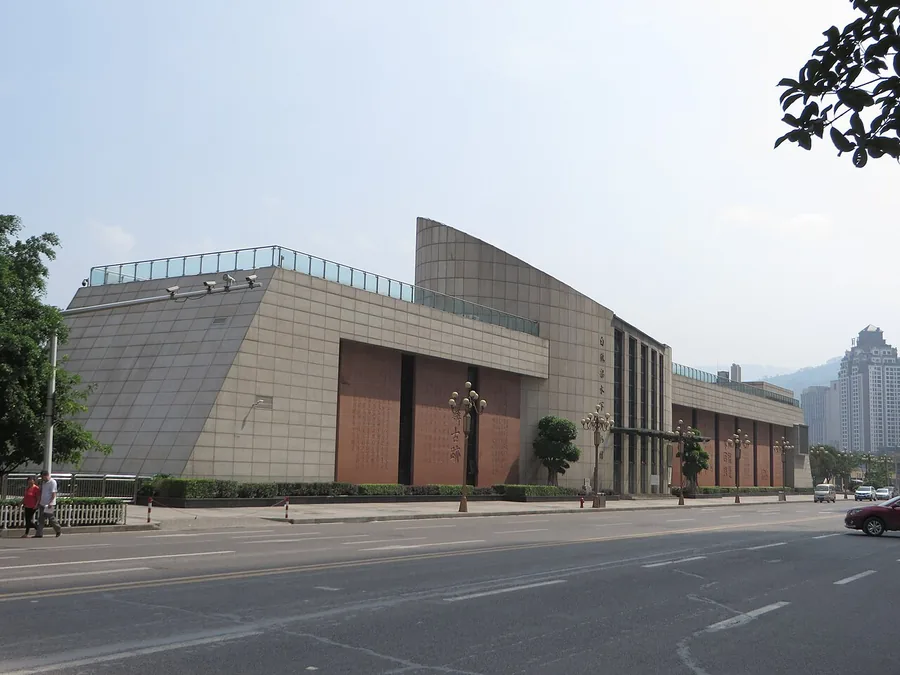 The street-side exterior of Baiheliang Underwater Museum in Fuling, Chongqing; 14 September 2014.
Baiheliang Underwater Museum白鹤梁水下博物馆
Baiheliang preserves inscriptions carved into a natural stone ridge in the Yangtze at Fuling. Many record historic low-water conditions, turning the riverbed into a long environmental archive. The museum combines above-water…
Read the place guide → Underground chamber inside the 816 Nuclear Plant · 816地下核工程内部空间 Photograph date recorded by the source: 26 June 2020, 13:34:37.
816 Nuclear Plant816地下核工程
The 816 site at Baitao is an unfinished underground nuclear-industrial project now interpreted through a managed visitor route. Long passages open into very large chambers, including the reactor hall and former control room…
Read the place guide →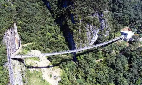 Wuling Mountain Great Rift Valley · 武陵山大裂谷
Wuling Mountain Great Rift Valley武陵山大裂谷
Wuling Mountain Great Rift Valley is a forested gorge destination southeast of Fuling, near the northwestern end of the Wuling range.
Read the place guide → 816 Gong Cheng · 816工程
816 Gong Cheng816工程
The 816 Project is an unfinished underground nuclear plant driven into a mountain at Baitao Subdistrict in Fuling District, Chongqing. It was built as the reactor and chemical reprocessing works of what was intended to be China's second nuclear raw-material industrial base, and was abandoned before it ever operated.
Read the place guide → Wulingshan National Forest Park · 武陵山国家森林公园
Wulingshan National Forest Park武陵山国家森林公园
Wuling Mountain National Forest Park covers karst uplands at Damu, some 55 kilometres southeast of the district town of Fuling in Chongqing, on the northern section of the Wuling range. Its core area of 16.33 square kilometres is high, cold and heavily wooded.
Read the place guide →Local life & food
Fuling District local specialties
涪陵区特色美食 · 7 specialties to discover
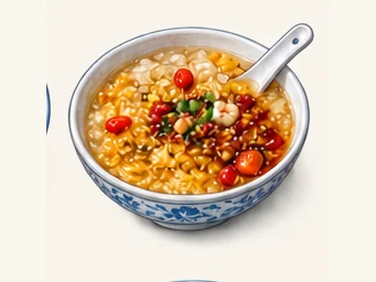 Fuling oil-toasted sweet rice wine 涪陵油醪糟AI illustration · AI 示意图
The bowl combines soft rice, sweetness and a fermented aroma with richer fat and crunchy bits. It may retain an alcoholic note.
Source ↗Read the dish guide → Fuling preserved mustard stem 涪陵榨菜AI dish illustration / AI 菜品示意图
Expect a crisp, salty bite with concentrated vegetable savouriness. Chilli-seasoned products can be noticeably hotter than plain ones.
Source ↗Read the dish guide → Fuling Stir-Fried Pork with Preserved Mustard 涪陵榨菜炒肉
Fuling Stir-Fried Pork with Preserved Mustard (涪陵榨菜炒肉) is pork stir-fried with zhacai (榨菜), the pressed and pickled mustard stem of Fuling (涪陵) in Chongqing.
Read the dish guide →Photo adjustments
EXIF orientation normalized; resized without changing aspect ratio; converted to WebP. No subject edits.
 Rouge Red Radish 胭脂萝卜AI illustration · AI 示意图(仅供参考,非实拍)
Rouge Red Radish (胭脂萝卜) is a radish from Fuling District (涪陵区), Chongqing, whose skin and flesh are both red, which is why it is also called the red-heart radish (红心萝卜).
Read the dish guide → Fuling Soft Tofu with Rice 涪陵豆花饭AI illustration · AI 示意图(仅供参考,非实拍)
Fuling Soft Tofu with Rice (涪陵豆花饭) is a meal of freshly set bean curd, or douhua, eaten with rice in Fuling District (涪陵区), Chongqing.
Read the dish guide → Shredded Pork and Preserved Mustard Noodles 榨菜肉丝面
Shredded Pork and Preserved Mustard Noodles (榨菜肉丝面) is listed among the local specialties of Fuling District, Chongqing. The term 面 points to noodles or flour-based food.
Read the dish guide →Photo adjustments
EXIF orientation normalized; resized without changing aspect ratio; converted to WebP. No subject edits.
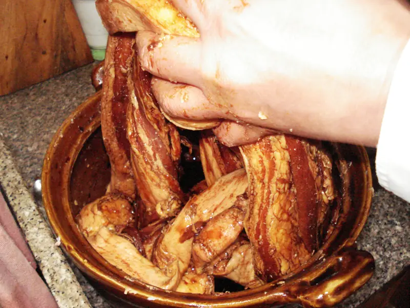 Fuling Red-Heart Radish Stewed with Cured Pork 涪陵红心萝卜炖腊肉Reference photo of a similar dish · 同类菜品参考照片
Fuling Red-Heart Radish Stewed with Cured Pork (涪陵红心萝卜炖腊肉) is listed among the local specialties of Fuling District, Chongqing. 腊 describes curing.
Read the dish guide →
Photo adjustments
Full frame retained; EXIF orientation normalized, proportionally resized to at most 800 pixels and converted to WebP. No generated pixels or subject changes. Cards may crop the display.
All dish names · 全部菜名 (7)
More dishes from across Chongqing are in the Chongqing food guide.
Plan your visit
Getting there
Fuling District is about 85 km in a straight line from central Chongqing. Search for 涪陵区 in a map app to find stations and your accommodation.
Where to stay →Build your route
Baiheliang Underwater Museum and 816 Nuclear Plant are about 20 km apart in a straight line. The linked place guides have entrance and visit details.
Continue with Chongqing →More in Chongqing
Sources & geographic information
Administrative names and parent areas: Official geographic directory · Reference date 2026-09-06.
Photo: Baiheliang Underwater Museum · Jpbowen · CC BY-SA 4.0. Proportionally resized and converted to WebP without cropping, retouching or changing the photographed subject.

Photo: 816 Nuclear Plant · Iswzo · Iswzo — 816工程内部0626.jpg — CC BY-SA 4.0 · CC BY-SA 4.0. The exact downloaded source bytes are separately retained and hashed. Prepared JPEG is proportionally reduced to a maximum 720-pixel long edge; full frame retained, no subject alteration. Final website rendition: full frame retained, proportionally resized to at most 720 pixels and converted to WebP. No additional retouching or subject alteration. Card displays may crop the view.

Photo: Wuling Mountain Great Rift Valley · Source photographer · License not provided. EXIF orientation normalized; resized without changing aspect ratio; converted to WebP. No subject edits.
Photo: 816 Gong Cheng · 重庆轨交18 · CC BY-SA 4.0. EXIF orientation normalized; resized without changing aspect ratio; converted to WebP. No subject edits.

Photo: Wulingshan National Forest Park · Source photographer · License not provided. EXIF orientation normalized; resized without changing aspect ratio; converted to WebP. No subject edits.
Map data © OpenStreetMap contributors. Pins mark approximate centres, not entrances or boundaries.