

Get to know Móng Há e Reservatório
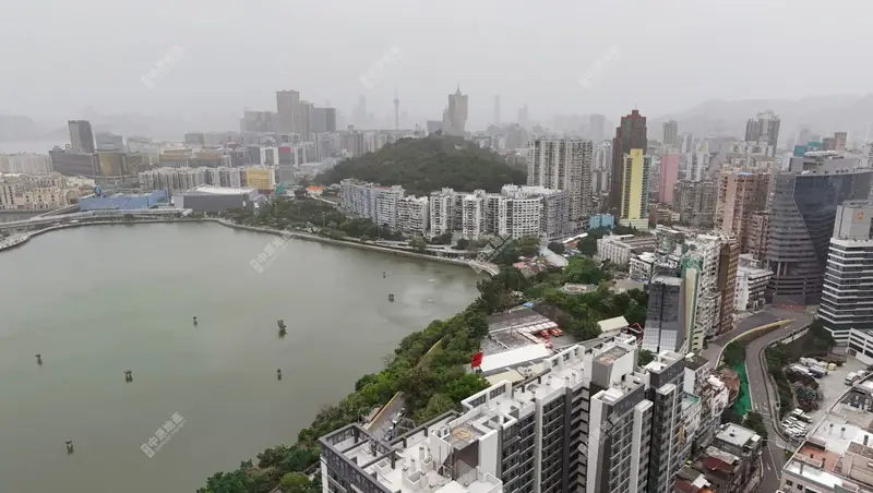
Photo adjustments
EXIF orientation normalized; resized without changing aspect ratio; converted to WebP. No subject edits.
- Administrative area
- Statistical area · 統計分區
- Part of
- Macau
- Chinese name
- 望廈及水塘區
- Local areas
- Statistical area guide
Setting and landscape
Mong Ha Hill (望廈山) is a small hill in the north of the Macau Peninsula, 60.7 metres high. Its older name, Lin Fong Hill (蓮峰山, "Lotus Peak"), comes from its lotus-like shape, and the hill is a classified site on Macau's heritage list.
The Reservoir lies north of the ZAPE district (新口岸) and has no official name beyond Reservatório. It is Macau's largest reservoir by area and by storage, built between 1935 and 1938 on what had been sea at Tong Kau Wan (劏狗環), south of Areia Preta. A Dutch fleet reached Macau on 22 June 1622, and its troops landed on that beach before a smaller Portuguese force beat them back. In 2000, 160,000 square metres of the water were filled to build Reservoir Road (水塘馬路). Reservoir Park (水塘公園), about 2,600 metres long, runs around the water and is the main walking route between ZAPE and Areia Preta.
History
Mong Ha village (望廈村) grew up at the south-western foot of the hill and gave it its name. Many villagers came from Xiamen (廈門) in Fujian, and the village name is read as "looking toward Xiamen". In 1743 the Qing government moved the office of Macau's county deputy magistrate (澳門縣丞衙署) into the village to handle Chinese-foreign affairs; the Portuguese expelled the official in 1849.
What to see
Mong-Há Fort (望廈炮台) on the summit was begun in 1849 and completed in 1866. Together with Ma Kau Seak Fort (馬交石砲台) in the north of the peninsula it formed a line guarding the northern land approach and the north-eastern waters. Built without lightning protection, it was struck so often that it was nicknamed the "lightning fort" (雷打炮台). Two replica muzzle-loading guns now stand on it.
The Portuguese garrison left in 1974. The barracks became a guest house in 1979 and, from 1995, a training unit of the Institute for Tourism Studies (澳門旅遊學院). In June 1997 the hillside was laid out with trails as Mong Ha Hill Municipal Park (望廈山市政公園), which takes in the fort.
Highlights
- Mong-Há Fort 望廈炮台: Hilltop fort begun in 1849 and completed in 1866, listed as a monument on Macau's heritage list.
- Mong Ha Hill Municipal Park 望廈山市政公園: Park with hill trails laid out in June 1997; the fort is part of it.
- Reservoir Park 水塘公園: Path of about 2,600 metres around Macau's largest reservoir, linking ZAPE and Areia Preta.
Sources for this guide
澳門行政區劃 - 維基百科,自由的百科全書 · Chinese Wikipedia · CC BY-SA 4.0
望廈山 - 維基百科,自由的百科全書 · Chinese Wikipedia · CC BY-SA 4.0
望廈炮台 - 維基百科,自由的百科全書 · Chinese Wikipedia · CC BY-SA 4.0
新口岸水塘 - 維基百科,自由的百科全書 · Chinese Wikipedia · CC BY-SA 4.0
望廈村 - 維基百科,自由的百科全書 · Chinese Wikipedia · CC BY-SA 4.0
Original English written from the listed sources and checked sentence by sentence against quoted extracts by a separate reviewer. Updated 2026-09-23.
Find Móng Há e Reservatório
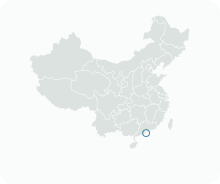
A reliable area-level map point is not available in the current sources.
Plan your visit
Getting there
Search for 望廈及水塘區 in a map app to find stations and your accommodation.
Where to stay →More in Macau
Sources & geographic information
Administrative names and parent areas: Official geographic directory · Reference date 2026-09-06.
DSEC statistical-zone directory
Government Information Bureau: Where to find off-the-beaten-track Macao? Try Mong Ha
Government Information Bureau: Main Storage Reservoir recreation area
Some facts checked against 澳門行政區劃 — Wikipedia contributors, CC BY-SA 4.0.
Some facts checked against 望廈山 — Wikipedia contributors, CC BY-SA 4.0.
Some facts checked against 望廈炮台 — Wikipedia contributors, CC BY-SA 4.0.
Some facts checked against 新口岸水塘 — Wikipedia contributors, CC BY-SA 4.0.
Some facts checked against 望廈村 — Wikipedia contributors, CC BY-SA 4.0.
Map data © OpenStreetMap contributors. Pins mark approximate centres, not entrances or boundaries.