


Get to know Pingluo County
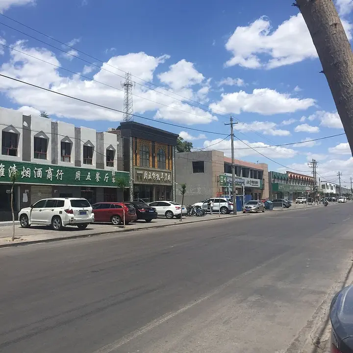
Photo adjustments
Full frame retained; proportionally resized and converted to WebP. No retouching or changes to the photographed subject. Card displays may crop the view.
- Administrative area
- County · 县
- Part of
- Shizuishan
- Chinese name
- 平罗县
- Local areas
- County guide
Area & population
- Administrative seat
- Chengguan
Source: cited geographic source, as of the dates shown.
What to see
Sand Lake (沙湖), 42 km from Yinchuan (银川), became a national 5A scenic area in 2007. The Ministry of Culture and Tourism describes it as some 45 square kilometres of water beside 22.5 square kilometres of desert, with reed beds, birds and lotus. The county government calls it the largest freshwater lake in Ningxia and says bird species there rose from 178 in 2011 to more than 210 after fish farming and fields were returned to lake and wetland; grey herons raise chicks in the reeds in early spring, and swans and red-crested pochards are regular visitors.
The Yuhuang Pavilion (玉皇阁) stands on the west side of North Street in Pingluo town. A White Dragon Temple on the site was rebuilt as a Taoist pavilion to the Jade Emperor early in the Guangxu reign, after residents credited it with rain that ended a drought. In 1934 troops under Ma Hongkui (马鸿逵) held the pavilion in a battle against Sun Dianying (孙殿英), and Ma had it enlarged in 1939 to mark the victory. Its halls rise on an earthen platform 98 metres long, facing south, and the top of the three-storey building stands 27 metres above the ground. It was listed at regional level in 1963 and as a Major Historical and Cultural Site Protected at the National Level in 2013.
Tianhewan National Wetland Park (天河湾国家湿地公园) lies on the Yellow River, and its ditches, lakes and streams all connect to the river. Xinhua reports that tens of thousands of birds stop there each year on migration routes that link western China with East Asia and Australia; tundra swans, egrets and common cranes are among them.
History
On 3 January 1739 a magnitude-8 earthquake struck Pingluo and the Yinchuan area, destroying towns and villages across the Yinchuan plain and killing more than 50,000 people; Chinese Wikipedia records it as the largest in the region's history.
Highlights
- Sand Lake 沙湖: 5A scenic area since 2007 where a 45-square-kilometre lake meets 22.5 square kilometres of desert.
- Yuhuang Pavilion 玉皇阁: Taoist temple on a 98-metre earthen platform, a national protected site since 2013.
- Tianhewan National Wetland Park 天河湾国家湿地公园: Yellow River wetland used by tens of thousands of migrating birds each year.
Sources for this guide
平罗县 - 维基百科,自由的百科全书 · Wikipedia (Chinese) · CC BY-SA 4.0
平罗玉皇阁 - 维基百科,自由的百科全书 · Wikipedia (Chinese) · CC BY-SA 4.0
1739年平罗地震 - 维基百科,自由的百科全书 · Wikipedia (Chinese) · CC BY-SA 4.0
5A级旅游景区 - 宁夏沙湖旅游景区 · Ministry of Culture and Tourism of the People's Republic of China
沙水相依 鸥鸟翔集 宁夏沙湖和谐共生美丽画卷徐徐展开→ · Pingluo County People's Government
魅力天河湾的生态交响曲 · Pingluo County People's Government (from Xinhua)
Original English written from the listed sources and checked sentence by sentence against quoted extracts by a separate reviewer. Updated 2026-09-26.
Explore Pingluo County
Core places to explore, with English and Chinese names.
Places to explore around Pingluo County
 Shahu Lake (沙湖), Shizuishan. Photograph: "DesertLake2".
Shahu Lake沙湖
Freshwater lake below the Helan Mountains in Pingluo, Ningxia, where desert meets water, with reedbeds, Bird Island and a wetland museum.
Read the place guide → AI illustration · AI 示意图(仅供参考,非该地点实拍)
Pingluo Yuhuang Pavilion Complex玉皇阁
Pingluo’s Yuhuang Pavilion is a Daoist architectural complex in the county town, known for its connected courtyards, halls and pavilions.
Read the place guide →Plan your visit
Getting there
Pingluo County is about 15 km in a straight line from central Shizuishan. Search for 平罗县 in a map app to find stations and your accommodation.
Where to stay →Build your route
Shahu Lake and Pingluo Yuhuang Pavilion Complex are both listed here. The linked place guides have entrance and visit details.
Continue with Shizuishan →More in Shizuishan
Sources & geographic information
Administrative names and parent areas: Official geographic directory · Reference date 2026-09-06.
Some facts checked against 平罗县 — Wikipedia contributors, CC BY-SA 4.0.
Some facts checked against 平罗玉皇阁 — Wikipedia contributors, CC BY-SA 4.0.
Some facts checked against 1739年平罗地震 — Wikipedia contributors, CC BY-SA 4.0.
Photo: Shahu Lake · Fanghong · CC BY-SA 3.0. Full frame retained; EXIF orientation normalized, proportionally resized to at most 800 pixels and converted to WebP. No generated pixels or subject changes. Cards may crop the display.

Map data © OpenStreetMap contributors. Pins mark approximate centres, not entrances or boundaries.