

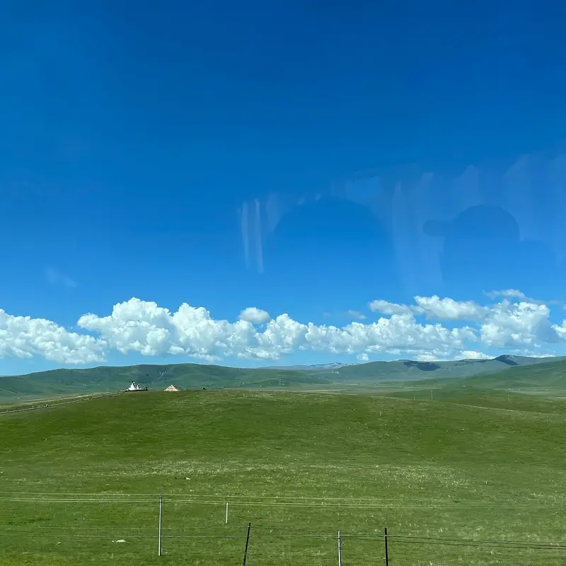
Photo adjustments
EXIF orientation normalized; resized without changing aspect ratio; converted to WebP. No subject edits.
Explore the region
About Gahai Lake Viewing Area
The prefecture environment bureau's article places the wetland in Luqu county at 3,000–4,300 m with a total area of 43,176 hectares, and records that it is one of the source areas of the Tao river, the largest tributary of the Yellow River, and also of the Bailong river, which is the source of the Jialing river on the upper Yangtze; it says the wetland's peat matters for biodiversity protection, for storing and supplying water and especially for carbon storage. The county government's own overview gives the lake the Tibetan name 姜托措柑, meaning “ancient plateau lake”, and the local names 高原神湖 and 勒加秀姆, puts the lake surface at 3,480 m with a deepest point of about 5 m, and calls it the largest freshwater lake of the Gannan grassland. On the lake's size the sources disagree: the county overview gives nearly 1,000 hectares, the prefecture's 2015 article lists 2,513 hectares of lake within the wetland, and the prefecture's 2023 article puts the lake at 2,700 hectares, and on the reserve the prefecture's 2023 article gives 2,474 square kilometres against about 200 square kilometres in the county overview. The record sets the disagreement out rather than choosing between the figures.
The prefecture environment bureau records that the lake dried out three times, in 1995, 1997 and 2000, under heavy grazing and falling runoff, that after 2000 it went 15 years without drying, and that more than 60% of the dried-up springs around the wetland have begun flowing again. It records a 174 m trapezoidal dam built at the lake's north-western outlet in 2002 to raise the water level, a 4.7 km ecological water-diversion channel bringing water from the Zhongqu river into the lake, and the replacement of the 22 km road that ran through the reserve by a 60 km road from Gaxiu to Maqu. In September 2011 the wetland was listed as a wetland of international importance, the 1,975th in the world and the 41st in China. The page puts the migratory birds at more than 70 species a year and says rare birds including black-necked cranes, grey cranes and whooper swans number more than 30,000, and it notes a boardwalk along the lake shore. The county overview adds that the lake was made a provincial migratory-bird reserve in 1982 and that in 1998, together with Zecha, it was approved as a national nature reserve, and it lists black storks, bearded vultures, white-tailed sea eagles, otters and lynx among the wetland's animals; it also records that a spring it names 多诗曲果 enters the lake from the east and that three streams rising in the southern hills flow in from the surrounding grassland.
What to look for
- The boardwalk along the lake shore, which the prefecture environment bureau's article notes
- The black-necked cranes, grey cranes and whooper swans that the same article says come to the wetland in their tens of thousands
- The 174 m trapezoidal dam at the lake's north-western outlet, built in 2002 to raise the water level
- The 4.7 km ecological water-diversion channel that brings water from the Zhongqu river into the lake
- The spring the county overview names 多诗曲果, entering the lake from the east, and the three southern streams it records flowing in from the grassland
Location & getting there
Getting to Gahai Lake Viewing Area
Check the open visitor route and follow the site’s rules on distance, food and photography. Conservation areas may limit access beyond designated paths.
- Search for 尕海湖开放观景区 with 甘南藏族自治州 and 碌曲县.

Find Gahai Lake Viewing Area
尕海湖开放观景区 · 碌曲县
No reliable map pin yet: search by the Chinese name.
Sources & visit information
The linked sources support the identity and background described in this introduction. Opening hours, admission, activity availability and exact arrival arrangements have not been comprehensively checked. Confirm current visitor information with the venue; the original catalogue locality and editorial review flag are retained.