
Northwest · Destination guide
Gansu 甘肃
Gansu's long shape links eastern loess country, the Hexi Corridor and desert margins with higher Tibetan plateau landscapes in the south. Lanzhou is the capital on the Yellow River, and a useful beginning or end to several possible journeys. The province needs a direction rather than a checklist: a westward route through corridor cities is a different commitment from Tianshui or Gannan. Choose the historical and landscape chapters that matter most, then give each a suitable base, local transfer and time to understand what makes it distinct.
Gansu at a glance
- Population
- 24,430,000Year-end resident population, entire provincial-level administrative area · 2025Source ↗
- Income per person
- 28,224Mean annual disposable income per person, all residents · 2025 · CNYSource ↗
- Languages & dialects
- Mandarin and northwestern Chinese varieties, including Lanyin Mandarin; Tibetan in Gannan and other Tibetan communities.Source ↗
- Geography
- Loess Plateau country, the Hexi Corridor, Qilian mountains and southern plateau areas.Source ↗
- Elevation
- Many central and eastern uplands lie around 1,500–2,500 m; the Qilian and Gannan highlands commonly exceed 3,000 m.Regional terrain bands rather than a province-wide average.Source ↗
- Main gateway
- LanzhouProvince
Map & places
Explore Gansu
Browse places and sight guides by category, or choose a city below the map to see its location and boundary.
Browse 134 places; 81 have map coordinates. Some listings cover overlapping areas.
Colour-coded categories. Pins are approximate; confirm entrances and routes in Amap or Apple Maps before setting off. District boundaries: © OpenStreetMap contributors (ODbL), simplified, for travel reference only.
Cities, counties & districts in Gansu
Select a city name to show its boundaries on the map above; its details remain available separately.
Top sights in Gansu
- 1Trip.Best #1
Mingsha Mountain And Crescent Spring鸣沙山月牙泉
Ming Sha Shan Yue Ya Quan (鸣沙山月牙泉) is a grasslands & deserts entry in Dunhuang, Gansu.
- 2Trip.Best #2
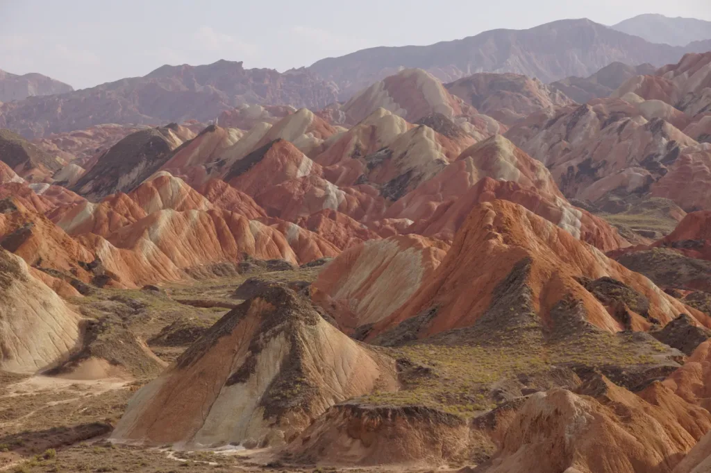
Zhangye Rainbow Mountains张掖七彩丹霞
Zhangye Rainbow Mountains are a protected landscape of coloured hills and Danxia landforms in Linze and Sunan counties, where folded Cretaceous rock layers meet wind- and water-cut ridges. The visitor experience centres on designated viewing platforms rather than a hike onto the fragile formations: compare the bands, folds and changing light from several viewpoints, then confirm the day’s official vehicle arrangement before leaving.
- 3Trip.Best #3
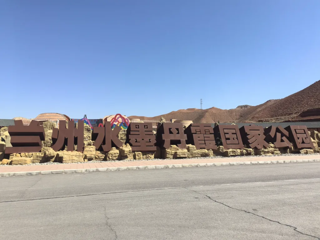
Lanzhou Ink-Wash Danxia Landform兰州水墨丹霞
Lanzhou Ink-Wash Danxia is a managed geological scenic area in Xinghua Village, Shuping Town, Yongdeng County, where coloured hills are viewed from platforms, shuttle-connected slopes and boardwalks. It is worth visiting for the changing bands of red, ochre and pale rock, the high-to-low route through the main viewpoints, and the geological and Silk Road interpretation at the visitor centre.
- 4Trip.Best #4
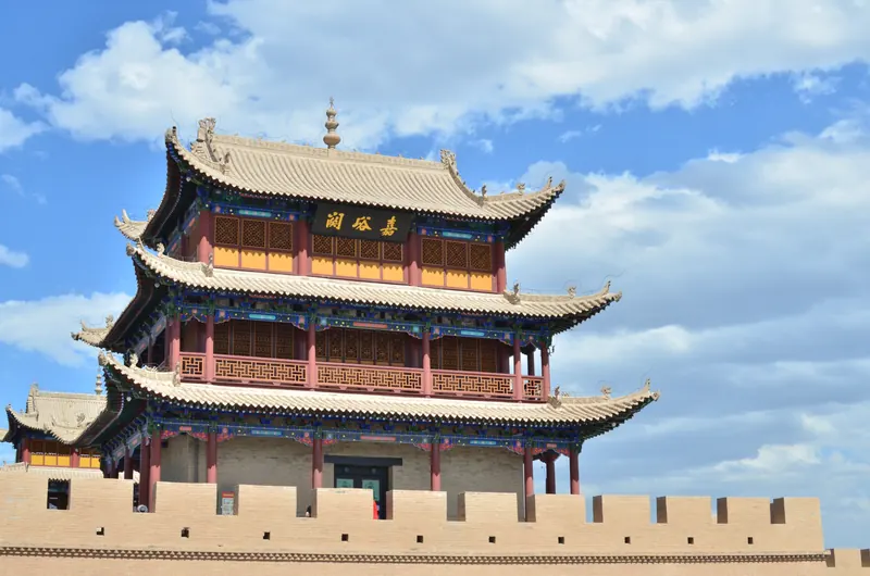
Jiayuguan Guancheng嘉峪关关城
Jiayu Pass concentrates the western frontier of the Ming Great Wall into a compact fortress of successive defensive layers.
- 5Trip.Best #5
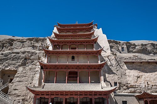
Mogao Grottoes莫高窟
Mogao’s cliff contains a long sequence of Buddhist caves in which murals, painted sculpture and architecture work together.
- 6Trip.Best #6
Pingshanhu Grand Canyon平山湖大峡谷
Pingshanhu Grand Canyon is an independent canyon and geological attraction in Pingshanhu Mongolian Township, Ganzhou District, Zhangye. Its appeal is the change of scale: broad rim viewpoints show a northern dryland Danxia and coloured-hill landscape, while a lower route—when open and suitable—leads into narrow channels and tall eroded walls. It is a separate visit from Qicai Danxia, not another entrance to it.
- 7Trip.Best #7
Zhagana扎尕那
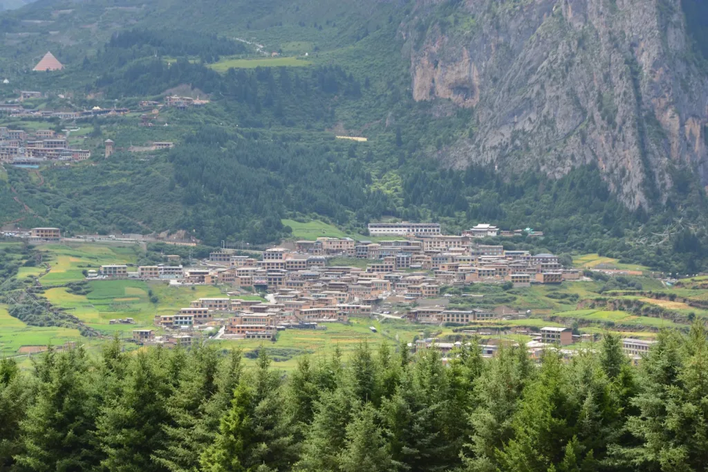
Zhagana is an inhabited Tibetan village in a natural stone basin, where four hamlets, cultivated fields, forested slopes and pale rock walls make the landscape as much a place to walk through as a viewpoint to photograph.
- 8Trip.Best #8
Gansu Provincial Museum甘肃省博物馆
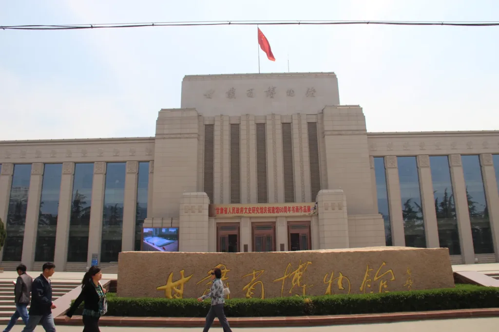
Gansu Provincial Museum is Lanzhou’s regional museum for archaeology, natural history and modern Gansu. Its strongest visit connects painted pottery, Silk Road exchange, Buddhist art and fossils, with the Eastern Han Bronze Galloping Horse (铜奔马) as the best-known single object. The museum is free, but visitors should reserve in advance and check the current exhibition list and temporary closure notices.
 9Trip.Best #9
Qilian Mountains Binggou River Scenic Area祁连山冰沟河景区
Binggou River Scenic Area lies in Qilian Town, Tianzhu Tibetan Autonomous County, about 40 km from Wuwei, deep in the Qilian Mountains. Named after a glacier-fed river, it offers valley walks among forests, meadows and alpine scenery.
- 10Trip.Best #10
Giant Buddha Temple张掖大佛寺
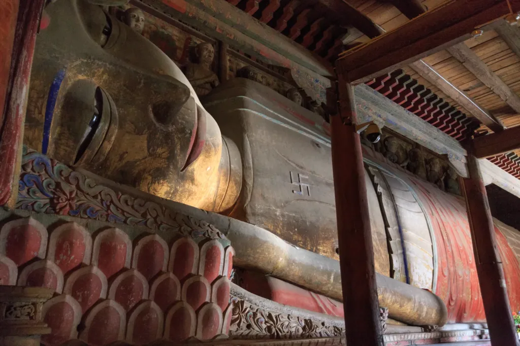
Zhangye’s Giant Buddha Temple (Dafo Temple, 大佛寺) is a city-centre Buddhist and heritage complex built around a 34.5-metre Western Xia reclining Buddha. Its timber hall, painted clay sculpture, murals and surviving scripture hall make it a distinct urban visit, separate from the colourful Danxia landscapes outside Zhangye.



Gansu travel guides
In-depth articles and itineraries for planning your time in Gansu.
SOON
Itinerary
3 days in Gansu: a first-timer's itinerary
How to split your days between the essential sights, neighbourhood walks and a relaxed evening, with transport tips between each stop.
Coming soonSOON
Food
Where to eat in Gansu
Local dishes worth seeking out, how to order and what to expect.
Coming soonSOON
Transport
Getting around Gansu by metro and taxi
Cards, apps and station tips for moving between sights.
Coming soonSOON
Day trip
Day trips from Gansu
Plan the outward and return journeys and visiting time before mapping out your day.
Coming soonSOON
Neighbourhoods
Neighbourhood walks in Gansu
Discover everyday Gansu on a slow walk.
Coming soonSOON
Seasons
Choosing a season for Gansu
See how visiting changes from spring to winter.
Coming soonLocal dishes
Lanzhou beef noodles兰州牛肉面
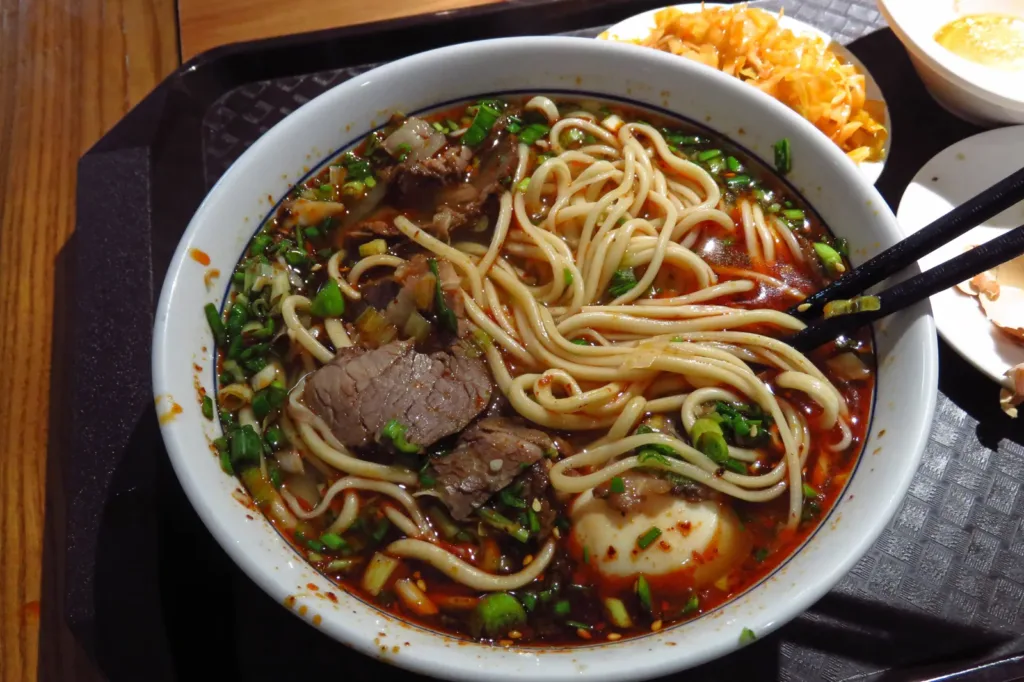
Lanzhou beef noodles are a hand-pulled wheat-noodle soup rooted in Lanzhou’s food culture: clear beef broth, radish, sliced beef, green herbs and optional chilli, with noodle width chosen at order. The local technique is listed in China’s national intangible cultural heritage register, and the official description connects its ingredient geography to wheat from the Loess Plateau and beef from Gannan and Qinghai.
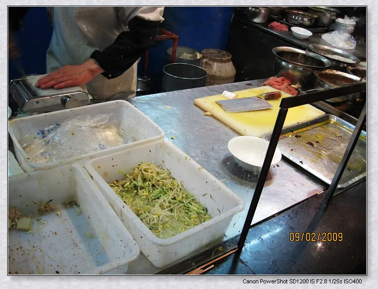
Niangpi noodle sheets酿皮
Xining niangpi (酿皮) is a cool, wheat-based sheet snack whose smooth ribbons are dressed with chili oil, vinegar, garlic and other seasonings, then paired with springy pieces of wheat gluten; it is a practical way to taste Qinghai’s everyday food culture rather than a fixed recipe.

Tianshui guagua天水呱呱
AI dish illustration · AI 菜品示意图Guagua is soft but substantial, with an earthy grain flavor beneath a sharp, spicy dressing.

Tianshui malatang天水麻辣烫
Expect a savory, chili-fragrant coating, with chewy noodles and vegetables providing contrasting textures. The visible red color does not precisely predict heat.

Sanpaotai tea三炮台
The drink changes as sugar dissolves and fruit releases flavor, combining tea bitterness with sweetness and dried-fruit aroma.
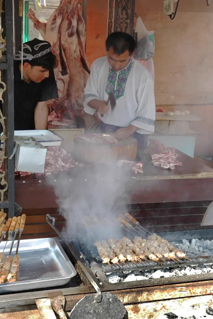
Xinjiang lamb skewers烤羊肉串
Xinjiang lamb skewers (烤羊肉串) are a regional grilled-lamb snack: small pieces of lamb, rendered fat and cumin-led seasoning, served hot and varied by kitchen.
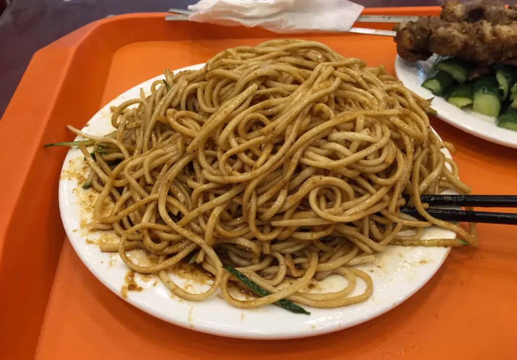
Lanzhou cool noodles兰州凉面
Lanzhou liangmian (兰州凉面) is a seasonal noodle dish built from wheat noodles cooled after cooking, tossed with oil, and served with a cooked vegetable gravy. In Lanzhou it is also described as “liangmian tiaor, re luzhi” (凉面条、热卤子); the topping’s temperature and vegetables can vary by kitchen.

Jiangshui sour-broth noodles浆水面
In Lanzhou, 浆水面 pairs wheat noodles with a pale, naturally fermented vegetable broth: sour, herbal and refreshing, but part of a wider Gansu tradition rather than a dish unique to one city.
Arrival, stays & getting around
Arrive, stay & get around Gansu
Check the precise airport or station name on the ticket before arranging the final transfer to your hotel.
Your arrival gateway
Lanzhou 兰州
This Gansu entry uses Lanzhou as its selected gateway city. It does not describe transport coverage across the entire region.
Airports
Lanzhou Zhongchuan International Airport
兰州中川国际机场
Airport in Lanzhou New Area, far from the central riverfront. Use current terminal and airport-rail guidance.
Railway stations
Lanzhou West Railway Station
兰州西站
Principal high-speed gateway on the western side of central Lanzhou.
Lanzhou Railway Station
兰州站
The established central railway gateway southeast of the main riverfront districts.
Metro & city transport
Lanzhou Metro
兰州轨道交通
The local rail network links the city’s urban corridors. The airport’s national-rail connection is separate from the metro.
Bus stations
Zhongchuan Airport Bus Line 1
中川机场巴士1号线
A city-airport road connection from the civil-aviation ticket-office area; airport buses moved to Terminal 3 with the terminal transfer.
More about getting around
Lanzhou is the main transport gateway, with Zhongchuan airport outside the urban area. Trains help connect corridor cities, but desert viewpoints and cave sites require local transfers. Before committing to a westward route, confirm both your chosen Mogao visit and the onward departure city.
Transport reference review: 2026-09-06. Consult the operator for current services and timetables.
Accommodation
Stay in Gansu
Use central Lanzhou for riverside time and urban connections, then move your base with the itinerary. Dunhuang town suits meals and excursions; desert lodgings trade convenience for setting. For Xiahe, stay near the town and monastery area instead of attempting a rushed return journey.
Find hotels on Trip.com ↗Change your destination, dates and guests on Trip.com.
Weather
Lanzhou weather
Loading the current-hour forecast…
The western corridor is dry, with hot sunshine and large changes between daytime and night. Winters can be severe, and wind can carry dust in exposed areas. Pack warm layers even for a warm-season itinerary; southern highland stops require their own forecast.
Seasons & when to go
Check the city forecast ↗Bookings & travel
Make your travel plans a reality
Stays
Find hotels in Gansu on Trip.com
Change your destination, dates and guests on Trip.com.
Find hotels on Trip.comWhy I recommend Trip.comFlights
Search for flights on Trip.com
Change your destination, dates and passengers on Trip.com.
Search flights on Trip.comWhy I recommend Trip.comTrains
Search for trains on Trip.com
Change your stations, travel date and passengers on Trip.com.
Search trains on Trip.comWhy I recommend Trip.comCars
Browse car rentals on Trip.com
Change your pick-up location and rental dates on Trip.com.
Open Trip.comWhy I recommend Trip.comActivities
Explore activities on Trip.com
Change your destination, dates and participants on Trip.com.
Explore activities on Trip.comWhy I recommend Trip.comFood
Explore local food guides
Browse local dishes, breakfast ideas, snacks and regional cooking.
Explore food guidesWhat to eat in GansuWritten by China Revealed · Editorially updated 2026-09-07
Maps & transport note
Transport suggestions on this site may be inaccurate or out of date. Confirm your exact destination, visitor entrance, current route and return connection before setting off.
For travel in mainland China, we recommend Amap (高德地图) or Apple Maps (苹果地图) for checking local directions. Both support English. Keep the Chinese place name and full address handy, and compare the result with the venue or transport operator’s latest information.
Do not rely on Google Maps or another overseas map as your only route check for mainland China. Map coverage and features vary, and no app can guarantee an error-free route.
Amap’s English interface depends on the app version and store region. Apple Maps follows your device or app language settings; some place labels may remain in Chinese. Apple states that its map service in China uses AutoNavi (Amap). Features differ in Hong Kong, Macao and Taiwan.
Information checked 2026-09-07.Photo credits (8)
- Mogao Caves · GansuPhoto: xiquinhosilva · CC BY 2.0
- Mingsha Mountain And Crescent Spring (鸣沙山月牙泉)Photo: Trip.com
- Jiayuguan Guancheng (嘉峪关关城)Photo: Trip.com
- Mogao Grottoes (莫高窟)Photo: Trip.com
- Pingshanhu Grand Canyon (平山湖大峡谷)Photo: Trip.com
- Qilian Mountains Binggou River Scenic Area (祁连山冰沟河景区)Photo: Trip.com
- Tianshui malatang (天水麻辣烫)Photo: Liuxingy · CC BY-SA 4.0
- Sanpaotai tea (三炮台)Photo: Brücke-Osteuropa · CC0
Sources & useful links (56)
- China National Tourist Office London: Gansu
- China National Tourist Office: Gansu
- UNESCO: Mogao Caves
- Zhangye government: Coloured Danxia scenic area
- Silk Road Dunhuang Expo: Zhongshan Bridge
- Gansu Economic Information: Sanpaotai tea
- Gansu government Belt and Road portal: Lanzhou beef noodles
- Gansu government Belt and Road portal: Tianshui food report
- Gansu government Belt and Road portal: Tianshui streets
- Gansu Health Commission: producer's guagua specification
- Dunhuang Academy: Maijishan Caves
- Dunhuang Academy: official Mogao ticket channels
- Gansu government Belt and Road portal: local flavours
- Gansu — population background
- Gansu — languages background
- Gansu — geography background
- Gansu — Lanzhou map reference
- Gansu — Zhangye map reference
- Gansu — Jiayuguan Pass map reference
- Gansu — Dunhuang map reference
- Gansu — Mogao Caves map reference
- Gansu — Crescent Lake and dunes map reference
- Gansu — Labrang Monastery map reference
- Gansu — Maijishan Grottoes map reference
- Gansu — Bingling Temple map reference
- Gansu — Zhangye National Geopark map reference
- Gansu — Yumen Pass map reference
- Gansu — Suoyang City map reference
- Gansu — Langmusi map reference
- Gansu attraction ranking source
- Gansu specialty reference — ydyl.gansu.gov.cn
- Gansu specialty reference — ydyl.gansu.gov.cn
- Gansu specialty reference — ydyl.gansu.gov.cn
- Gansu specialty reference — ydyl.gansu.gov.cn
- Gansu specialty reference — www.gswbj.gov.cn
- Gansu specialty reference — www.pingliang.gov.cn
- Gansu specialty reference — ydyl.gansu.gov.cn
- Niangpi noodle sheets — local food reference
- Destination food reference — wlt.xinjiang.gov.cn
- Gansu Daily: the range of Jingyuan lamb preparations
- HEPiX Lanzhou visitor handbook: local sweet snacks
- Gansu heritage: Lanzhou food traditions
- People's Daily Gansu: local fermented-grain milk tea
- Huzhu government: Qinghai fermented grain and milk tea traditions
- 冶力关旅游区 — place reference
- 庆阳油酥角 — local food reference
- 文县白马十大碗 — local food reference
- 临泽四坝蒸饼 — local food reference
- Local food reference: 玉泉烤全羊
- Local food reference: 热冬果
- Local food reference: 羊羔肉
- Local food reference: 饸饹面
- Local food reference: 油香
- Local food reference: 盖碗茶
- Local food reference: 糌粑
- Local food reference: 酥油茶