

Photo adjustments
Proportionally resized and converted to WebP without cropping, retouching or changing the photographed subject.
Explore the region
About Wanfeng Lake
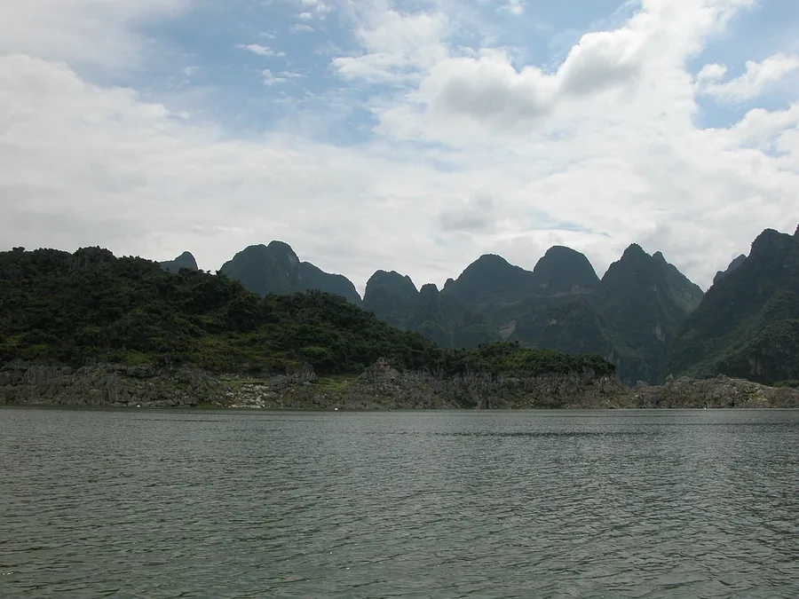
The Hongchun area gives a useful view of the relationship between the water and the surrounding karst hills. Shore viewpoints and an authorised sightseeing cruise offer different perspectives, but the lake is much larger than a single visitor stop. Choose one departure area and confirm what route is operating instead of assuming boats connect every lakeside attraction.
Wanfeng Lake is the artificial lake formed by the Tianshengqiao-I Hydropower Station (天生桥一级水电站), a hydropower station on the Nanpan River (南盘江) on the border of Guizhou and Guangxi, between Anlong County (安龙县) and Longlin Multiethnic Autonomous County (隆林各族自治县). Construction began in June 1991; river closure took place at the end of 1994 and the reservoir began to fill at the end of 1997, with the project completed in December 2000. The reservoir has a total capacity of 10.26 billion cubic metres, of which 5.796 billion cubic metres is regulating capacity, and functions as an incompletely multi-year regulated reservoir. Wanfeng Lake itself covers an area of about 600 square kilometres.
What to look for
- Karst peaks frame the reservoir’s inlets and peninsulas.
- The Hongchun shore reveals islands and small stone-forest forms along the lake edge.
Location & getting there
Getting to Wanfeng Lake
The official Xingyi visitor address is Hongchun Wharf, Group 8 of Changchong Village in Zerong Township. Arrange the road journey to this wharf if using that lake area, then confirm any cruise and its return point locally.
Combine your visit
Suggested order for the visit:
-
Hongchun shore viewpoint
Read the arrangement of water, peaks and peninsulas.
-
Authorised lake cruise, if operating
See a different perspective from the booked route.
-
Hongchun visitor area
Return to the same departure area unless another connection is confirmed.
This is an editorial sequence of named spaces or places. It does not imply a verified walking connection or promise opening, ticket availability or a journey time.

Find Wanfeng Lake
万峰湖 · 黔西南州
The pin marks the area, not the entrance.
More places nearby
Approximate straight-line distances between map pins, not travel distances.
Wanfenglin 万峰林
20 km awayWanfenglin’s karst peaks rise above a lived-in valley of fields, lanes and villages. The paid ridge-road circuit provides elevated views, while the valley floor gives a closer perspective on the agricultural landscape. These are…
View guide →Maling River Canyon 马岭河峡谷
26 km awayMaling River Canyon cuts deeply into the ground north-east of Xingyi. Waterfalls descend along the gorge walls, with hanging vegetation and connected cave features adding detail to the narrow river landscape. Its main visual…
View guide →Anlong Zhaodi 安龙招堤
42 km awayZhaodi is a waterside landscape in Anlong built around a long embankment, lotus ponds and willow trees. In the flowering season the lotus becomes the focus, but the dike and its views remain the structure of the visit. Banshan…
View guide →Sources & visit information
The sources below support the place-specific description and arrival information. Suggested combinations are editorial planning ideas; confirm current opening, entry arrangements and transport services for your date.
- Tianshengqiao-I Dam ↗
- Maling River scenic-area plan: existing Hongchun conditions ↗
- Guizhou scenic-area directory ↗
- Chinese Wikipedia: 天生桥一级水电站 (revision 92544963, 2026-05-05) ↗
Visitor information adapted and edited from Wikipedia contributors, “Tianshengqiao-I Dam” · CC BY-SA 4.0. Source revision 1366575067.
Background paragraphs translated and condensed from Wikipedia contributors, "天生桥一级水电站", Chinese Wikipedia · CC BY-SA 4.0. Source revision 92544963.