

Photo adjustments
Proportionally resized and converted to WebP without cropping, retouching or changing the photographed subject.
Explore the region
About South Lake Park (Tangshan)
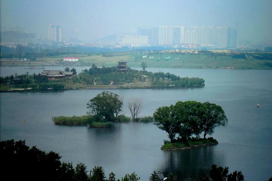
It later hosted the 2016 horticultural exposition. The park is divided among named lakes rather than one continuous basin: Taohuatan is the older South Lake area, while Longquanwan and Qinglongze form part of the larger later landscape. Choose a lakeside section from the visitor map, paying attention to the railway that separates northern and southern water bodies instead of assuming every shore path connects directly.
The park's site was originally the Kailuan (开滦) coal mining area; mining caused the ground to subside and groundwater to seep upward, and local residents called the resulting hollow the 'South Big Hollow' (南大洼). The 1976 Tangshan earthquake worsened the subsidence, and from 1996 the government began greening and remediating the sunken land. Construction of the South Lake Urban Central Ecological Park (南湖城市中央生态公园) began on 1 March 2008; it opened to visitors on 1 May 2009 and was rated a national 4A tourist attraction (国家4A级旅游景区) that year. It hosted the 2016 World Horticultural Exposition (世界园艺博览会) and was upgraded to a national 5A tourist attraction (国家5A级旅游景区) on 6 February 2024.
What to look for
- Longquanwan and Qinglongze in the larger lakeside landscape.
- Taohuatan, the older South Lake area, and the park's reclaimed mining-land setting.
The surrounding area
An eastern provincial city with its own regional snacks and contemporary food-and-leisure districts.
Location & getting there
Getting to South Lake Park (Tangshan)
The visitor centre approach is at Danfeng Road and Minghu Road in Lunan District, on the park's southwestern side.
- Use the entrance map to choose one lake circuit; the grounds extend across several water bodies and the railway corridor.
Combine your visit
Suggested order within this visit:
-
Visitor centre and park map
Choose the accessible lake section before walking.
-
Longquanwan
Begin with one of the main open-water landscapes.
-
Qinglongze
Continue into the adjoining lake area if the current path connects.
This sequence is an editorial suggestion based on the features described in the sources. Access to individual buildings or areas should be checked locally; no travel time or shared admission is implied.
Find South Lake Park (Tangshan)
唐山南湖 · 唐山市
The pin marks the area, not the entrance.
More places nearby
Approximate straight-line distances between map pins, not travel distances.
Kailuan National Mine Park 开滦国家矿山公园
4 km awayKailuan's mine park explains how coal extraction, railway building and company finance helped shape industrial Tangshan. The museum's Black River exhibition starts with the formation of coal and moves into the machinery…
View guide →Hetou Old Street 河头老街
7 km awayHetou Old Street is a modern visitor district along the Tangjin Canal in Fengnan, built around the place once known as the canal's head. That location connects it to Tangshan's coal-transport history, while today's experience…
View guide →Eastern Qing tombs 清东陵
79 km awayThe Eastern Qing Tombs spread across a mountain-backed landscape near Zunhua. The spirit road, ceremonial halls and burial mounds form a sequence intended for imperial ritual, with different compounds repeating and elaborating…
View guide →Sources & visit information
The sources below support the place-specific description and arrival information. Suggested combinations are editorial planning ideas; confirm current opening, entry arrangements and transport services for your date.
Visitor information adapted and edited from Wikipedia contributors · CC BY-SA 4.0. Source revision 80817083.
Visitor information adapted and edited from Wikivoyage contributors · CC BY-SA 4.0.
Background paragraphs translated and condensed from Wikipedia contributors, "南湖 (唐山)", Chinese Wikipedia · CC BY-SA 4.0. Source revision 80817083.