


Get to know Tangshan
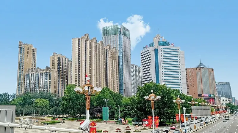
Photo adjustments
Full frame retained; proportionally resized and converted to WebP. No retouching or changes to the photographed subject. Card displays may crop the view.
- Administrative area
- Prefecture-level city · 地级市
- Part of
- Hebei
- Chinese name
- 唐山市
- Local areas
- 14 local areas
Area & population
- Area in the source
- 13,472.00 km²
- Population · 2020 census
- 7,717,983
- Administrative seat
- Lubei District
Source: cited geographic source, as of the dates shown.
Much of the city's development is thanks to the industrialization, beginning in 1870, when Kailuan Group established coal mines in the region. It is the birthplace of China's first standard-gauge railway, the first railway plant, the first steam locomotive, and the first cement factory. It was hailed as China's "cradle of industrialization". Even today, Tangshan is a hub of steel, energy, chemical, and ceramics production. Ping opera, which originated from the city's Luanzhou county, is one of the five most popular Chinese operas.
Tourism
Eastern Qing tombs Anti-Seismic Monument, located in Anti-Seismic Square Tangshan Nanhu Park (Lunan District) Kailuan National Mine Park (Lunan District) Tangshan science and Technology Museum (Lubei District)
Explore Tangshan
Core places to explore, with English and Chinese names.
Eastern Qing tombs 清东陵
South Lake Park (Tangshan) 唐山南湖
Kailuan National Mine Park 开滦国家矿山公园
Hetou Old Street 河头老街
Puti Island 菩提岛
Moon Island 月岛
Luanzhou Ancient City 滦州古城
Tangshan Nanhu Park 南湖公园
Shanyekou Scenic Area 山叶口
Baiyangyu Great Wall 白羊峪长城
Jingzhong Mountain 景忠山
Qingshanguan Pass 青山关
Lunan District 路南区
Lubei District 路北区
Guye District 古冶区
Kaiping District 开平区
Fengnan District 丰南区
Fengrun District 丰润区
Caofeidian District 曹妃甸区
Luannan County 滦南县
Laoting County 乐亭县
Qianxi County 迁西县
Yutian County 玉田县
Zunhua 遵化市
Qian'an 迁安市
Luanzhou 滦州市
Places to explore around Tangshan
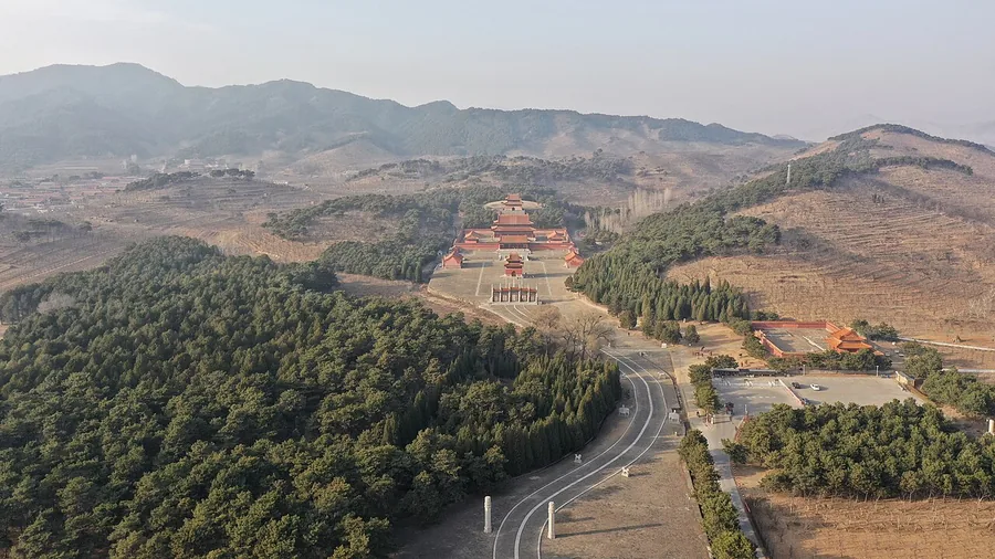 Yuling, the Qianlong Emperor's mausoleum within the Eastern Qing Tombs, Hebei; 9 March 2023.
Eastern Qing tombs清东陵
The Eastern Qing Tombs spread across a mountain-backed landscape near Zunhua. The spirit road, ceremonial halls and burial mounds form a sequence intended for imperial ritual, with different compounds repeating and elaborating…
Read the place guide →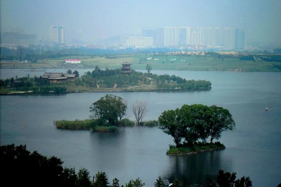 Tangshan South Lake seen toward the northeast from Fenghuang Terrace, August 2011.
South Lake Park (Tangshan)唐山南湖
Tangshan South Lake occupies former mining-subsidence land that was reshaped into a large urban water-and-garden landscape. It later hosted the 2016 horticultural exposition. The park is divided among named lakes rather than one…
Read the place guide →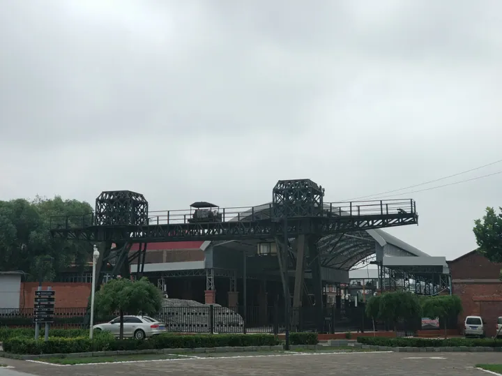 A large brown steel gantry with two lattice towers spanning a trackbed in front of an industrial hall with an arched roof and brick outbuildings, with a hedge, fence, parked car and minibus in the foreground under a blank grey sky.
Kailuan National Mine Park开滦国家矿山公园
Kailuan's mine park explains how coal extraction, railway building and company finance helped shape industrial Tangshan. The museum's Black River exhibition starts with the formation of coal and moves into the machinery…
Read the place guide →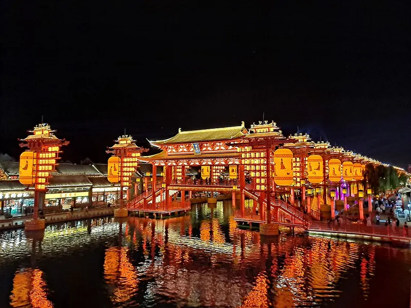 Hetou Old Street and bridge at night · 河头老街 Photograph date recorded by the source: 2024-09-06.
Hetou Old Street河头老街
Hetou Old Street is a modern visitor district along the Tangjin Canal in Fengnan, built around the place once known as the canal's head. That location connects it to Tangshan's coal-transport history, while today's experience…
Read the place guide → AI illustration · AI 示意图(仅供参考,非该地点实拍)
Puti Island菩提岛
Puti Island (菩提岛), formerly known as Shijiutuo, is a wooded island off the Laoting coast with bird habitat and Buddhist cultural landmarks.
Read the place guide → Moon Island · 月岛
Moon Island月岛
Yue Dao (月岛), or Moon Island, is a crescent-shaped resort island in Tangshan's Bohai Sea island group off the Laoting coast.
Read the place guide →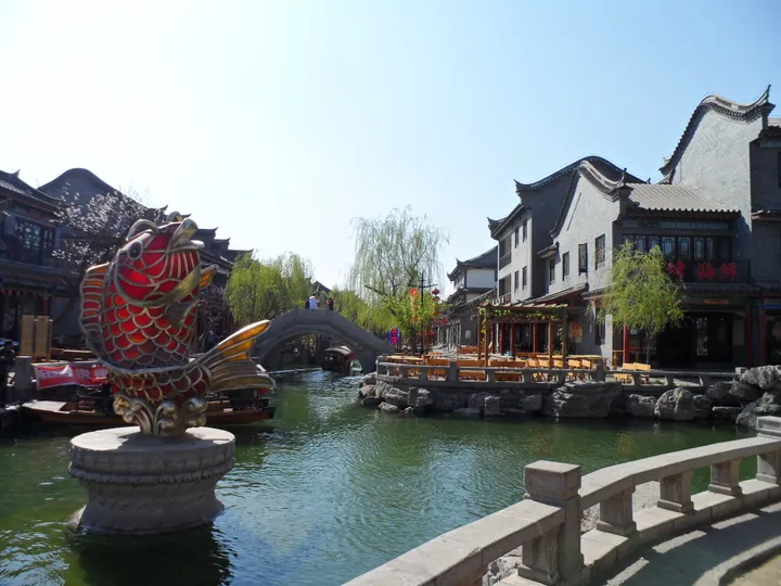 A canal lined with traditional buildings and a stone arch bridge in Luanzhou Ancient City, Tangshan · 唐山滦州古城运河,两岸为传统建筑,一座石拱桥横跨其上 Source-recorded photograph date: 2011-11-11.
Luanzhou Ancient City滦州古城
Luanzhou Ancient City (滦州古城) is a modern tourism district in Luanzhou designed around Qing-style streets and the culture of the Luan River.
Read the place guide → Tangshan Nanhu Park · 南湖公园
Tangshan Nanhu Park南湖公园
Tangshan Nanhu Park (南湖公园) is Tangshan's large southern lake-and-park landscape, created through the rehabilitation of land affected by Kailuan coal mining.
Read the place guide → Shanyekou Scenic Area · 山叶口
Shanyekou Scenic Area山叶口
Shanyekou Scenic Area (山叶口) is a mountain scenic area in Qian'an known for colourful rock formations, old pines and its close connection with Shanyekou village.
Read the place guide → AI illustration · AI 示意图(仅供参考,非该地点实拍)
Baiyangyu Great Wall白羊峪长城
Baiyangyu Great Wall (白羊峪长城) crosses the ridges above Baiyangyu village in Qian'an and is distinguished by sections with red-marble foundations.
Read the place guide →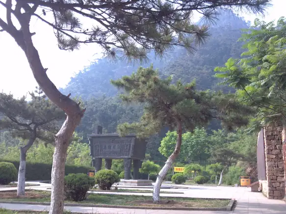 Jingzhong Mountain · 景忠山
Jingzhong Mountain景忠山
Jingzhong Mountain (景忠山) is a 610-metre mountain in Qianxi where Buddhist temples, Daoist halls and shrines to historical figures share a pine-covered hillside.
Read the place guide →AI illustration · AI 示意图(仅供参考,非该地点实拍)Qingshanguan Pass青山关
Qingshanguan is a Great Wall pass and fortified settlement in Qianxi County, set among the hills north of Tangshan.
Read the place guide →Local life & food
Tangshan local specialties
唐山市特色美食 · 10 specialties to discover
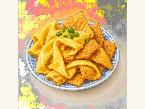 Gezha 饹馇AI dish illustration · AI 菜品示意图
Fresh sheets are pliable and lightly beany; frying gives crisp edges, while stewing produces a soft, sauce-absorbing texture.
Source ↗Read the dish guide → Qizi shaobing 棋子烧饼AI dish illustration · AI 菜品示意图
The surface and layers are crisp and crumbly, enclosing a concentrated savory center. Sweet variants should be identified separately rather than assumed to taste the same.
Source ↗Read the dish guide →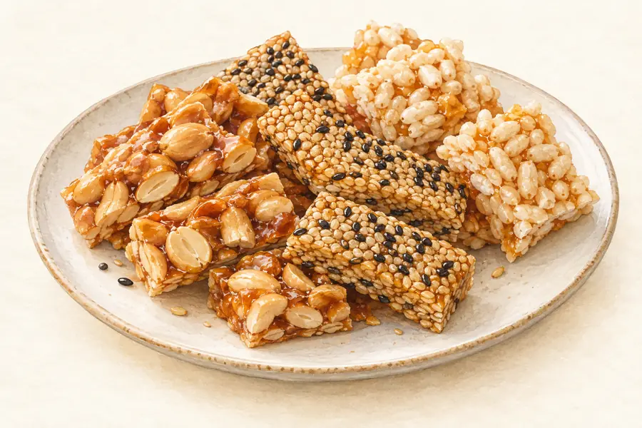 Honey Fried Pastry Flowers 蜂蜜麻糖AI illustration · AI 示意图(仅供参考,非实拍)
Honey Fried Pastry Flowers (蜂蜜麻糖) are a handmade sweet from Qishuzhuang town (七树庄镇) in Fengrun district (丰润区), Tangshan (唐山), where they are also known as Qishuzhuang matang (七树庄麻糖).
Read the dish guide → Tangshan Lazy Tofu with Greens 唐山懒豆腐Reference photo of a similar dish · 同类菜品参考照片
Tangshan Lazy Tofu with Greens (唐山懒豆腐) is a thick soybean dish that began in rural cooking around Tangshan (唐山), Hebei: ground soybeans, pulp and all, simmered with leafy greens.
Read the dish guide →
Photo adjustments
Full frame retained; EXIF orientation normalized, proportionally resized to at most 800 pixels and converted to WebP. No generated pixels or subject changes. Cards may crop the display.
 Qianxi Chicken Stewed with Chestnuts 迁西板栗炖鸡AI illustration · AI 示意图(仅供参考,非实拍)
Qianxi Chicken Stewed with Chestnuts (迁西板栗炖鸡) is listed among the local specialties of Tangshan, Hebei. The name includes 鸡 (chicken), 板栗 (chestnuts). 炖 describes slow simmering.
Read the dish guide → Seafood with Mung Bean Gezha 海鲜饹馇
Seafood with Mung Bean Gezha (海鲜饹馇) is listed among the local specialties of Tangshan, Hebei. The name includes 海鲜 (seafood).
Read the dish guide →Photo adjustments
EXIF orientation normalized; resized without changing aspect ratio; converted to WebP. No subject edits.
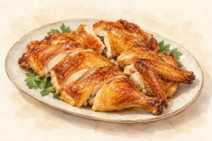 Yishengyong Smoked Chicken 义盛永熏鸡AI illustration · AI 示意图(仅供参考,非实拍)
Yishengyong Smoked Chicken (义盛永熏鸡) is a Tangshan (唐山) specialty whose preparation begins with seasoned stock kept from earlier batches of chicken.
Read the dish guide →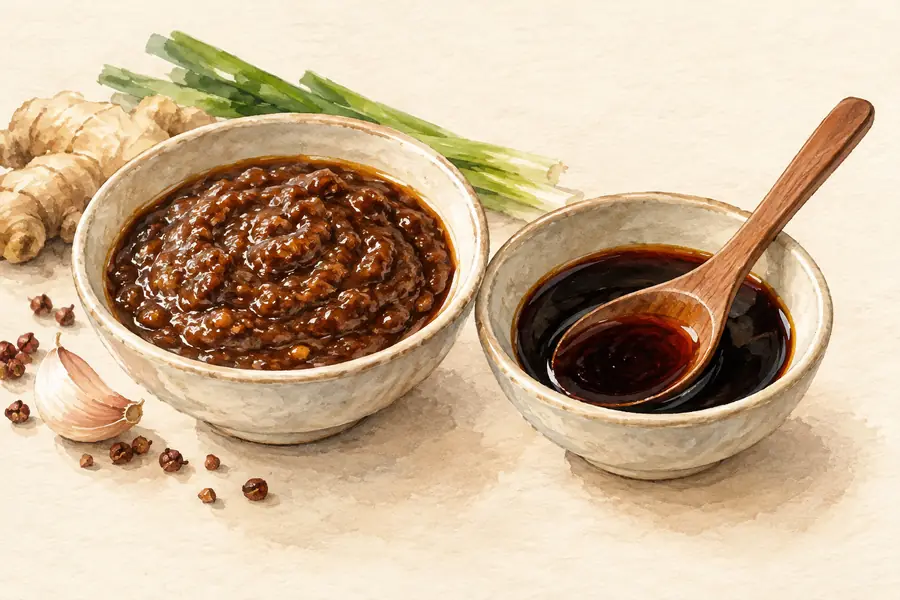 Tangshan Shrimp Paste 唐山虾酱AI illustration · AI 示意图(仅供参考,非实拍)
Tangshan Shrimp Paste (唐山虾酱) includes the fermented coastal pastes made in Luannan (滦南) and Leting (乐亭).
Read the dish guide →All dish names · 全部菜名 (10)
- Gezha · 饹馇
- Qizi shaobing · 棋子烧饼
- Honey Fried Pastry Flowers · 蜂蜜麻糖
- Tangshan Lazy Tofu with Greens · 唐山懒豆腐
- Qianxi Chicken Stewed with Chestnuts · 迁西板栗炖鸡
- Seafood with Mung Bean Gezha · 海鲜饹馇
- Yishengyong Smoked Chicken · 义盛永熏鸡
- Tangshan Shrimp Paste · 唐山虾酱
- Luanzhou Donkey Meat Sandwich · 滦州驴肉火烧
- Ledou Noodles · 饹豆捞面
More dishes from across Hebei are in the Hebei food guide.
Counties & districts in Tangshan
14 areas belong directly to Tangshan.
14 areas
Lunan District 路南区
Lunan District (simplified Chinese: 路南区; traditional Chinese: 路南區; pinyin: Lùnán Qū; lit. 'South of the Road') is a district of the city of Tangshan, Hebei province, China.
Explore the area →DistrictLubei District 路北区
Lubei District (simplified Chinese: 路北区; traditional Chinese: 路北區; pinyin: Lùběi Qū; lit. 'North of the road') is a district of the city of Tangshan, Hebei, China.
Explore the area →DistrictGuye District 古冶区
Guye District is a district of the city of Tangshan, Hebei province, China. The district is located approximately 28 kilometres (17 mi) to the east of Tangshan's urban center.
Explore the area →DistrictKaiping District 开平区
Kaiping District (simplified Chinese: 开平区; traditional Chinese: 開平區; pinyin: Kāipíng Qū) is a district of Tangshan, Hebei, China.
Explore the area →Show fewer areas
Fengnan District 丰南区
Fengnan District (simplified Chinese: 丰南区; traditional Chinese: 豐南區; pinyin: Fēngnán Qū) is a district of Tangshan, Hebei, China on the coast of the Bohai Sea and bordering Tianjin to the west.
Explore the area →DistrictFengrun District 丰润区
Fengrun District (simplified Chinese: 丰润区; traditional Chinese: 豐潤區; pinyin: Fēngrùn Qū) is a district of the city of Tangshan, Hebei province, China.
Explore the area →DistrictCaofeidian District 曹妃甸区
Caofeidian District (simplified Chinese: 曹妃甸区; traditional Chinese: 曹妃甸區; pinyin: Cáofēidiān Qū), formerly known as Tanghai County (唐海县; 唐海縣; Tánghǎi Xiàn), is a newly developed district located in Tangshan…
Explore the area →CountyLuannan County 滦南县
Luannan County (simplified Chinese: 滦南县; traditional Chinese: 灤南縣; pinyin: Luánnán Xiàn) is a county in the east of Hebei province, China.
Explore the area →CountyLaoting County 乐亭县
Laoting County (simplified Chinese: 乐亭县; traditional Chinese: 樂亭縣; pinyin: Làotíng Xiàn), often mispronounced as Leting County in accordance with the alternative frequently used Mandarin pronunciation, is a…
Explore the area →CountyQianxi County 迁西县
Qianxi County (simplified Chinese: 迁西县; traditional Chinese: 遷西縣; pinyin: Qiānxī Xiàn) is a county of Hebei province, China. It is northernmost county-level city of Tangshan city.
Explore the area →CountyYutian County 玉田县
Yutian County (simplified Chinese: 玉田县; traditional Chinese: 玉田縣; pinyin: Yùtián Xiàn; lit. 'Jade Field County') is a county in the northeast of Hebei province, China, and is under the administration of the…
Explore the area →County-level cityZunhua 遵化市
Zunhua is a county-level city in the northeast of Hebei province, China, bordering Tianjin to the west. It is under the administration of the prefecture-level city of Tangshan.
Explore the area →County-level cityQian'an 迁安市
Qian'an (simplified Chinese: 迁安; traditional Chinese: 遷安; pinyin: Qiān'ān) is a county-level city in the northeast of Hebei province, China.
Explore the area →County-level cityLuanzhou 滦州市
Luanzhou (simplified Chinese: 滦州市; traditional Chinese: 灤州市; pinyin: Luánzhōu Shì), formerly Luan County (simplified Chinese: 滦县; traditional Chinese: 灤縣; pinyin: Luán Xiàn), is a county-level city in the…
Explore the area →No areas match this name.
Plan your visit
Getting there
Search for 唐山市 in a map app to find stations and your accommodation.
Where to stay →Build your route
Eastern Qing tombs and South Lake Park (Tangshan) are about 80 km apart in a straight line. The linked place guides have entrance and visit details.
Continue with Hebei →More in Hebei
Sources & geographic information
Administrative names and parent areas: Official geographic directory · Reference date 2026-09-06.
Background text adapted from Tangshan — Wikipedia contributors, under CC BY-SA 4.0. Text has been shortened and reorganized; source revision 1367836277.
Photo: Eastern Qing tombs · Charlie fong · CC BY-SA 4.0. Proportionally resized and converted to WebP without cropping, retouching or changing the photographed subject.

Photo: South Lake Park (Tangshan) · 董辰兴 · CC BY-SA 4.0. Proportionally resized and converted to WebP without cropping, retouching or changing the photographed subject.

Photo: Kailuan National Mine Park · 董辰兴 · CC BY-SA 4.0. Full frame retained; proportionally resized and converted to WebP. No retouching or changes to the photographed subject. Card displays may crop the view.

Photo: Hetou Old Street · E2568 · CC0. Full frame retained; proportionally resized and converted to WebP. No retouching or changes to the photographed subject. Card displays may crop the view.

Photo: Moon Island · Source photographer · License not provided. EXIF orientation normalized; resized without changing aspect ratio; converted to WebP. No subject edits.
Photo: Luanzhou Ancient City · E2568 · CC0. Full frame retained; proportionally resized and converted to WebP. No retouching or changes to the photographed subject. Card displays may crop the view.

Photo: Tangshan Nanhu Park · 瑞丽江的河水 · CC BY-SA 4.0. EXIF orientation normalized; resized without changing aspect ratio; converted to WebP. No subject edits.

Photo: Shanyekou Scenic Area · Source photographer · License not provided. EXIF orientation normalized; resized without changing aspect ratio; converted to WebP. No subject edits.
Photo: Jingzhong Mountain · Source photographer · License not provided. EXIF orientation normalized; resized without changing aspect ratio; converted to WebP. No subject edits.
Map data © OpenStreetMap contributors. Pins mark approximate centres, not entrances or boundaries.