

Photo adjustments
The exact downloaded source bytes are separately retained and hashed. Prepared JPEG is proportionally reduced to a maximum 720-pixel long edge; full frame retained, no subject alteration. Final website rendition: full frame retained, proportionally resized to at most 720 pixels and converted to WebP. No additional retouching or subject alteration. Card displays may crop the view.
Explore the region
About Sai Kung
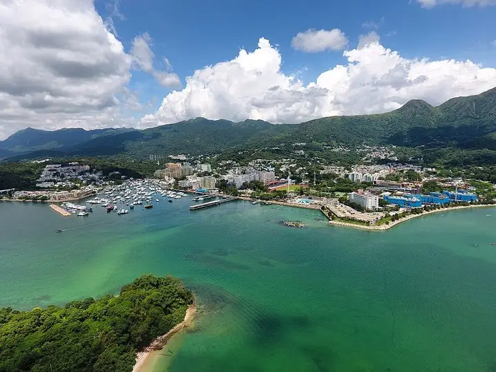
The waterfront combines small-boat activity with seafood restaurants and display tanks, while the older streets behind contain everyday shops and newer cafes. Off Po Tung Road, the Tin Hau Temple complex preserves an early twentieth-century facade associated with the town’s seafaring community. Keep a town visit distinct from an island trip: each boat destination needs its own departure point, return arrangement and weather check.
What to look for
- The waterfront shows fishing and passenger-boat activity beside seafood tanks.
- The Tin Hau Temple complex retains its older facade just off Po Tung Road.
Location & getting there
Getting to Sai Kung
Arrive at Sai Kung Bus Terminus beside the public-pier area. The tourism board identifies a bus connection from Diamond Hill MTR station to this terminus. From there, begin with the waterfront or head to the temple complex off Po Tung Road.
Combine your visit
Suggested order for the visit:
-
Public-pier waterfront
Watch the boats without entering working berths.
-
Seafood Street
Look at the waterfront restaurant and tank displays.
-
Tin Hau Temple complex
Finish with the older religious frontage off Po Tung Road.
This is an editorial sequence of named spaces or places. It does not imply a verified walking connection or promise opening, ticket availability or a journey time.
Find Sai Kung District overview
西貢 · 西贡区
The pin marks the area, not the entrance.
More places nearby
Approximate straight-line distances between map pins, not travel distances.
Sharp Island 桥咀洲
3 km awaySharp Island’s western shore offers a compact introduction to volcanic rocks and tidal landforms. The rounded boulders called Pineapple Bun Rocks have cracked surfaces formed through weathering, while a sand-and-gravel tombolo…
View guide →High Island Reservoir 万宜水库
8 km awayHigh Island Reservoir’s East Dam brings water-engineering structures and volcanic geology together. Quarrying for the reservoir exposed pale hexagonal rock columns, including an S-shaped section cut by a dark dyke. The geotrail…
View guide →Chi Lin Nunnery 志莲净苑
8 km awayChi Lin Nunnery uses a disciplined sequence of timber buildings, courtyards and water to create a Tang-inspired Buddhist setting. Cypress components are joined by an interlocking system, rewarding a close look at the roof…
View guide →Sources & visit information
The sources below support the place-specific description and arrival information. Suggested combinations are editorial planning ideas; confirm current opening, entry arrangements and transport services for your date.