


Get to know Zhongxiang
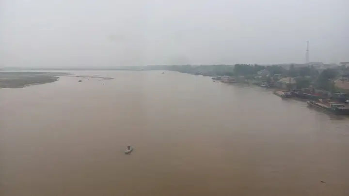
Photo adjustments
Full frame retained; resized proportionally to a maximum dimension of 960 pixels and converted to WebP quality 88. No crop, retouch, generated elements, or subject alteration. Final website rendition: full frame retained, proportionally resized to at most 720 pixels and converted to WebP. No additional retouching or subject alteration. Card displays may crop the view.
- Administrative area
- County-level city · 县级市
- Part of
- Jingmen
- Chinese name
- 钟祥市
- Local areas
- County-level city guide
Area & population
- Area in the source
- 4,488.00 km²
- Population · 2020 census
- 868,897
- Administrative seat
- Yingzhong Subdistrict (郢中街道)
Source: cited geographic source, as of the dates shown.
Setting and landscape
The city mixes mountains, plains and hills under a subtropical monsoon climate, and its farms grow rice, wheat, cotton and sesame. The Shimen Reservoir (石门水库), 20 kilometres from the town and built mainly for irrigation, was the first large reservoir in Hubei. It is part of the Dakou National Forest Park (大口国家森林公园) and lies beside the Xianling tomb and Huangxian Cave (黄仙洞). The Dahongshan (大洪山) scenic area is also counted among Zhongxiang's national key scenic areas.
History
In the Spring and Autumn and Warring States periods the town was Jiaoying (郊郢), a secondary capital of the state of Chu (楚). The Lantai (兰台), a detached palace of the Chu kings, stood in what is now the Yingzhong (郢中) quarter, and the poet Song Yu (宋玉) is said to have written his "Rhapsody on the Wind" (风赋) there. Mochou (莫愁女), a Chu singer and dancer, is also claimed as a native.
The future Jiajing emperor grew up here as the Prince of Xing (兴王) and succeeded to the throne after his cousin the Zhengde emperor died without a son. In 1531 Anlu Zhou (安陆州) was raised to Chengtian Prefecture (承天府), one of three prefectures governed directly by the court alongside Shuntian (顺天府, now Beijing) and Yingtian (应天府, now Nanjing), and the emperor named the county Zhongxiang, "where good omens gather". The Xingwang Palace (兴王府) and Yuanyou Temple (元佑宫) in the town are also linked to Jiajing.
What to see
Xianling (明显陵), 5 kilometres northeast of the town on Chunde Hill (纯德山), is the joint tomb of Jiajing's parents, Zhu Youyuan (朱祐杬) and Empress Dowager Zhangsheng (章圣皇太后). Building ran for forty years, from 1519 to 1559, and the Jingmen city government calls it a product of the Great Rites Controversy (大礼议) of the early Jiajing reign. A double wall encloses the site, the outer one 3,600 metres around, and more than 30 groups of buildings step up the terraces: a stele pavilion, stone figures, the Nine-Bend Imperial River (九曲御河), a square fort and a soul tower. It is a national 5A scenic area and part of the World Heritage listing of the Ming and Qing imperial tombs, added in 2000.
Highlights
- Xianling 明显陵: Tomb of the Jiajing emperor's parents, built 1519–1559; part of the Ming and Qing imperial tombs World Heritage listing since 2000.
- Xingwang Palace 兴王府: One of the town-centre sites linked to the Jiajing emperor.
- Dakou National Forest Park 大口国家森林公园: Includes the Shimen Reservoir, beside Xianling and Huangxian Cave.
Sources for this guide
荆门市人民政府 旅游景点 明显陵 · Jingmen Municipal People's Government
钟祥市 - 维基百科,自由的百科全书 · Wikipedia (Chinese) · CC BY-SA 4.0
石门水库 (钟祥) - 维基百科,自由的百科全书 · Wikipedia (Chinese) · CC BY-SA 4.0
Original English written from the listed sources and checked sentence by sentence against quoted extracts by a separate reviewer. Updated 2026-09-25.
Explore Zhongxiang
Core places to explore, with English and Chinese names.
Places to explore around Zhongxiang
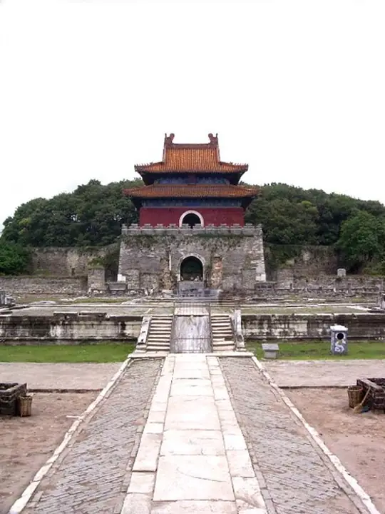 Minglou tower at Ming Xianling Mausoleum, Zhongxiang · 钟祥明显陵明楼 Photograph date recorded by the source: 5 April 2005.
Xianling (Ming dynasty)明显陵
Xianling at Zhongxiang is the joint mausoleum of the Jiajing emperor’s parents, whose posthumous status became a major political issue of the Ming court. Its processional route works with the hills and water, leading past stone…
Read the place guide →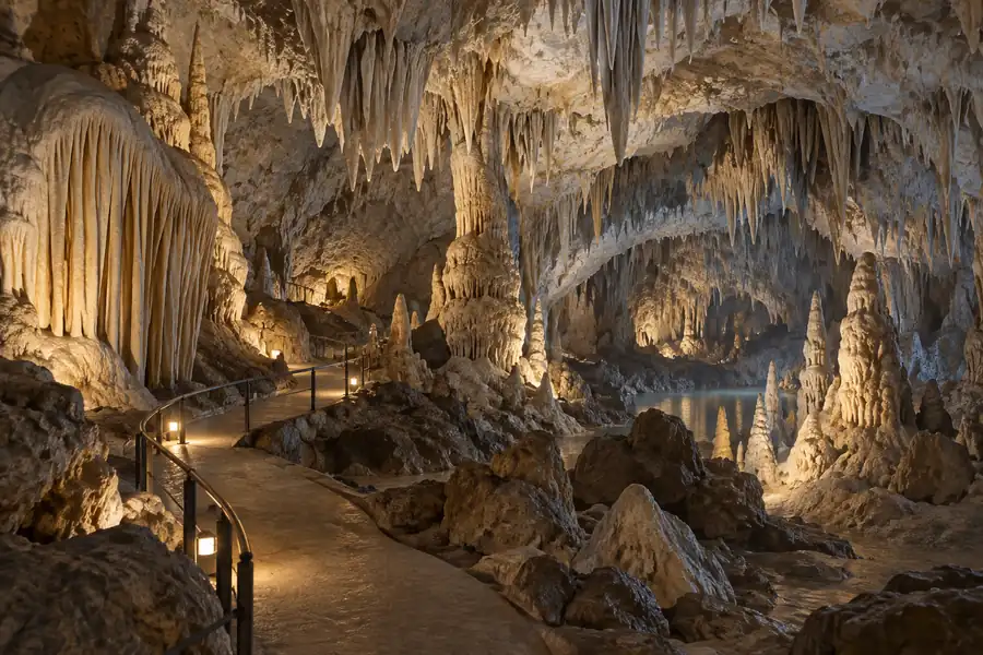 AI illustration · AI 示意图(仅供参考,非该地点实拍)
Huangxian Cave黄仙洞
Huangxian Cave (黄仙洞) is a large limestone cave on the southern flank of the Dahong Shan range in Zhongxiang, Jingmen, Hubei, about 66 kilometres from the town of Yingzhong. It is one of the core sites of the Dahongshan national scenic and historic area.
Read the place guide →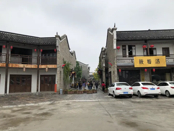 Street of traditional-style buildings with red lanterns in the Mochou Village tourist area, Zhongxiang, Jingmen · 湖北省荆门市钟祥市莫愁村旅游景区街景 Source-recorded photograph date: 2019-10-06 12:24:32.
Mochou Village莫愁村
Mochou Village (莫愁村) is a purpose-built folk-culture street village in Zhongxiang, Jingmen, Hubei, laid out between the Ming Xianling imperial tomb to its north and the Mochou Lake national wetland park to its south.
Read the place guide →Plan your visit
Getting there
Zhongxiang is about 40 km in a straight line from central Jingmen. Search for 钟祥市 in a map app to find stations and your accommodation.
Where to stay →Build your route
Xianling (Ming dynasty) and Huangxian Cave are both listed here. The linked place guides have entrance and visit details.
Continue with Jingmen →More in Jingmen
Sources & geographic information
Administrative names and parent areas: Official geographic directory · Reference date 2026-09-06.
Some facts checked against 钟祥市 — Wikipedia contributors, CC BY-SA 4.0.
Some facts checked against 石门水库 (钟祥) — Wikipedia contributors, CC BY-SA 4.0.
Photo: Xianling (Ming dynasty) · Kallgan · Kallgan — Mingxianling_minglou.jpg — Public domain · Public domain. The exact downloaded source bytes are separately retained and hashed. Prepared JPEG is proportionally reduced to a maximum 720-pixel long edge; full frame retained, no subject alteration. Final website rendition: full frame retained, proportionally resized to at most 720 pixels and converted to WebP. No additional retouching or subject alteration. Card displays may crop the view.


Photo: Mochou Village · Fxqf · CC BY-SA 4.0. Full frame retained; proportionally resized and converted to WebP. No retouching or changes to the photographed subject. Card displays may crop the view.

Map data © OpenStreetMap contributors. Pins mark approximate centres, not entrances or boundaries.