


Get to know Guangshui
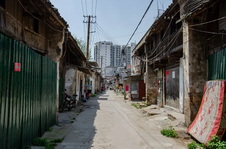
Photo adjustments
Full frame retained; proportionally resized and converted to WebP. No retouching or changes to the photographed subject. Card displays may crop the view.
- Administrative area
- County-level city · 县级市
- Part of
- Suizhou
- Chinese name
- 广水市
- Local areas
- County-level city guide
Area & population
- Area in the source
- 2,645.50 km²
- Population · 2020
- 710,900
Source: cited geographic source, as of the dates shown.
Setting and landscape
Guangshui is low mountain and hill country at the southern foot of the Tongbai range and the western end of the Dabie range. Its highest point is Dagui Mountain (大贵山), at 907.8 metres. Dawu County (大悟县) lies to the east, Xiaochang (孝昌县) and Anlu (安陆市) to the south, and Zengdu District of Suizhou to the west.
History
The city government dates human activity here to the Neolithic, some 5,000 years ago. In the Zhou period the area was the state of Er (贰国): the Zuo Zhuan records that in 701 BC the Chu general Qu Xia (屈瑕) joined Er and Zhen (轸国) to surround Yun (郧国), and Chu later absorbed Er. A county named Yongyang (永阳县) was set up in 536, and the name Yingshan County (应山县) dates from 598, probably taken from a hill in the town centre now called Yintai Hill (印台山). In December 1988 Yingshan became the city of Guangshui, named after Guangshui town on the Beijing–Guangzhou railway, while the seat stayed at Yingshan; in 2000 it came under the new prefecture-level city of Suizhou.
The 'three passes of Yingshan' (应山三关) were long fought over. Wusheng Pass (武胜关) marked a state border in the Southern and Northern Dynasties; Pingjing Pass (平靖关), anciently Ming'e (冥阨), is counted by the Lüshi Chunqiu among the nine strongholds of the realm; Huangtu Pass (黄土关) lies in present-day Caihe town (蔡河镇).
What to see
The city government lists the Wangzishan site (王子山古遗址), occupied from the Western Zhou to the Han, and the Eastern Zhou to Warring States Heidongwan tombs (黑洞湾古墓群), both in Wudian town (吴店镇). The city emblem, a fire phoenix, is named after a phoenix-and-crane figure excavated from an ancient tomb. The Golden Summit at Santan (三潭金顶) is linked with Bodhidharma, founder of Chan Buddhism, and Longquan Temple (龙泉寺) with the Tang poet Li Bai, who lived there in retreat. Other named sites are Baolin Temple (宝林寺), where the Ming founder Zhu Yuanzhang (朱元璋) became a monk; the former home of the Ming official Yang Lian (杨涟); and the former headquarters of the Fifth Division of the New Fourth Army (新四军五师司令部旧址).
At Chenxiang town (陈巷镇) is the tomb of the Northern Song recluse Lian Shunbin (连舜宾), carved with an epitaph by Ouyang Xiu (欧阳修). Guangshui carries national titles as a home of Chinese poetry, a home of Chinese folk art for calligraphy, and a Chinese city of couplet culture.
Highlights
- Wusheng Pass 武胜关: One of the three passes of Yingshan; a state border in the Southern and Northern Dynasties.
- Heidongwan tombs 黑洞湾古墓群: Eastern Zhou to Warring States tombs in Wudian town.
- Baolin Temple 宝林寺: Temple where Zhu Yuanzhang, founder of the Ming, became a monk.
- Dagui Mountain 大贵山: Highest point of Guangshui at 907.8 metres.
Sources for this guide
广水市 - 维基百科 · Chinese Wikipedia · CC BY-SA 4.0
广水市情简介-广水市人民政府门户网站 · Guangshui Municipal People's Government
历史沿革-广水市人民政府门户网站 · Guangshui Municipal People's Government
Original English written from the listed sources and checked sentence by sentence against quoted extracts by a separate reviewer. Updated 2026-09-24.
Explore Guangshui
Core places to explore, with English and Chinese names.
Guangshui 广水市
Plan your visit
Getting there
Guangshui is about 45 km in a straight line from central Suizhou. Search for 广水市 in a map app to find stations and your accommodation.
Where to stay →More in Suizhou
Sources & geographic information
Administrative names and parent areas: Official geographic directory · Reference date 2026-09-06.
Some facts checked against 广水市 — Wikipedia contributors, CC BY-SA 4.0.
Map data © OpenStreetMap contributors. Pins mark approximate centres, not entrances or boundaries.