

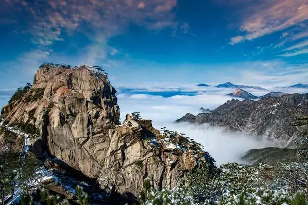
Photo adjustments
EXIF orientation normalized; resized without changing aspect ratio; converted to WebP. No subject edits.
Explore the region
About Tiantangzhai Mountain Hubei Side
Luotian County, founded in 523 CE, occupies 2,144 square kilometres on the southern slope of the Dabie range, its land falling from high ground in the north to hills and river valleys in the south. Tiantangzhai rises inside the county at 1,729.13 metres; Hubei Daily's county profile describes the peak as commanding the old frontier between Wu and Chu and dividing the Yangtze and Huai drainages, a strategic point of the central plains since antiquity. Forest covers 68 per cent of the county, which the same profile calls an important gene pool of higher plants for central China.
The Dabie Mountain National Forest Park groups Tiantangzhai with four other scenic areas – Baodaofeng, Tiantang Lake, Qingtaiguan and the Jiuzihe countryside – so the summit is one component of a larger protected landscape rather than the whole of it. The Hubei-side approach runs through Jiuzihe town, where a 37-square-kilometre provincial tourism resort area approved in 2010 stretches from the Tiantangzhai scenic area in the east to the Tiantang Lake national wetland park in the west, with forest over 92 per cent of its ground.
What to look for
- The summit of Tiantangzhai at 1,729.13 metres, the high point of the Dabie range and a divide between the Yangtze and Huai drainages
- The old-growth forest of the Dabie Mountain National Forest Park, of which the Tiantangzhai scenic area is one of five parts
- Named features catalogued within the forest park, grouped as three mountains, four caves, five passes and six stockades
- Shengrentang, Jiangfeng Hall and Tianzifen, listed among the forest park's named landmarks
- Tiantang Lake national wetland park, the western limit of the Jiuzihe resort area that forms the Hubei-side approach
Location & getting there
Getting to Tiantangzhai Mountain Hubei Side
Check weather, trail access and the last return service. A mountain or forest area is not one entrance, and a map’s central pin may be far from the trailhead.
- Search for 天堂寨湖北侧 with 黄冈市 and 罗田县.
Find Tiantangzhai Mountain Hubei Side
天堂寨湖北侧 · 罗田县
No reliable map pin yet: search by the Chinese name.
Sources & visit information
The linked sources support the identity and background described in this introduction. Opening hours, admission, activity availability and exact arrival arrangements have not been comprehensively checked. Confirm current visitor information with the venue; the original catalogue locality and editorial review flag are retained.