


Get to know Otog Banner
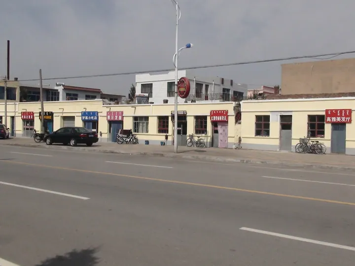
Photo adjustments
Full frame retained; proportionally resized and converted to WebP. No retouching or changes to the photographed subject. Card displays may crop the view.
- Administrative area
- Banner · 旗
- Part of
- Ordos
- Chinese name
- 鄂托克旗
- Local areas
- Banner guide
Area & population
- Area in the source
- 20,064.00 km²
- Population · 2020
- 162,726
- Administrative seat
- Ulan
Source: cited geographic source, as of the dates shown.
Setting and landscape
The banner stretches 209 km from north to south and 188 km from east to west. Its highest ground is Urin Dushi Peak (乌仁都西峰), also called Table Mountain (桌子山), in the Arbas range, the top of the Ordos Plateau; the Dustu (都斯图河) and Xiniwusu (西尼乌素河) rivers water the banner's grassland. The Ordos government counts two national nature reserves in the banner, among them one for dinosaur remains, and rare plants such as Tetraena mongolica (四合木) and Helianthemum (半日花) grow here.
Otog is a Mongolian word for a camp or tribal unit, the subdivision of a Mongol tumen in the Yuan and Ming.
History
A Qin Great Wall runs 11,681 m through the hills of Mengxi (蒙西镇) and Qipanjing (棋盘井镇) on the east bank of the Yellow River, with three beacon towers and one fort. Inner Mongolia News identifies the Baolehaoxiao ruins (包乐浩晓古城) as the site of the Tang county town of Yan'en (延恩县), built in 738 to settle mainly Sogdians, a Central Asian people known for Silk Road trade. In 1649 the Qing made this area the Ordos Right Wing Middle Banner.
What to see
The Arjai Grottoes (阿尔寨石窟), a national protected site in Qipanjing 130 km from Wulan, are known locally as the "hundred-eye caves". The banner's culture and tourism bureau describes them as the largest and richest cave-temple group of the Western Xia to Yuan period found in Inner Mongolia; 65 caves survive, with murals of religious life, daily life and battle scenes and captions in Uyghur-Mongolian, Tibetan and Sanskrit.
The Hundred-Eye Wells (百眼井) at Baiyanjing village, a regional protected site, are 184 wells dug on an oval ridge of less than a square kilometre. Western Xia coins and Northern Song pottery found there suggest the wells were dug at least by the Western Xia period.
Food and local products
The banner is the place of origin of the Arbas white cashmere goat (阿尔巴斯白绒山羊), whose cashmere is called "soft gold" on the international market.
Highlights
- Arjai Grottoes 阿尔寨石窟: National protected site; 65 Western Xia to Yuan cave temples with murals.
- Hundred-Eye Wells 百眼井: 184 wells on one small ridge, dug by the Western Xia period.
- Urin Dushi Peak 乌仁都西峰: Highest point of the Ordos Plateau, also called Table Mountain.
- Baolehaoxiao ruins 包乐浩晓古城: Identified by Inner Mongolia News as the Tang county town of Yan'en, built in 738.
Sources for this guide
鄂托克旗_鄂尔多斯市人民政府 · Ordos Municipal People's Government
鄂托克旗 - 维基百科,自由的百科全书 · Wikipedia (Chinese) · CC BY-SA 4.0
阿尔寨石窟_鄂托克旗人民政府 · Otog Banner Culture and Tourism Bureau (Otog Banner People's Government website)
【行走北疆看中国·北疆百城文化探源】草原长廊连古今-内蒙古新闻-内蒙古新闻网 · Inner Mongolia News Network (nmgnews.com.cn)
Original English written from the listed sources and checked sentence by sentence against quoted extracts by a separate reviewer. Updated 2026-09-25.
Explore Otog Banner
Core places to explore, with English and Chinese names.
Otog Banner 鄂托克旗
Plan your visit
Getting there
Otog Banner is about 165 km in a straight line from central Ordos. Search for 鄂托克旗 in a map app to find stations and your accommodation.
Where to stay →More in Ordos
Sources & geographic information
Administrative names and parent areas: Official geographic directory · Reference date 2026-09-06.
Some facts checked against 鄂托克旗 — Wikipedia contributors, CC BY-SA 4.0.
Map data © OpenStreetMap contributors. Pins mark approximate centres, not entrances or boundaries.