

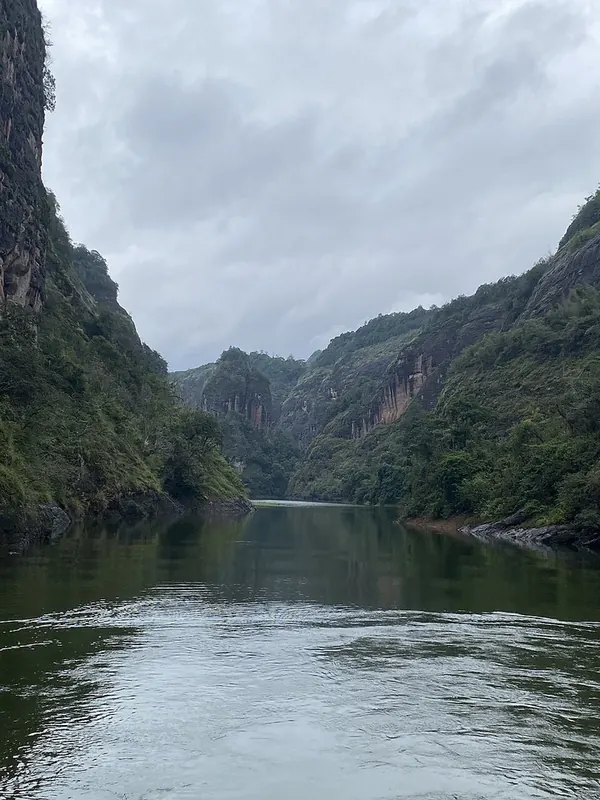
Photo adjustments
Full frame retained; proportionally resized and converted to WebP. No retouching or changes to the photographed subject. Card displays may crop the view.
Explore the region
About Dajin Lake
Ganlu Temple is a particular architectural focus, sheltered under the rock and supported by an unusual timber arrangement. The boat view reveals how the cliffs continue into the water, while landing stops change the scale to paths and buildings. Choose a sailing by its included stops; the whole lake is far too extensive to treat as one continuous shore walk.
The lake originated as the Chitan Reservoir (池潭水库), built on the Jinxi River (金溪), a tributary of the Futun River (富屯溪), near Chitan village in Kaishan township, Taining county. Classed as a large (二) reservoir, it was built mainly for power generation, with flood control and tourism as secondary functions. Also called Dajin Lake, it is known for its Danxia landform and forms the core of the Taining World Geopark, formerly the Dajin Lake National Geopark.
The lake runs long from north to south and narrow from east to west, its arc-shaped surface likened to a crescent moon and known as the 'Hundred-li Jinhu' (百里金湖). Its Danxia landform, shaped over 7.6 million years by faulting, collapse, water erosion and weathering, includes red cliffs, mesas, peaks, stone pillars and stone walls, along with deep meandering channels and gorges, forming blocky mountains and peak clusters that combine with the lake into a landscape of 'mountain within lake, lake within mountain.'
China National Geographic magazine named Jinhu and Shangqingxi (上清溪) as China's largest water-covered Danxia area, and the scholar Cai Shangsi (蔡尚思) called Dajin Lake 'the foremost lake-and-mountain scenery under heaven.' It was listed among Fujian's ten scenic spots in 1987, upgraded to a national key scenic area (国家重点风景名胜区) in 1994, and designated a provincial tourism development zone and resort area in 1995.
What to look for
- The red cliffs and narrow water passages of the lake landscape.
- Ganlu Temple’s rock-sheltered timber structure.
Location & getting there
Getting to Dajin Lake
Travel by road to the Dajin Lake tourist landing from Taining and confirm the boat itinerary before boarding. Ganlu Temple is reached by boat access; arrange the return sailing rather than relying on a path around the reservoir.
Combine your visit
A suggested sequence linking the specific features of this visit.
-
Lake cliff-viewing section
Read the red rock formations from the boat.
-
Ganlu Temple landing
If included in the sailing, inspect the temple’s relation to the sheltering cliff.
This order is editorial. Confirm access and any transfers between stops; it does not establish a walking route, same-day connection or common admission ticket.
Find Dajin Lake
泰宁大金湖 · 三明市
The pin marks the area, not the entrance.
Sources & visit information
The sources below support the place-specific description and arrival information. Suggested combinations are editorial planning ideas; confirm current opening, entry arrangements and transport services for your date.
Visitor information adapted and edited from Wikipedia contributors, “大金湖” · CC BY-SA 4.0. Source revision 92176345.
Background paragraphs translated and condensed from Wikipedia contributors, "大金湖", Chinese Wikipedia · CC BY-SA 4.0. Source revision 92176345.