


Get to know Sanming
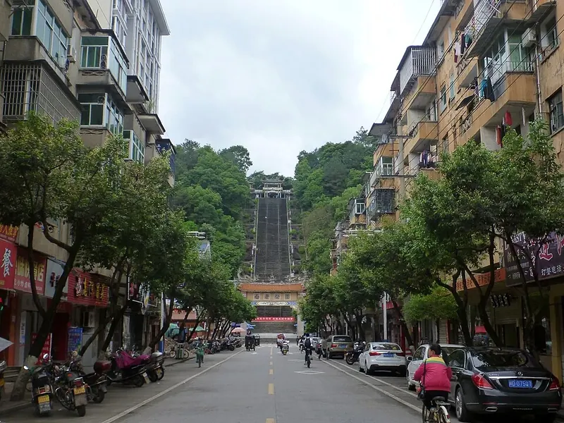
Photo adjustments
Full frame retained; proportionally resized and converted to WebP. No retouching or changes to the photographed subject. Card displays may crop the view.
- Administrative area
- Prefecture-level city · 地级市
- Part of
- Fujian
- Chinese name
- 三明市
- Local areas
- 11 local areas
Area & population
- Area in the source
- 22,929.00 km²
- Population · 2020 Census
- 2,486,450
- Administrative seat
- Sanyuan District
Source: cited geographic source, as of the dates shown.
Setting and landscape
Low mountains and hills cover most of the land: the Wuyi range lies to the north-west, the Daimao Mountains (玳瑁山) run through the middle and the Daiyun range touches the south-east corner. The land is higher in the south-west and lower in the north-east; mountains make up 82 percent of the area, and Baishiding (白石顶) in Jianning (建宁) rises to 1,858 m. Rocks of the Late Archaean Tianjingping Formation (天井坪组) occur around Jianning. The city government gives forest cover as 77.12 percent.
History
Wanshouyan (万寿岩), an isolated limestone hill with karst caves at Yanqian Town (岩前镇) in Sanyuan District, is a Palaeolithic site and has been a national key protected site since 2001. Stone tools and animal fossils from its Lingfeng Cave (灵峰洞) are dated to about 185,000 years ago, and those from Chuanfan Cave (船帆洞) to 30,000–20,000 years ago. The whole city lay in the Central Soviet Area, and the city government counts it among the starting points of the Red Army's Long March. In 1956 Sanyuan (三元) and Mingxi (明溪) counties merged as Sanming County; the prefecture-level city dates from 1983.
What to see
The city government lists a World Natural Heritage site and a UNESCO Global Geopark in Taining (泰宁). The Taining Global Geopark, on the south-eastern side of the middle Wuyi range, was upgraded to UNESCO status in 2005; its 492.5 km² are mostly Danxia landforms, with volcanic and granite features, and it has five zones: the Shangqing Stream (上清溪), Taining Old Town (泰宁古城), Dajin Lake (大金湖), Longwangyan–Baxianya (龙王岩-八仙崖) and Jinnao Mountain (金铙山).
Food and local products
The making of Shaxian snacks (沙县小吃), concentrated in Shaxian (沙县), entered the national intangible heritage list in 2021. The listing describes a cuisine formed as Central Plains migrants settled in the south, blending northern and southern traits, which rose in the Tang and Song and flourished in the Ming and Qing. Mostly local ingredients such as bamboo fungus, taro and tea-tree mushrooms go into more than 110 snacks, among them Shaxian wontons (沙县扁肉), stuffed tofu balls and pressed duck, seasoned with Shaxian chilli sauce, peanut sauce and Maoxi winter wine (茂溪冬酒).
Getting oriented
Sanming borders Nanping to the north, Fuzhou to the east, Quanzhou and Longyan to the south, and Ganzhou and Fuzhou (抚州) in Jiangxi to the west. The government sits in Sanyuan District (三元区).
Highlights
- Taining County 泰宁: Home of the Taining Global Geopark, mostly Danxia landforms across 492.5 km².
- Dajin Lake 泰宁大金湖: One of the five zones of the Taining Global Geopark.
- Wanshouyan site 万寿岩遗址: Palaeolithic cave site in Sanyuan District; national key protected site since 2001.
- Shaxian Pork Wontons 沙县扁肉: One of more than 110 Shaxian snacks covered by the national intangible heritage listing.
Sources for this guide
三明市概况 _ 走进三明 _ 三明市人民政府门户网站 · Sanming Municipal People's Government
小吃制作技艺(沙县小吃制作技艺) - 中国非物质文化遗产网·中国非物质文化遗产数字博物馆 · China Intangible Cultural Heritage Network (ihchina.cn)
三明市 - 维基百科,自由的百科全书 · Chinese Wikipedia · CC BY-SA 4.0
泰宁世界地质公园 - 维基百科,自由的百科全书 · Chinese Wikipedia · CC BY-SA 4.0
万寿岩遗址 - 维基百科,自由的百科全书 · Chinese Wikipedia · CC BY-SA 4.0
Original English written from the listed sources and checked sentence by sentence against quoted extracts by a separate reviewer. Updated 2026-09-30.
Explore Sanming
Core places to explore, with English and Chinese names.
Taining County 泰宁
Dajin Lake 泰宁大金湖
Taining Zhaixia Grand Canyon 泰宁寨下大峡谷
Taining Shangqing Stream 泰宁上清溪
Taining Jiulong Pond 泰宁九龙潭
Yuhua Cave 玉华洞
Guifeng Old Village 桂峰古村
Jinnao Mountain 金铙山
Anzhen Fortress 安贞堡
Taoyuandong Scenic Area 桃源洞
Dajin Lake 大金湖
Zhaixia Grand Canyon 寨下大峡谷
Taining Ancient City 泰宁古城
Tianfang Yuetan Hot Spring 天芳悦潭温泉
Sanyuan District 三元区
Shaxian District 沙县区
Mingxi County 明溪县
Qingliu County 清流县
Ninghua County 宁化县
Datian County 大田县
Youxi County 尤溪县
Jiangle County 将乐县
Taining County 泰宁县
Jianning County 建宁县
Yong'an 永安市
Places to explore around Sanming
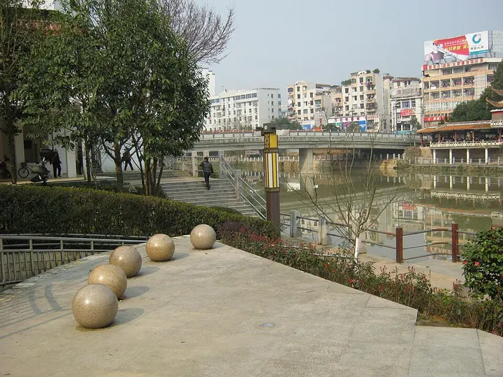 Tongxin Bridge and the waterside in Taining · 泰宁同心桥 Photograph date recorded by the source: 11 March 2012.
Taining County泰宁
Taining combines a small historic centre with the red-cliff landscape around Dajin Lake. In town, Shangshu Di preserves an elaborate Ming residence arranged along a large passage, with halls, service buildings and garden spaces…
Read the place guide →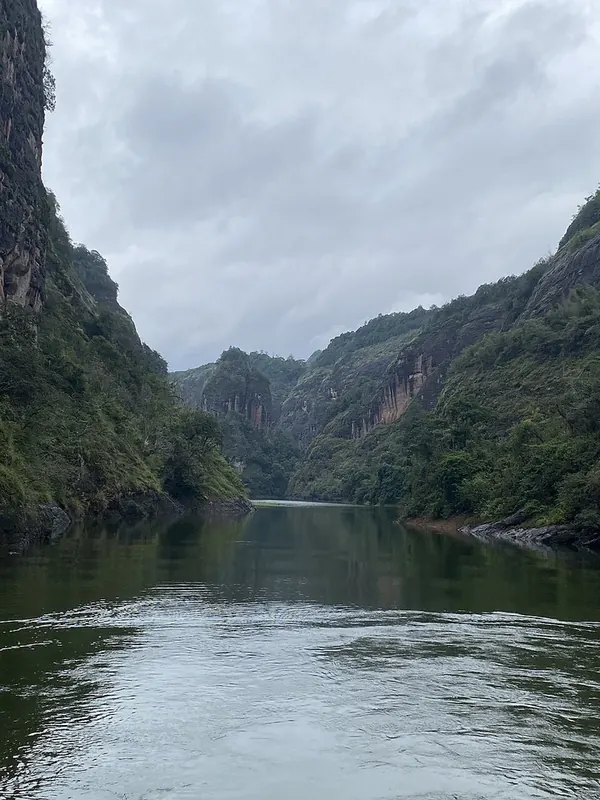 A narrow gorge on Dajin Lake. Photograph date recorded by the source: 2025-07-13 10:01:34.
Dajin Lake泰宁大金湖
Dajin Lake places red sandstone cliffs, narrow water passages and wooded slopes around a reservoir. Ganlu Temple is a particular architectural focus, sheltered under the rock and supported by an unusual timber arrangement. The…
Read the place guide → Taining Zhaixia Grand Canyon · 泰宁寨下大峡谷
Taining Zhaixia Grand Canyon泰宁寨下大峡谷
Zhaixia Grand Canyon is a walking-focused part of Taining's Danxia landscape. Narrow ravines, red cliffs and dense vegetation provide a close view of the rock scenery that appears at a larger scale around Dajin Lake.
Read the place guide → AI illustration · AI 示意图(仅供参考,非该地点实拍)
Taining Shangqing Stream泰宁上清溪
Shangqing Stream is a bamboo-raft excursion through the wooded Danxia valleys of Taining. It gives visitors a low, moving viewpoint between steep banks, with a quieter and more enclosed setting than a broad lake cruise.
Read the place guide → Taining Jiulong Pond · 泰宁九龙潭
Taining Jiulong Pond泰宁九龙潭
Jiulong Pond is a compact Danxia water landscape near Chongji Village in Taining. Its name refers to nine mountain streams feeding the pond, where red-rock terrain and thick vegetation meet the water.
Read the place guide → Illuminated rock formations inside Yuhua Cave, Jiangle County · 将乐县玉华洞内彩灯照射的岩石景观 Source-recorded photograph date: Taken on 9 September 2006.
Yuhua Cave玉华洞
Limestone karst cave near Jiangle, Fujian: six halls, three underground streams and inscriptions from the Song to the Republic, visited by Xu Xiake in 1628.
Read the place guide →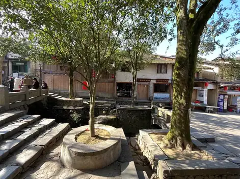 Guifeng Old Village · 桂峰古村
Guifeng Old Village桂峰古村
Guifeng in Youxi is a mountain village where old houses rise across three slopes above a stream and winding lanes.
Read the place guide → Jinnao Mountain · 金铙山
Jinnao Mountain金铙山
Jinnao Mountain rises above Jianning’s Suixi countryside, with Baishiding reaching approximately 1,858 metres among steep ridges and forest.
Read the place guide →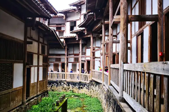 Anzhen Fortress · 安贞堡
Anzhen Fortress安贞堡
A walled earthen residence of the Chi family in Yong'an, Fujian, built 1885–1899 against bandits, with 198 gun holes and carved, painted interiors.
Read the place guide →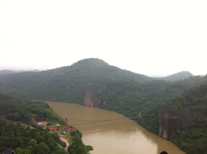 An elevated view of a river gorge: a broad muddy-brown river curving between forested hills and reddish sandstone cliffs, a slender suspension footbridge crossing the water, and a visitor area with red-roofed buildings, a road and parked cars on the near bank under a pale overcast sky.
Taoyuandong Scenic Area桃源洞
Taoyuan Dong is the Danxia cliff landscape beside the Shaxi River in Yong’an, best known for the narrow Yixiantian fissure.
Read the place guide →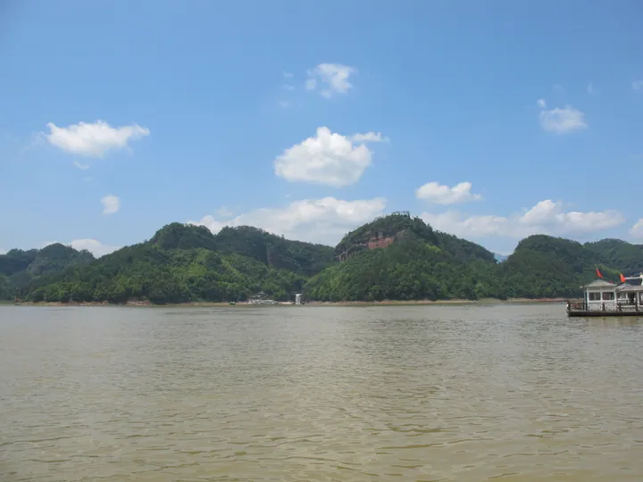 Danxia peaks rising above the waters of Dajin Lake, with a tour boat on the lake, Taining County, Sanming. · 三明市泰宁县大金湖丹霞峰林与游船。 Source-recorded photograph date: Taken on 1 May 2014.
Dajin Lake大金湖
A reservoir lake in Taining, northwest Fujian, ringed by red Danxia cliffs, core of the Taining part of the China Danxia World Heritage site.
Read the place guide →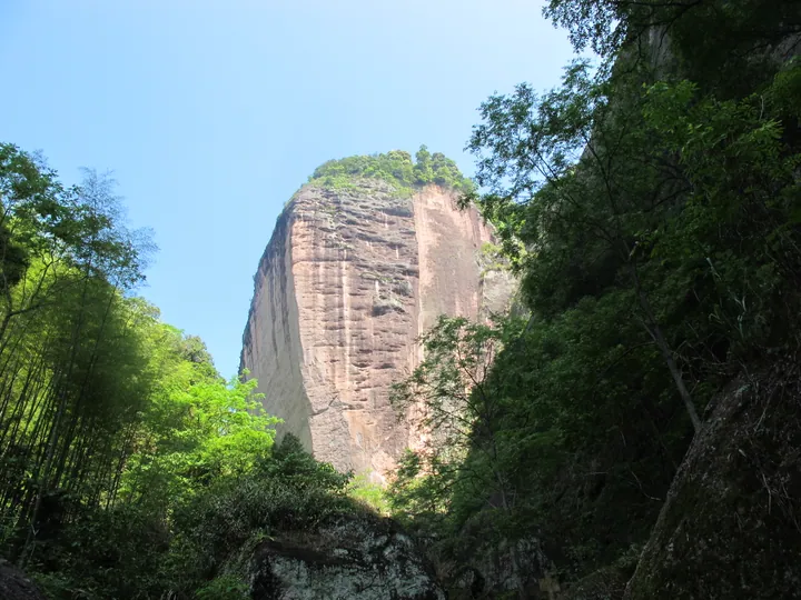 A sheer cliff face at Zhaixia Grand Canyon, Taining County · 寨下大峡谷云崖,泰宁县 Source-recorded photograph date: Taken on 1 May 2014.
Zhaixia Grand Canyon寨下大峡谷
Zhaixia Grand Canyon is a connected landscape of red cliffs, narrow ravines and wooded streams at Zhaixia village in Taining.
Read the place guide → The Xiuyifang gate archway with waterwheels at the Old Town of Taining · 泰宁古城"绣衣坊"牌坊与水车 Source-recorded photograph date: Taken on 2 May 2014.
Taining Ancient City泰宁古城
Taining Old Town brings together historic lanes, the Ming-period Shangshudi residence and a later layer of revolutionary sites within the county town.
Read the place guide →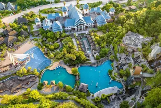 Tianfang Yuetan Hot Spring · 天芳悦潭温泉
Tianfang Yuetan Hot Spring天芳悦潭温泉
Tianfang Yuetan is a developed hot-spring resort in Qingliu, combining landscaped bathing areas with a wooded hillside setting.
Read the place guide →Local life & food
Sanming local specialties
三明市特色美食 · 11 specialties to discover
 Shaxian Snacks 沙县小吃AI illustration · AI 示意图(仅供参考,非实拍)
Shaxian Snacks (沙县小吃) is the collective name for a family of small dishes from Sha County (沙县), now Shaxian District of Sanming (三明) in Fujian. The snacks belong to Fujian cuisine (闽菜).
Source ↗Read the dish guide → Shaxian Noodles with Peanut Sauce 沙县拌面AI dish illustration / AI 菜品示意图
Fine Shaxian wheat noodles tossed with a glossy savoury sauce; this illustrated version uses peanut paste and scallions.
Source ↗Read the dish guide →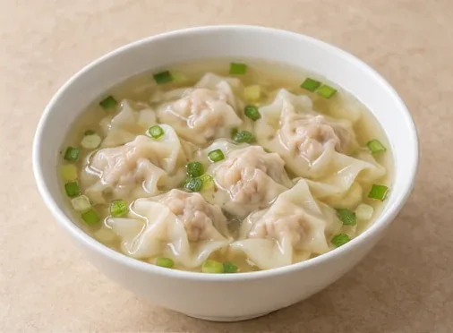 Shaxian Pork Wontons 沙县扁肉AI dish illustration / AI 菜品示意图
Small Shaxian wontons with delicate wheat wrappers and finely beaten pork filling, served in clear stock.
Source ↗Read the dish guide →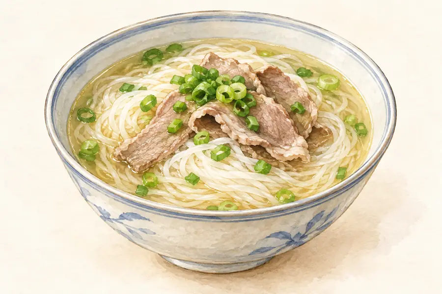 Loach with Rice Noodles 泥鳅粉干AI illustration · AI 示意图(仅供参考,非实拍)
Loach with Rice Noodles (泥鳅粉干) is listed among the local specialties of Sanming, Fujian. It is grouped here with fish & seafood; retain the complete Chinese name when comparing local menus.
Read the dish guide →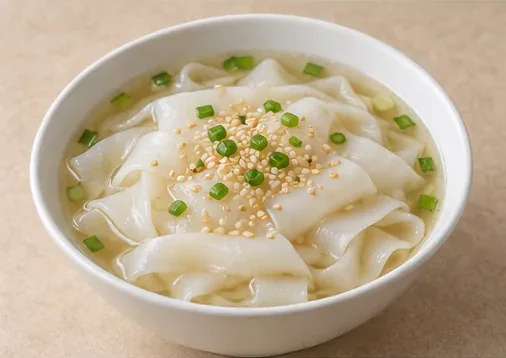 Yong'an Rice-Noodle Soup 永安粿条AI dish illustration / AI 菜品示意图
Smooth white Yong'an rice ribbons in clear savoury broth, illustrated with scallion and toasted sesame.
Source ↗Read the dish guide →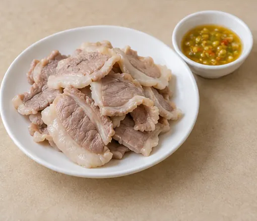 Yong'an Huorou Pork 永安活肉AI dish illustration / AI 菜品示意图 — not a restaurant photograph
Yong'an huorou uses tender pork facial muscle near the upper lip, warmed in broth and served with yellow-chilli dipping sauce.
Source ↗Read the dish guide →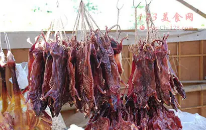 Ninghua Smoked Dried Field Rat 宁化老鼠干
Ninghua Smoked Dried Field Rat (宁化老鼠干) is field rat, trapped by hand in Ninghua County (宁化县) in Sanming (三明), Fujian, then cleaned and smoked dry over rice husk or bran.
Read the dish guide →Photo adjustments
EXIF orientation normalized; resized without changing aspect ratio; converted to WebP. No subject edits.
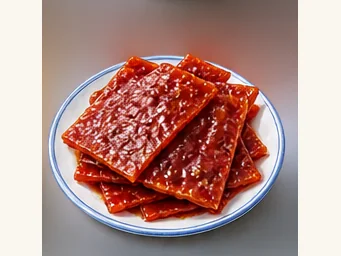 Mingxi dried pork jerky 明溪肉脯干AI illustration · AI 示意图
The texture is firm and fibrous, with a savory-sweet meat flavor that grows as it is chewed. Thinner pieces are easier to tear.
Source ↗Read the dish guide →All dish names · 全部菜名 (11)
- Shaxian Snacks · 沙县小吃
- Shaxian Noodles with Peanut Sauce · 沙县拌面
- Shaxian Pork Wontons · 沙县扁肉
- Loach with Rice Noodles · 泥鳅粉干
- Yong'an Rice-Noodle Soup · 永安粿条
- Yong'an Huorou Pork · 永安活肉
- Ninghua Smoked Dried Field Rat · 宁化老鼠干
- Mingxi dried pork jerky · 明溪肉脯干
- Taining Jade-Green Rolls · 泰宁碧玉卷
- Jianning Cudweed Dumplings · 建宁暖菇包
- Jiangle Pounded Tea · 将乐擂茶
More dishes from across Fujian are in the Fujian food guide.
Counties & districts in Sanming
11 areas belong directly to Sanming.
11 areas
Sanyuan District 三元区
Sanyuan District is a district of the city of Sanming, Fujian province, People's Republic of China.
Explore the area →DistrictShaxian District 沙县区
Shaxian District (simplified Chinese: 沙县区; traditional Chinese: 沙縣區; pinyin: Shāxiàn Qū), formerly Sha County, is a district of Sanming, Fujian Province, People's Republic of China.
Explore the area →CountyMingxi County 明溪县
Mingxi County (simplified Chinese: 明溪县; traditional Chinese: 明溪縣; pinyin: Míngxī Xiàn) is a county of Sanming City, Fujian, People's Republic of China.
Explore the area →CountyQingliu County 清流县
Qingliu (simplified Chinese: 清流县; traditional Chinese: 清流縣; pinyin: Qīngliú Xiàn, Hakka: Chhîn-liù-yen) is a county of western Fujian province, People's Republic of China.
Explore the area →Show fewer areas
Ninghua County 宁化县
Ninghua (simplified Chinese: 宁化县; traditional Chinese: 寧化縣; pinyin: Nínghuà Xiàn, Hakka: Nèn-fa-yen) is a county of the prefecture-level city of Sanming, in western Fujian province, People's Republic of…
Explore the area →CountyDatian County 大田县
Datian (; simplified Chinese: 大田县; traditional Chinese: 大田縣; pinyin: Dàtián Xiàn; Pe̍h-ōe-jī: Tāi-chhân-koān) is a county of central Fujian province, People's Republic of China.
Explore the area →CountyYouxi County 尤溪县
Youxi is a county of central Fujian province, People's Republic of China. It is under the administration of Sanming City.
Explore the area →CountyJiangle County 将乐县
Jiangle County (simplified Chinese: 将乐县; traditional Chinese: 將樂縣; pinyin: Jiānglè Xiàn) is a county of western Fujian province, People's Republic of China. It is under the administration of Sanming City.
Explore the area →CountyTaining County 泰宁县
Taining County (simplified Chinese: 泰宁县; traditional Chinese: 泰寧縣; pinyin: Tàiníng Xiàn) is a county in the northwest of Fujian province, People's Republic of China.
Explore the area →CountyJianning County 建宁县
(simplified Chinese: 建宁县; traditional Chinese: 建寧縣; pinyin: Jiànníng Xiàn; lit. 'build peace') lies in the municipal region of Sanming, Fujian province, China.
Explore the area →County-level cityYong'an 永安市
Yong'an is a county-level city in west-central Fujian province, People's Republic of China. It is located on the Sha River, which is a tributary of the Min River.
Explore the area →No areas match this name.
Plan your visit
Getting there
Search for 三明市 in a map app to find stations and your accommodation.
Where to stay →Build your route
Taining County and Dajin Lake are about 20 km apart in a straight line. The linked place guides have entrance and visit details.
Continue with Fujian →More in Fujian
Sources & geographic information
Administrative names and parent areas: Official geographic directory · Reference date 2026-09-06.
Some facts checked against 三明市 — Wikipedia contributors, CC BY-SA 4.0.
Some facts checked against 泰宁世界地质公园 — Wikipedia contributors, CC BY-SA 4.0.
Some facts checked against 万寿岩遗址 — Wikipedia contributors, CC BY-SA 4.0.
Photo: Taining County · PanShiBo · CC BY-SA 3.0. Full frame retained; proportionally resized and converted to WebP. No retouching or changes to the photographed subject. Card displays may crop the view.

Photo: Dajin Lake · Liedward390 · CC BY-SA 4.0. Full frame retained; proportionally resized and converted to WebP. No retouching or changes to the photographed subject. Card displays may crop the view.

Photo: Taining Zhaixia Grand Canyon · Source photographer · License not provided. EXIF orientation normalized; resized without changing aspect ratio; converted to WebP. No subject edits.
Photo: Taining Jiulong Pond · Source photographer · License not provided. EXIF orientation normalized; resized without changing aspect ratio; converted to WebP. No subject edits.
Photo: Yuhua Cave · jlgdzsq · CC BY-SA 3.0. Full frame retained; proportionally resized and converted to WebP. No retouching or changes to the photographed subject. Card displays may crop the view.

Photo: Guifeng Old Village · Source photographer · License not provided. EXIF orientation normalized; resized without changing aspect ratio; converted to WebP. No subject edits.
Photo: Jinnao Mountain · Source photographer · License not provided. EXIF orientation normalized; resized without changing aspect ratio; converted to WebP. No subject edits.
Photo: Anzhen Fortress · Source photographer · License not provided. EXIF orientation normalized; resized without changing aspect ratio; converted to WebP. No subject edits.
Photo: Taoyuandong Scenic Area · 张元柏 · CC BY-SA 3.0. Full frame retained; proportionally resized and converted to WebP. No retouching or changes to the photographed subject. Card displays may crop the view.

Photo: Dajin Lake · 江上清风1961 · CC BY 3.0. Full frame retained; proportionally resized and converted to WebP. No retouching or changes to the photographed subject. Card displays may crop the view.

Photo: Zhaixia Grand Canyon · 江上清风1961 · CC BY 3.0. Full frame retained; proportionally resized and converted to WebP. No retouching or changes to the photographed subject. Card displays may crop the view.
.jpg)
Photo: Taining Ancient City · 江上清风1961 · CC BY 3.0. Full frame retained; proportionally resized and converted to WebP. No retouching or changes to the photographed subject. Card displays may crop the view.
.jpg)
Photo: Tianfang Yuetan Hot Spring · Source photographer · License not provided. EXIF orientation normalized; resized without changing aspect ratio; converted to WebP. No subject edits.
Map data © OpenStreetMap contributors. Pins mark approximate centres, not entrances or boundaries.