

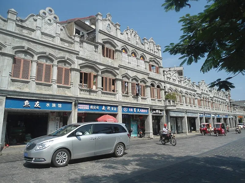
Photo adjustments
Full frame retained; proportionally resized and converted to WebP. No retouching or changes to the photographed subject. Card displays may crop the view.
Explore the region
About Wenchang
Wencheng’s urban centre provides food and transport, while Qinglan and Dongjiao belong to a coastal excursion; Longlou and the launch-viewing area require another transfer. The Song family ancestral home adds a modern-history stop in Changsa. Plan by these clusters rather than attempting to cover the whole municipality between trains, and leave time for Wenchang chicken as part of the local experience.
Wenchang covers an area of 2,403 square kilometres in the northeastern part of Hainan Island, with a coastline of 207 kilometres, and is divided into 17 towns. Its east side faces the South China Sea, while to the west it borders Dongzhai Harbour, Haikou's Meilan District, Qionghai and Ding'an County. The land is mostly hilly, with a mix of forest and agricultural areas.
Wenchang was elevated from a county to a city on 7 November 1995; its population was recorded as 86,551 in 1999, with an estimated increase to 115,000 by 2006. The city is a major target for typhoons in the northwestern Pacific and experiences the most frequent and severe typhoon-induced storm surges in the South China Sea.
What to look for
- The overseas-Chinese and family-history landscape around Wenchang.
- Coconut coast and Longlou’s connection with rocket launches.
The surrounding area
A separate northeastern city area for Puqian, chicken and coconut-growing coastal landscapes.
Location & getting there
Getting to Wenchang
Use Wenchang railway station for Wencheng, then arrange road transport to Qinglan, Dongjiao, Changsa or Longlou according to your itinerary.
Combine your visit
Suggested order for a focused visit to this part of Hainan.
-
Wencheng town文城镇
Begin with the urban centre and local food.
-
Qinglan and Dongjiao coast清澜与东郊海岸
Group these coastal areas into one separate outing.
Confirm the opening of individual stops and the return connection. This is an editorial sequence, not a combined ticket.
Find Wenchang overview
文昌 · 文昌
The pin marks the area, not the entrance.
More places nearby
Approximate straight-line distances between map pins, not travel distances.
Wenchang Confucian Temple 文昌孔庙
Less than 1 km awayWenchang Confucian Temple is arranged along a symmetrical central axis in Wencheng. A semicircular Pan Pool and the Zhuangyuan Bridge create the approach to the principal courtyard. Beyond Dacheng Gate, the timber-framed Dacheng…
View guide →Bamen Bay Mangrove Forest 八门湾红树林
5 km awayBamen Bay is Wenchang’s estuary landscape, where rivers meet the sheltered waters around Qinglan and mangroves fringe villages and channels. Its greenway was developed to connect wetland scenery with local settlements, making it…
View guide →Dongjiao Coconut Grove 东郊椰林
14 km awayDongjiao Coconut Grove is a coastal landscape of coconut palms in Wenchang’s Dongjiao area. Winding footpaths pass through the trees towards small buildings and the sandy shore. Its appeal is the repeated pattern of trunks, the…
View guide →Sources & visit information
The linked encyclopedia sources support background and place descriptions. Current opening hours, ticket prices, booking rules and transport schedules have not been independently verified for this guide. Confirm them with the venue or operator before travelling.
Visitor information adapted and edited from Wikipedia contributors, “Wenchang” · CC BY-SA 4.0. Source revision 1371949213.
Background paragraphs condensed from Wikipedia contributors, "Wenchang", English Wikipedia · CC BY-SA 4.0. Source revision 1374269121.