

Photo adjustments
Full frame retained; proportionally resized and converted to WebP. No retouching or changes to the photographed subject. Card displays may crop the view.
Explore the region
About Longjiang First Bend
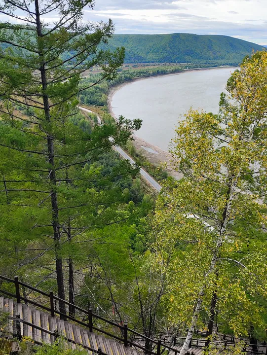
At the Hongqiling section, the river curls around a peninsula edged with sand. Sunlight on this pale rim gave rise to the name Golden Ring Island, although the landform is described as a peninsula.
Elevated viewpoints reveal how the river nearly encloses the land, setting the curve of the water against the surrounding woodland. The broad overhead view is the distinctive feature of this stretch of river scenery.
What to look for
- The river's omega-shaped bend from an elevated viewpoint
- The sandy rim of the Golden Ring peninsula
- Woodland framing the curved river channel
Location & getting there
Getting to Longjiang First Bend
Confirm the visitor entrance and which boat or walking routes operate on your date. Rainfall, water levels and weather can change access.
- Search for 龙江第一湾 with 大兴安岭地区 and 漠河市.
Find Longjiang First Bend
龙江第一湾 · 漠河市
No reliable map pin yet: search by the Chinese name.
Sources & visit information
The linked sources support the identity and background described in this introduction. Opening hours, admission, activity availability and exact arrival arrangements have not been comprehensively checked. Confirm current visitor information with the venue; the original catalogue locality and editorial review flag are retained.